

Latest Weather Blog
Thursday evening video forecast
Related Story
Two of the next three days will feature numerous showers and thunderstorms. Following the unsettled weather, temperatures will take a notable tumble.
Tonight & Tomorrow: Mostly cloudy skies early will gradually become overcast through the night. South winds of 5-15mph will keep low temperatures well above average in the low 70s. On Friday, a slow moving cold front will move into the region, increasing showers and thunderstorms even further. In fact, the final day of the workweek will likely feature the highest coverage of rain across the Capital Area. Any thunderstorm will be capable of producing heavy rain and gusty wind, potentially snarling traffic at times. The late morning to late afternoon period looks most active.
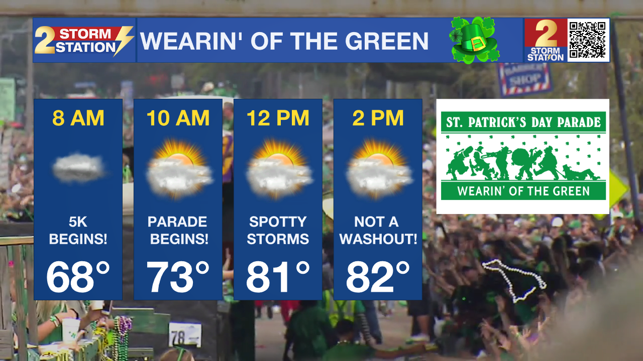
Up Next: The cold front is expected to stall over the region Saturday. However, given the weak and stalling nature of the front, a relative lull in precipitation is expected. Spotty showers and thunderstorms will be possible as daytime heating occurs, but not nearly as numerous as Friday and then what will follow on Sunday. As for the Wearin’ of the Green parade, while it is never a bad idea to be prepared for a passing shower, a lot of dry time is expected. Temperatures will move from the upper 60s in the morning to the low 80s in the afternoon.
Given the parade and many other outdoor events slated for the weekend, it will be important to keep tabs on the Storm Station forecast, especially regarding any possibility of lightning. Have an indoor contingency nearby in the event of a thunderstorm.
The cold front is expected to get a significant push south later Sunday. A final batch of more widespread rain and thunderstorms will press through. Over the three day stretch, this frontal system will drop about 1-3” of rain. Behind the front, expect a substantial drop in temperatures for the beginning of next week. Thermometers will be several degrees below average which is mid 70s over low 50s for the time of year. Some more lows in the 40s are likely. The area will be dry Monday through Wednesday.
Get the latest 7-day forecast and real time weather updates HERE.
Watch live news HERE.
– Josh
The Storm Station is here for you, on every platform. Your weather updates can be found on News 2, wbrz.com, and the WBRZ WX App on your Apple or Android device. Follow WBRZ Weather on Facebook and Twitter for even more weather updates while you are on the go.
News
