

Latest Weather Blog
Thursday evening video forecast
Related Story
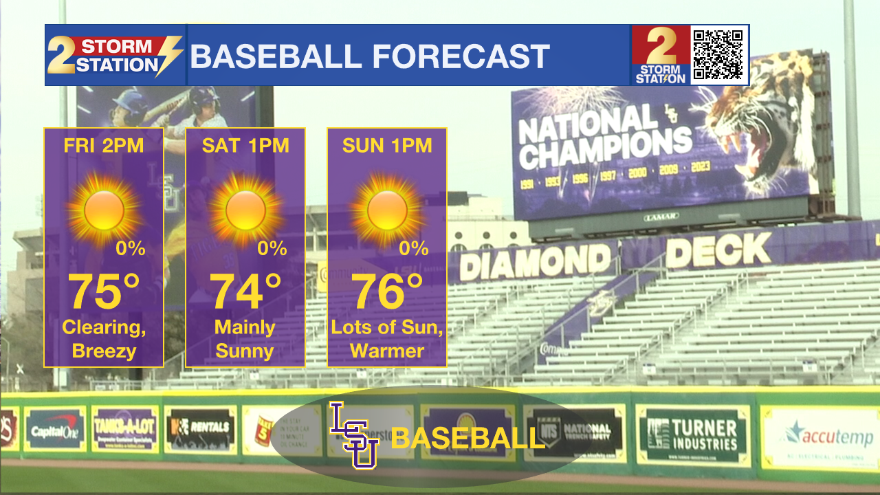
A weak cold front passage will give way to abundant sunshine and relaxing wind speeds. Though temperatures back off slightly on Friday, another warmup commences this weekend.
Tonight & Tomorrow: The clouds hang on through Thursday evening. There may be a brief window of partial clearing around midnight, but more low clouds arrive out of the northwest overnight as a cold front arrives. A spotty sprinkle isn’t out of the question, but they should be gone by daybreak. Lingering low clouds will keep overnight lows in the upper-50s to low 60s. After the cold front passes early Friday, winds will turn out of the northwest sustained at 10-20 mph. That’s still breezy, but not as windy as Thursday. Skies quickly clear out as the morning wears on. The afternoon features full sunshine with a high in the middle-70s.
Up Next: The weekend forecast still looks phenomenal. Skies will be dominated by sunshine, highs increase to the upper-70s, and the wind backs off a touch more. If you have plans to head out to Alex Box stadium, don’t let the weather stop you.
Next week, high temperatures will return to the 80s. On some days, we see highs coming within a few degrees of record values. The wind also picks back up ahead of our next cold front which is scheduled to arrive on Wednesday. For now, we mention a small storm chance as the front arrives. Behind that system, we scale back on temperatures by a fair amount.
Get the latest 7-day forecast and real time weather updates HERE.
Watch live news HERE.
-- Meteorologist Malcolm Byron
The Storm Station is here for you, on every platform. Your weather updates can be found on News 2, wbrz.com, and the WBRZ WX App on your Apple or Android device. Follow WBRZ Weather on Facebook and Twitter for even more weather updates while you are on the go.
News
