

Latest Weather Blog
Thursday evening video forecast
Related Story
After a rainy final morning drive of the workweek, windy conditions will overtake the area. Though a drop in temperatures is expected for the weekend, it will feel mild compared to the cold blast coming early next week.
Tonight & Tomorrow: The overnight hours will be mainly cloudy and breezy. Thanks to those clouds and a south breeze of 10-15mph, low temperatures will remain in the mid to upper 60s. By dawn Friday, a cold front will send a batch of showers and thunderstorms into the area.
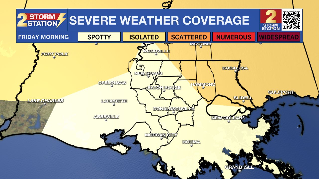
New today, the threat for severe weather has diminished a little, and there is now a 1/5 “Marginal Risk” for the Metro Area. This means a spotty strong thunderstorm with damaging wind or a brief tornado cannot be ruled out, but chances are rather low. Regardless of severe weather, this cold front will bring wet weather for the morning commute, so some delays may be expected. Any showers and thunderstorms will quickly clear the area from west to east with dry conditions by lunchtime. The breeze will really pick up behind the cold front with sustained west winds of 15-25mph and gusts up to 40mph possible. A WIND ADVISORY has been issued from 6am to 3pm. Additionally, much cooler air will push in with high temperatures in the upper 60s occurring near daybreak followed by thermometers falling into the 50s by late afternoon.
Up Next: With mainly clear skies, Saturday and Sunday will both feature morning lows near or below freezing and afternoon highs in the upper 50s. This tranquil time may be well spent preparing for the coldest air in more than a year.
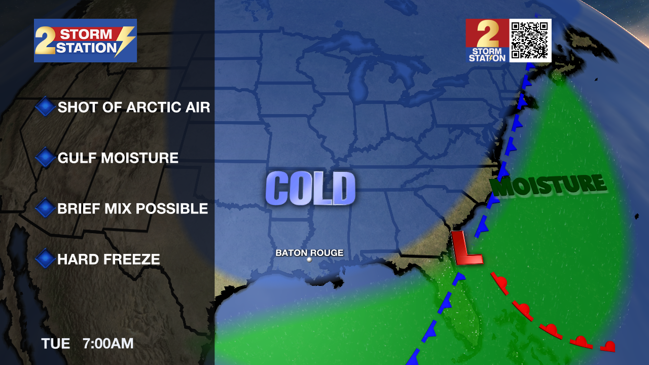
An Artic blast will invade on Monday. Ahead of the cold air, a batch of rain is expected to move across the central Gulf Coast. As of now, it appears unlikely that freezing temperatures will arrive in time for major impacts due to wintry precipitation. It is possible that some sleet briefly mixes in with rain before it ends on Monday evening. Additionally, wind and dry air following the rain should evaporate leftover moisture and puddles to minimize ice hazards. Regardless of precipitation, there is high confidence that the coldest air so far this season will take over the region. Especially on Tuesday, northerly winds of 10-20mph will cause wind chills in the teens and 20s. Tuesday and Wednesday morning will have several hours in the low to mid 20s. Plan for a hard freeze, taking the necessary precautions on pipes and other home infrastructure this weekend.
Get the latest 7-day forecast and real time weather updates HERE.
Watch live news HERE.
– Josh
The Storm Station is here for you, on every platform. Your weather updates can be found on News 2, wbrz.com, and the WBRZ WX App on your Apple or Android device. Follow WBRZ Weather on Facebook and Twitter for even more weather updates while you are on the go.
News
