

Latest Weather Blog
Sunday Evening Video Forecast
Related Story
Sunshine will continue to dominate on Monday. High temperatures will also warm a few more degrees. However, cloud cover returns as we get closer to the middle part of the week. By Wednesday, things could get a bit soggier as our next weathermaker nears.
Tonight & Tomorrow: Clear skies and light winds will remain on Sunday night. The combination of the two will set us up for another chilly night. We’re looking for a low temperature in the upper-40s early Monday morning. Sunshine will dominate into our Monday as well. However, the wind direction will flip around and turn more southwesterly. This should help temperatures warm into the middle-80s by peak heating, which is right around normal for this time of year.
Up Next: Skies turn mostly cloudy into Tuesday as a warm front in the Gulf of Mexico advances toward the region. That said, we should remain dry on Tuesday. However, that warm front will be a lot closer on Wednesday. By then, we will see showers building across southern Louisiana.
Coastal communities and parishes could see a lot of rain out of this. The real trick to the forecast will be determining the northern extent of the heavy rain. In reality, we’ll likely see a sharp cutoff between a lot of rain and not so much rain. There’s also a chance we could see a subtropical area of low pressure develop offshore. We’ll get a much better idea of how this will play out in the coming days. For now, be prepared to face rain on Wednesday just in case.
We’ll have a separate cold front arriving from the northwest this upcoming Friday. That will dry us out and cool us off into next weekend.
Get the latest 7-day forecast and real time weather updates HERE.
Watch live news HERE.
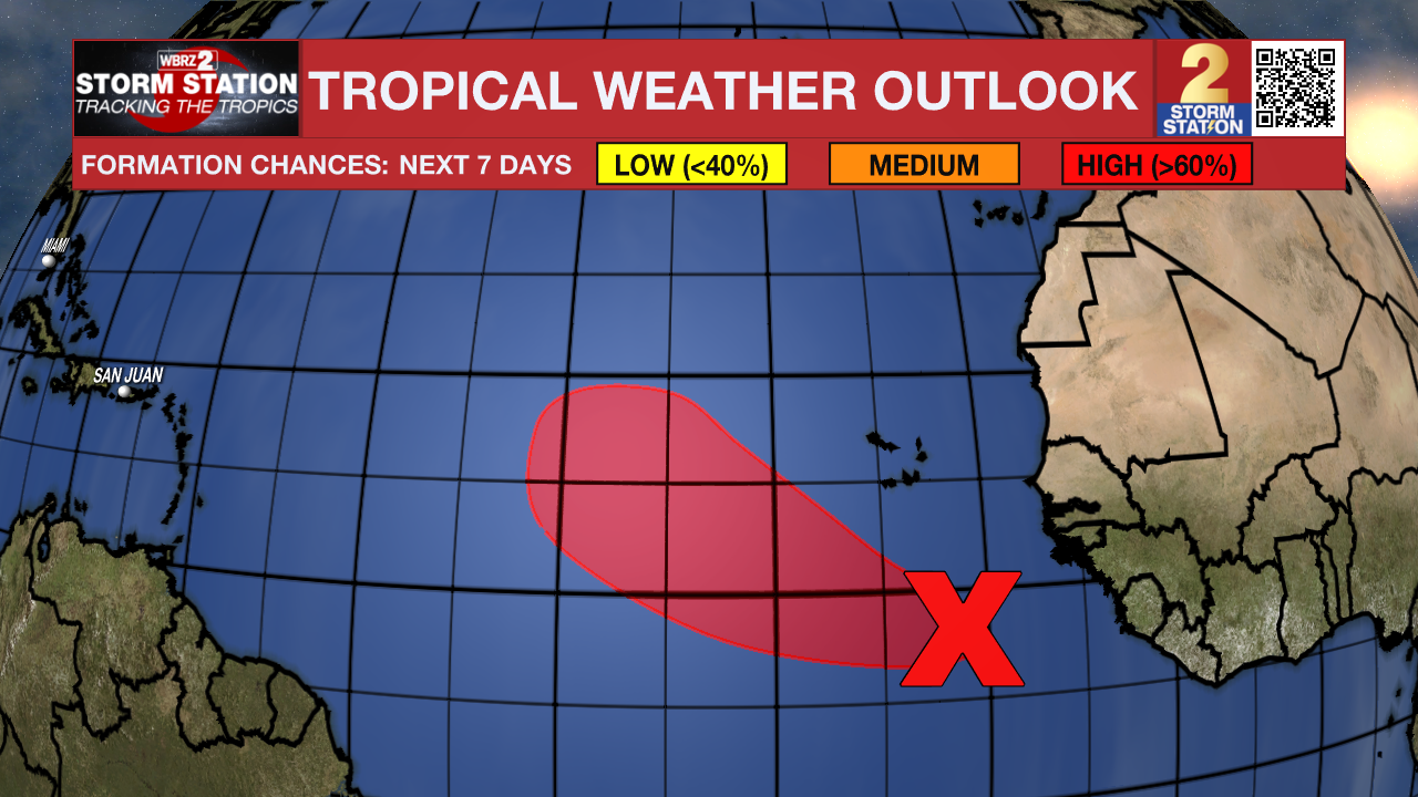
The Tropics: As of Sunday afternoon, there are no active storms in the Atlantic. However, there is one area to watch. Showers and storms are beginning to show signs of organization several hundred miles to the south of the Cabo Verde Islands off the coast of Africa. Conditions appear favorable for gradual development of this system. A tropical depression is likely to for by midweek as the wave moves west across the eastern tropical Atlantic.
-- Meteorologist Malcolm Byron
The Storm Station is here for you, on every platform. Your weather updates can be found on News 2, wbrz.com, and the WBRZ WX App on your Apple or Android device. Follow WBRZ Weather on Facebook and Twitter for even more weather updates while you are on the go.
News
