

Latest Weather Blog
Sunday Evening Video Forecast
Related Story
Many had to dodge storms over the weekend. Although some were able to see rain, others weren’t so lucky. However, fewer will be successful in dodging storms on Monday as the rain coverage ramps up. In fact, we’ll keep storm chances through much of the week.
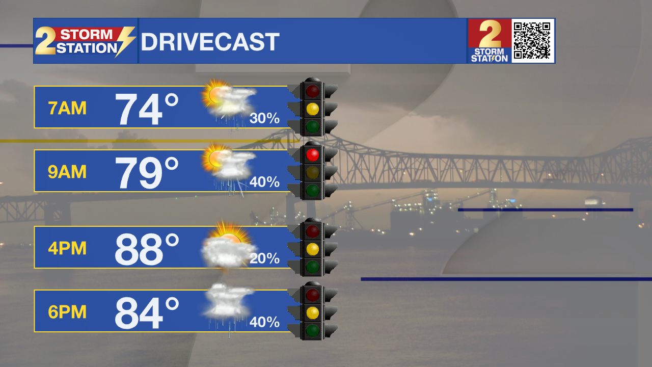
Tonight & Tomorrow: Sunday evening storms will gradually taper off into the overnight hours, leaving much of the area with partly to mostly cloudy skies. However, another wave of storms will be approaching from the northwest on Sunday night. These will be approaching the metro area in the hours leading up to sunrise. If things time just right, these storms could affect the morning commute. We expect overnight lows in the low to mid-70s.
Skies will remain mostly cloudy for the rest of Monday. Lingering showers look likely through much of the morning. Scattered late afternoon and evening storms are also possible. Temperatures will be closely tied to how the rain evolves. We have the potential to reach the upper-80s to near 90° for a high temperature.
Up Next: We will have ample moisture in place this week, so storm chances remain. That said, the highest rain coverage will likely be found on Monday. Rain coverage steadily declines as to get closer to the end of the week. As this happens, high temperatures will return to the 90s.
Another push of dry air will arrive on Friday which will drop the humidity and get rid of rain chances. This will set us up for a warm, dry, and, less humid weekend.
Get the latest 7-day forecast and real time weather updates HERE.
Watch live news HERE.
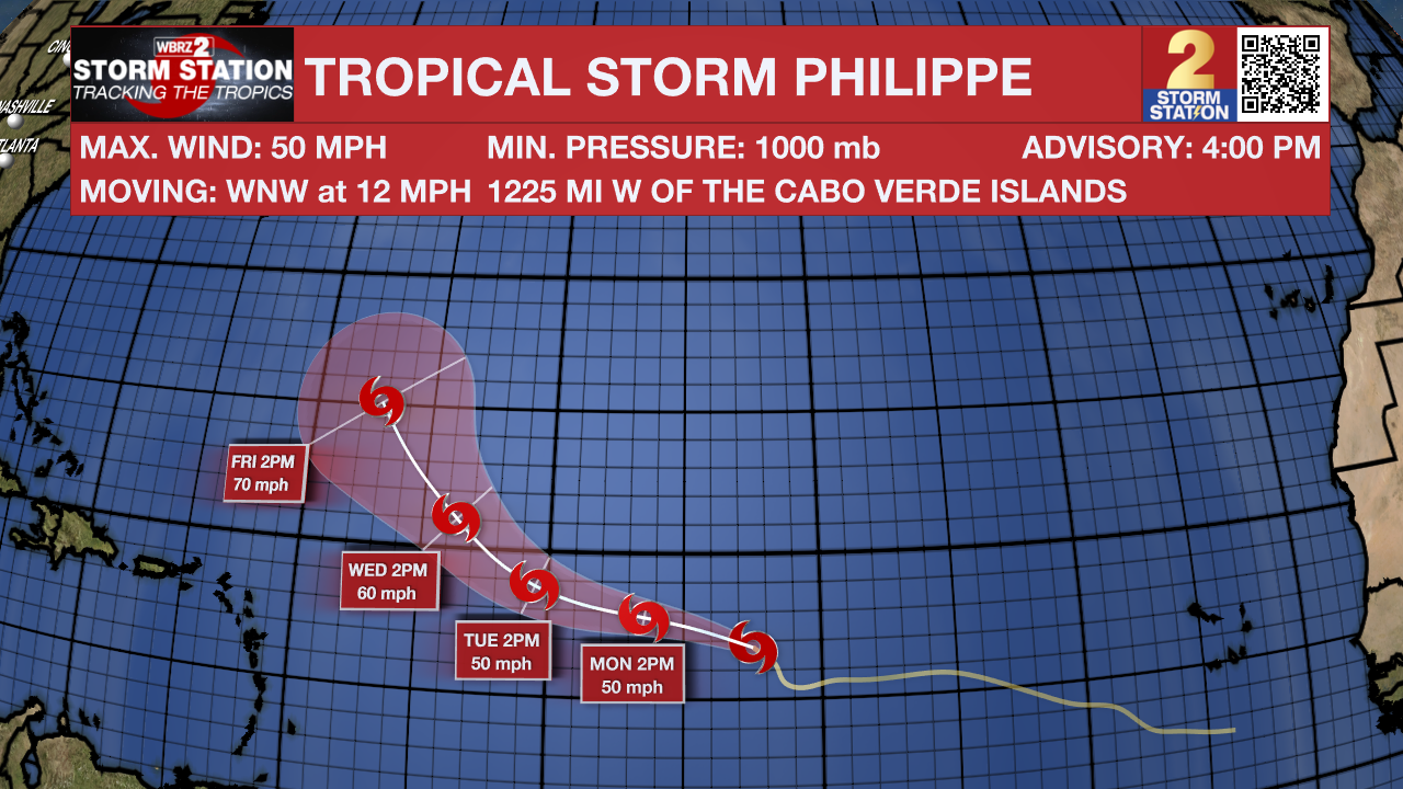
Tropics: Tropical Storm Philippe is the only active tropical system as of this writing with maximum winds at 50 mph. Philippe is in the central Atlantic, moving west-northwest at about 10-15 mph. The storm will keep this motion for the time being, but will take more of a northwesterly turn by Wednesday. There are still questions as to where Philippe goes in the long-term. That said, there is no threat to Louisiana in the foreseeable future.
There are a couple of tropical waves to watch as well. A small area of low pressure several hundred miles southwest of the Cabo Verde Islands may gradually develop into a tropical depression by mid-week. The system is generally moving west-northwest across the tropical Atlantic.
Another area of disorganized storms is located over the southeast Gulf of Mexico just north of the Yucatan Peninsula. Any development would occur slowly as the system drifts westward. By mid-week, the environment will render the system incapable of future development. Chances of this tropical wave organizing into something stronger are very slim.
-- Meteorologist Malcolm Byron
The Storm Station is here for you, on every platform. Your weather updates can be found on News 2, wbrz.com, and the WBRZ WX App on your Apple or Android device. Follow WBRZ Weather on Facebook and Twitter for even more weather updates while you are on the go.
News
