

Latest Weather Blog
Saturday Morning Video Forecast
Related Story
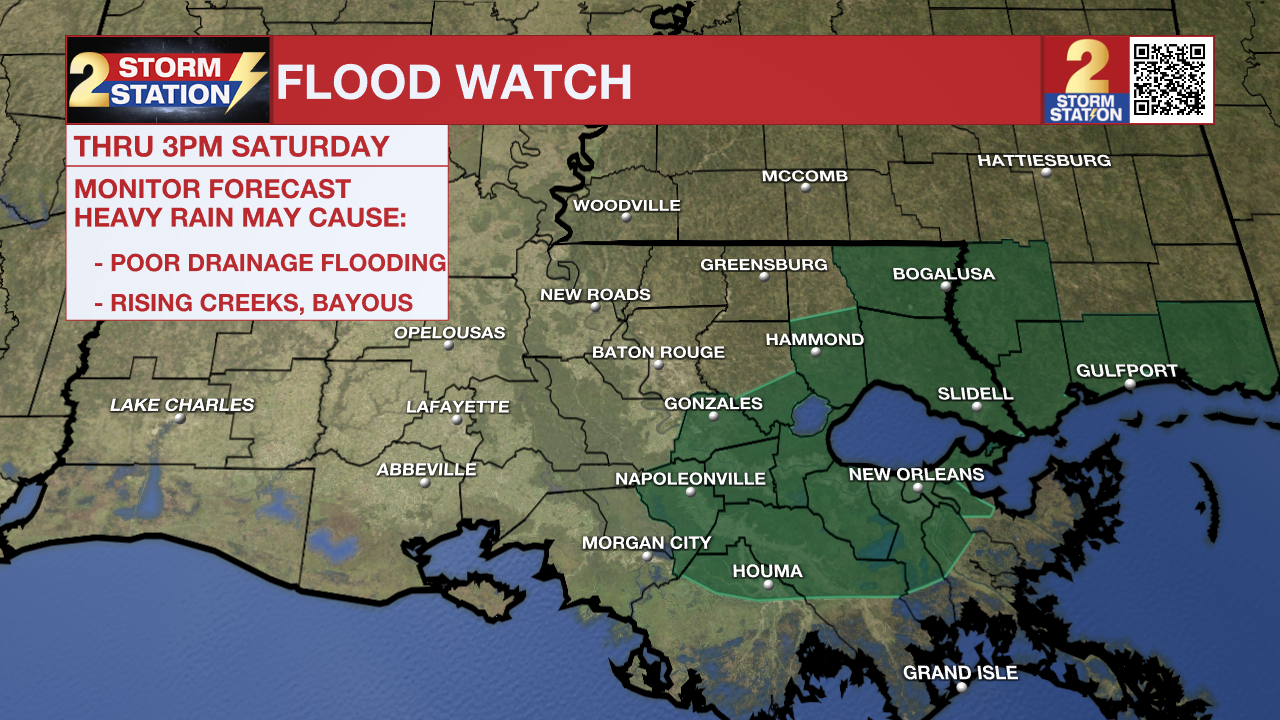
There is a FLOOD WATCH for Assumption, Ascension, St. James, Livingston, and Tangipahoa parishes today until 3pm. Excessive runoff may result in flooding of rivers, creeks, streams, and other low-lying and flood-prone locations. Low-water crossings may be flooded.
Isolated showers and storms continue to be possible early this morning. We’ll trend drier through the rest of Saturday with plenty of clouds hanging around. By Sunday, we’ll be completely dry – a trend that holds through next week.
Today & Tonight: The Tornado Watch has been lifted for all parishes in the WBRZ coverage area. This means the threat of severe weather is now over.
After some early morning showers and storms, we will start to dry out for the rest of the day. There will be the chance of some spotty showers throughout the day, but most will stay dry. Highs will top out in the mid 70's under mostly cloudy skies. Tonight, we will bottom out around 57 degrees under mostly cloudy skies.
Up Next: Clouds will stick around through Sunday but it will stay dry. Highs will be in the lower 70's. Relatively quiet weather sticks around next week also. We'll see a mixture of clouds and sun each day, and temperatures will get closer to "normal" values. By mid-week, we are looking at another potential cooldown with highs in the low to mid-60s. By Thursday morning, we might see lows dipping into the upper-30s.
-- Balin
Get the latest 7-day forecast and real time weather updates HERE.
Watch live news HERE.
The Storm Station is here for you, on every platform. Your weather updates can be found on News 2, wbrz.com, and the WBRZ WX App on your Apple or Android device. Follow WBRZ Weather on Facebook and Twitter for even more weather updates while you are on the go.
News
