

Latest Weather Blog
Saturday Evening Video Forecast
Related Story
Cloud cover continues to build through the remainder of the weekend, spilling over into next week. Storm chances also climb, with our most impactful weather day arriving closer to midweek.
Tonight & Tomorrow: High clouds made their presence known on Saturday. More high clouds envelop the region on Saturday night. Closer to daybreak, we might see low cloud formation also. Temperatures turn even milder into Sunday morning, with a low in the lower-60s. Skies will be mostly cloudy on Sunday, and a south wind off the Gulf will nudge the humidity closer to noticeable levels. Even so, highs have a shot at reaching the low-80s. We won't totally rule out a stray sprinkle or two during the day, but those will be the exception as opposed to the rule. Most rain stays well to our northwest through the end of the weekend.
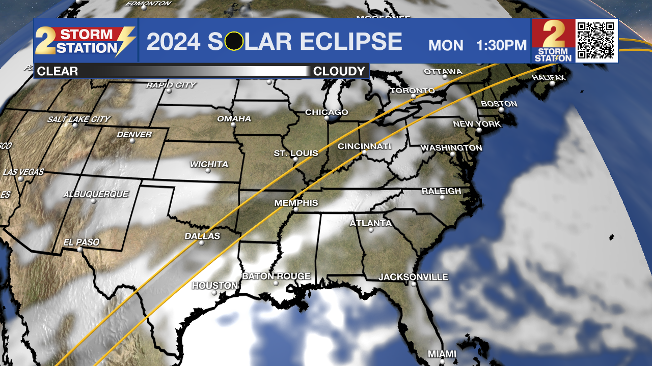
Up Next: The first part of next week looks to be on the warm/muggy side. Mother Nature will also open the door for showers and storms. Monday and Tuesday will not be a washout, but we do expect rain on an isolated basis. This will especially be the case for our northern parishes and counties. Have the rain gear on standby just in case. Rain or not, skies will be mainly cloudy on both days. This is unfortunate if you're hoping to view the solar eclipse on Monday (see below for more details).
A more impactful weather system will take aim at the capital area on Wednesday, bringing our best shot at rain for the week. Timing is still subject to shift around slightly, but the latest data suggest a soggy day with a cold front passage late. We will have some severe weather ingredients on Wednesday, and if they overlap, we could be looking at some stronger storms. The Storm Prediction Center continues to highlight all of Louisiana under a severe weather risk by midweek.
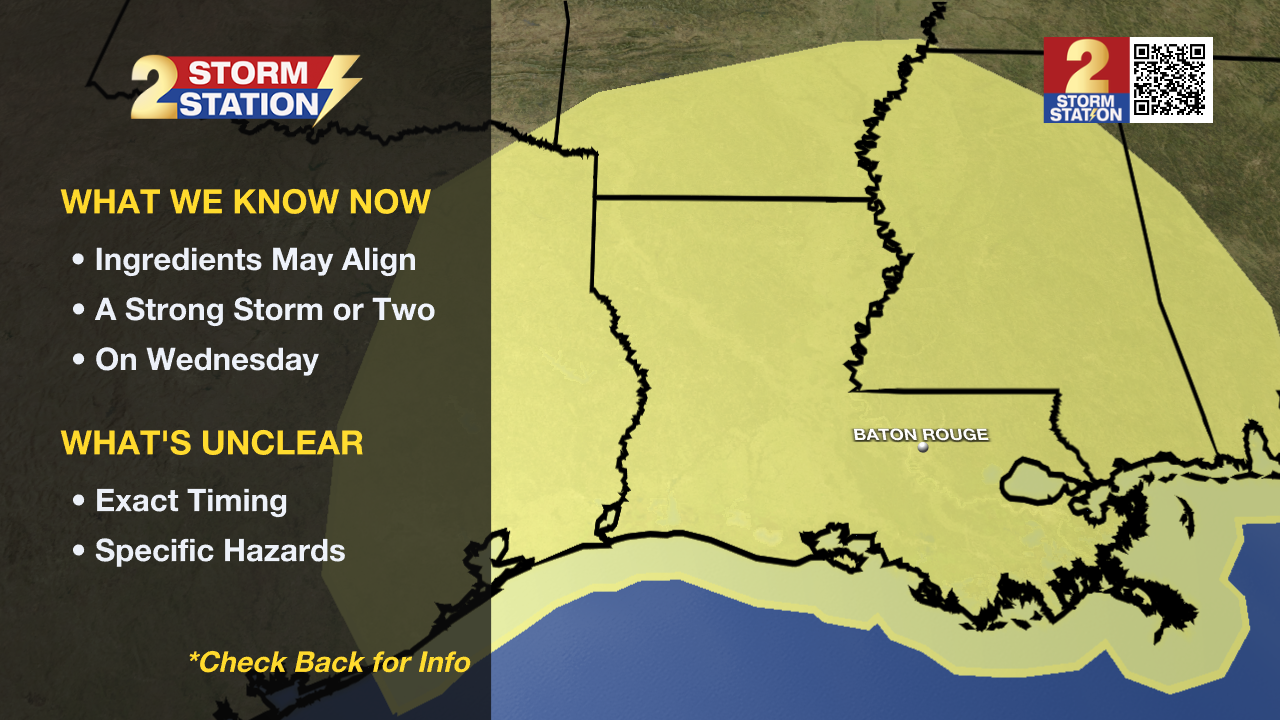
A few inches are possible with this round, which could result in isolated standing water concerns if that falls in too short of a duration. Make sure to check back in with the Storm Station daily for the latest as we get closer.
Eclipse Forecast:
Monday still looks mainly cloudy with isolated showers and storms during the solar eclipse (approx. Noon to 3 p.m.). While clouds appear to block the majority of the event, there could be a few cloud breaks from time to time. We suggest having your eclipse glasses ready to go in case clouds briefly cooperate so you can safety take a peek at the eclipse.
For those planning on traveling to the path of totality, much of Texas will be mainly cloudy also. Sky conditions improve dramatically across the Midwest, and portions of New England.
Get the latest 7-day forecast and real time weather updates HERE.
Watch live news HERE.
-- Meteorologist Malcolm Byron
The Storm Station is here for you, on every platform. Your weather updates can be found on News 2, wbrz.com, and the WBRZ WX App on your Apple or Android device. Follow WBRZ Weather on Facebook and Twitter for even more weather updates while you are on the go.
News
