

Latest Weather Blog
Saturday Evening Video Forecast
Related Story
Despite having to dodge a few showers for the last couple of days, we can temporarily ditch the rain gear into Sunday. This break in rain chances will be very short-lived as a coastal low pressure system comes to life on Monday. That system brings us a much better shot at heavier and more widespread rain early next week.
Tonight & Tomorrow: A hit-or-miss shower cannot be ruled out on Saturday night. That said, these showers will likely be more miss than they are hit. We’ll otherwise be left with cloudy skies. Morning lows on Sunday will likely end up in the upper-50s. Sunday is shaping up to be a dry day. Although clouds will continue to control the skies, there’s a chance we may see a few peeks of sun here or there. We expect highs to be a touch warmer on Sunday afternoon, in the middle-70s.
Up Next: Our next storm system arrives on Monday as a coastal low gets going in the western Gulf of Mexico. This appears to be a more potent system, so rain chances are higher as compared to recent days. Rain arrives from south to north through the day on Monday. There will be some dry air to overcome at first, meaning that steadier rain may not come until late Monday afternoon or evening. A fair deal of rain looks likely overnight Monday, with lingering rain possible into Tuesday. Indications still point toward several inches of rain out of this in the capital area.
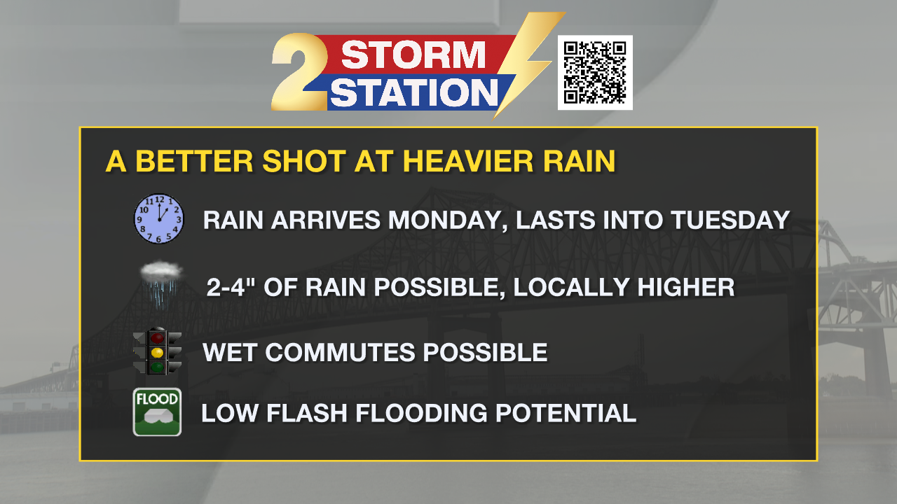
The flooding risk looks low with this round of rain, especially considering how dry it’s been lately. While there may be some areas of coastal flooding and/or localized areas of flash flooding, most will just see beneficial rain. Nevertheless, it could create a hazardous Monday evening and/or Tuesday morning commute depending on when the rain arrives and exits. We’ll keep fine-tuning this forecast as the details come into better agreement.
Get the latest 7-day forecast and real time weather updates HERE.
Watch live news HERE.
The Tropics: Although we expect no tropical development in the next 48 hours, a broad area of low pressure is expected to form in the southwest Caribbean Sea by the middle of next week. Conditions may favor gradual development of this wave as it meanders through the Caribbean into next weekend.
-- Meteorologist Malcolm Byron
The Storm Station is here for you, on every platform. Your weather updates can be found on News 2, wbrz.com, and the WBRZ WX App on your Apple or Android device. Follow WBRZ Weather on Facebook and Twitter for even more weather updates while you are on the go.
News
