

Latest Weather Blog
Saturday evening video forecast
Related Story
Dry air is now starting to enter the area and it is expected to stick around for several days. This will lower humidity and also keep rain chances near zero.
Tonight & Tomorrow: Tonight, there will be some clouds early but these are expected to clear out by the morning. Lows will be near 70 degrees and some neighborhoods could reach the upper 60's. Tomorrow will be a very dry day as a dry airmass overtakes the area. Rain chances will be near zero but humidity will be noticeably lower. Highs are expected to top out in the low 90's under mostly clear skies.
Up Next: Into next week, we will not be seeing much rain in the forecast which will not help our drought conditions in SE Louisiana. This dry air mass looks to stick around for the foreseeable future will will keep rain chances and humidity low. There is some early indications that there will be just enough moisture on Thursday and Friday to squeak out some showers especially near the coast. The coverage would be extremely minimal and it is too far out to say with confidence what will exactly happen.
Get the latest 7-day forecast and real time weather updates HERE.
Watch live news HERE.
Tropics: Tropical Depression Fifteen has formed in the central Atlantic between the Cabo Verde islands and the Lesser Antilles. The storm is moving northwest at 14 mph and will gradually strengthen this weekend. Currently it has maximum sustained winds of 35 mph, which is only a few mph short of Tropical Storm criteria. Fifteen will likely become a tropical storm later today, taking the name Nigel once that happens. We expect the storm to attain hurricane status next week.
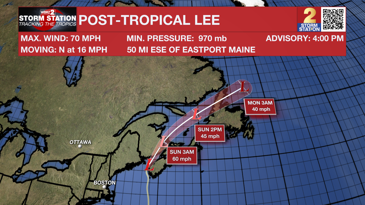
Post-Tropical Cyclone Lee is still a massive storm with sustained winds of 70mph moving North at 16 mph. Lee poses a large threat as it is expected to bring tropical storm force winds, 1-3 feet of storm surge, and 1-6 inches of rain to the New England and Atlantic Canada region during the next 24 hours .
Tropical Storm Margot continues to move very slowly. The storm will make a slow loop over the north-central Atlantic in the coming days. By the middle part of next week, we expect the storm to accelerate east toward the Azores.
-- Balin
The Storm Station is here for you, on every platform. Your weather updates can be found on News 2, wbrz.com, and the WBRZ WX App on your Apple or Android device. Follow WBRZ Weather on Facebook and Twitter for even more weather updates while you are on the go.
News
