

Latest Weather Blog
Monday Morning Video Forecast
Related Story
The workweek starts off sunny and warm but changes will arrive by mid-week. Clouds begin building on Tuesday followed by the chance for southern Louisiana to receive a decent amount of much needed rainfall on Wednesday.
Today & Tonight: A chilly start to your Monday morning will be followed by a pleasant afternoon with temperatures in the mid-80s. The clear skies we saw yesterday stick around to start off your workweek but clouds begin to build into the overnight. Low temperatures will be slightly more seasonable tonight as we will see them in the upper 50s. The next 24 hours will remain dry.
Up Next: Skies turn mostly cloudy into Tuesday as a warm front in the Gulf of Mexico advances toward the region. That said, we should remain dry on Tuesday. However, that warm front will be a lot closer on Wednesday. By then, we will see showers building across southern Louisiana.
Coastal communities and parishes could see a lot of rain on Wednesday. The real trick to the forecast will be determining the northern extent of the heavy rain. In reality, we’ll likely see a sharp cutoff between a lot of rain and not so much rain north and south of I-10/12. There’s also a chance we could see a subtropical area of low pressure develop offshore. We’ll get a much better idea of how this will play out in the coming days. For now, be prepared to face rain on Wednesday just in case.
We’ll have a separate cold front arriving from the northwest this upcoming Friday. That will dry us out and cool us off for another comfortable fall weekend in the boot.
Get the latest 7-day forecast and real time weather updates HERE.
Watch live news HERE.
The Tropics: As of Monday morning, there are no active storms in the Atlantic. However, there are two areas to watch. Showers and storms are beginning to show signs of organization several hundred miles to the south of the Cabo Verde Islands off the coast of Africa. Conditions appear favorable for gradual development of this system. A tropical depression is likely to for by midweek as the wave moves west across the eastern tropical Atlantic.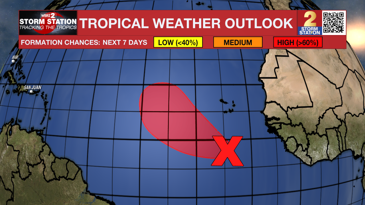
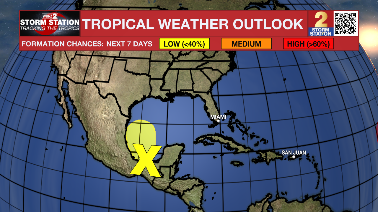
A small area of low pressure with disorganized thunderstorm activity has formed in the extreme southwestern Gulf of Mexico about 75 miles northeast of Coatzacoalcos, Mexico. Further development, if any, is expected to be slow to occur while the system moves slowly northwestward. Around midweek, the low is forecast to merge with a frontal system over the western Gulf of Mexico. This area has a low (20%) chance of developing into a tropical system at this time.
-- Emma Kate Cowan
The Storm Station is here for you, on every platform. Your weather updates can be found on News 2, wbrz.com, and the WBRZ WX App on your Apple or Android device. Follow WBRZ Weather on Facebook and Twitter for even more weather updates while you are on the go.
News
