

Latest Weather Blog
Monday Evening Video Forecast
Related Story
High pressure dominates our weather pattern for the first part of the week, keeping us cool and dry. That changes for the second half of the week as high pressure shifts east. Not only will we get warmer, but it opens the door for a few systems that could bring rain late this week and into the weekend.
Tonight & Tomorrow: A high cloud deck will be with us on Monday night. This will help hold back temperatures by a few degrees. Even so, it will be cold with temperatures in the 40s for much of the overnight stretch. We could even see temperatures dipping into the upper-30s by daybreak on Tuesday. Despite needing coats early on, we can trade those for jackets during the afternoon. High temperatures will climb into the 60s. The clouds will break as well, resulting in mainly sunny skies throughout Tuesday.
Up Next: High pressure remains in control through Wednesday, keeping us cool and dry. Wednesday morning looks like our coldest morning this week, with lows in the mid-30s. Rural pockets and areas north of the BR metro might even flirt with the freezing mark. Afternoon temperatures on Wednesday will be more pleasant, peaking in the mid-60s.
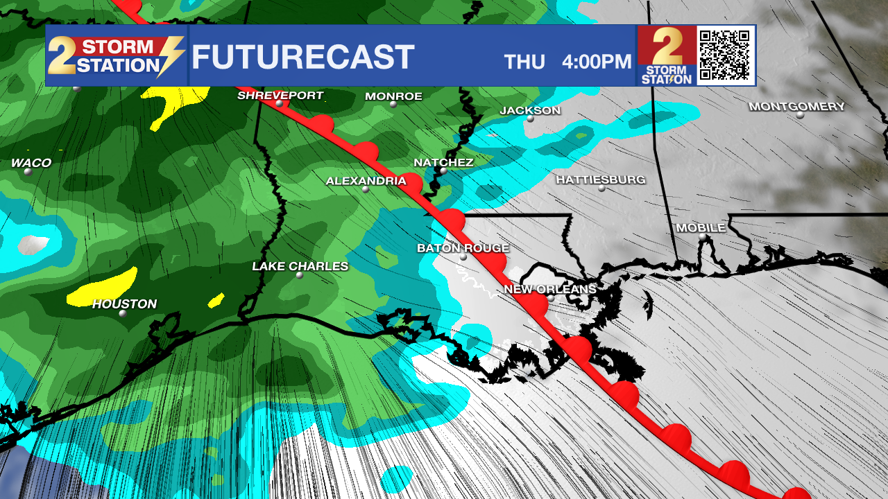
By Thursday, high pressure will have pushed east. This will allow winds to return out of the south, pushing warmer and muggier air inland from the Gulf of Mexico. This will also result in increased rain chances later this week and into the weekend. Our first wave of showers and storms arrives on Thursday from west to east. Rain coverage increases through the day, likely peaking on Thursday night. Friday looks like a drier day, but we still can’t rule out some lingering rain. A few more waves of showers look possible over the weekend. While some of the finer details may change in the coming days, the overall pattern seems to support more unsettled weather.
Get the latest 7-day forecast and real time weather updates HERE.
Watch live news HERE.
The Tropics: No tropical development is expected in the next 7 days. The final day of the Atlantic Hurricane Season is on Thursday.
-- Meteorologist Malcolm Byron
The Storm Station is here for you, on every platform. Your weather updates can be found on News 2, wbrz.com, and the WBRZ WX App on your Apple or Android device. Follow WBRZ Weather on Facebook and Twitter for even more weather updates while you are on the go.
News
