

Latest Weather Blog
Monday Evening Video Forecast
Related Story
Although Monday featured sunny skies from start to finish, more clouds are on the horizon. Cloud cover will thicken on Tuesday. By Wednesday, we may have enough moisture to bring a healthy dose of rain to southern Louisiana.
Tonight & Tomorrow: Despite a mostly clear sky on Monday evening, high clouds will be arriving from the south into the nighttime hours. By early Tuesday morning, we’ll see mostly cloudy skies. Overnight lows will also be much warmer, in the upper-50s. Skies eventually become overcast on Tuesday, and cloud bases will progressively lower through the day. Even with the clouds, it’ll be dry and warm with highs in the mid-80s.
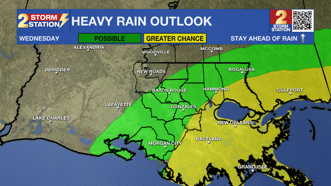
Up Next: On Tuesday night, we’ll begin to see some spotty showers moving onshore as a warm front nears the coast. We see a bigger uptick in rain chances closer to Wednesday morning, especially around and after sunrise. This could make for a soggy morning commute in some areas. Rain sticks around into the afternoon before exiting on Wednesday evening. Wind speeds also ramp up, with gusts pushing 30 mph in Baton Rouge.
Most rain should fall in the southeastern part of the state, where several inches are possible. There is a greater chance of coming across scattered flash flooding and coastal flooding in that direction also. There will be a sharp cutoff between those that see a lot of rain and those who don’t see much. Unfortunately, the metro area may end up close to the cutoff which makes rain totals trickier around the capital city. Nevertheless, there’s still a decent rain chance even if more of it falls to the southeast.
The rain coverage appears to be much lower on Thursday and Friday. By Friday night, another cold front will pass through. That will send temperatures tumbling over the weekend.
Get the latest 7-day forecast and real time weather updates HERE.
Watch live news HERE.
The Tropics: While there are no active storms in the Atlantic as of Monday afternoon, we are tracking a few tropical waves.
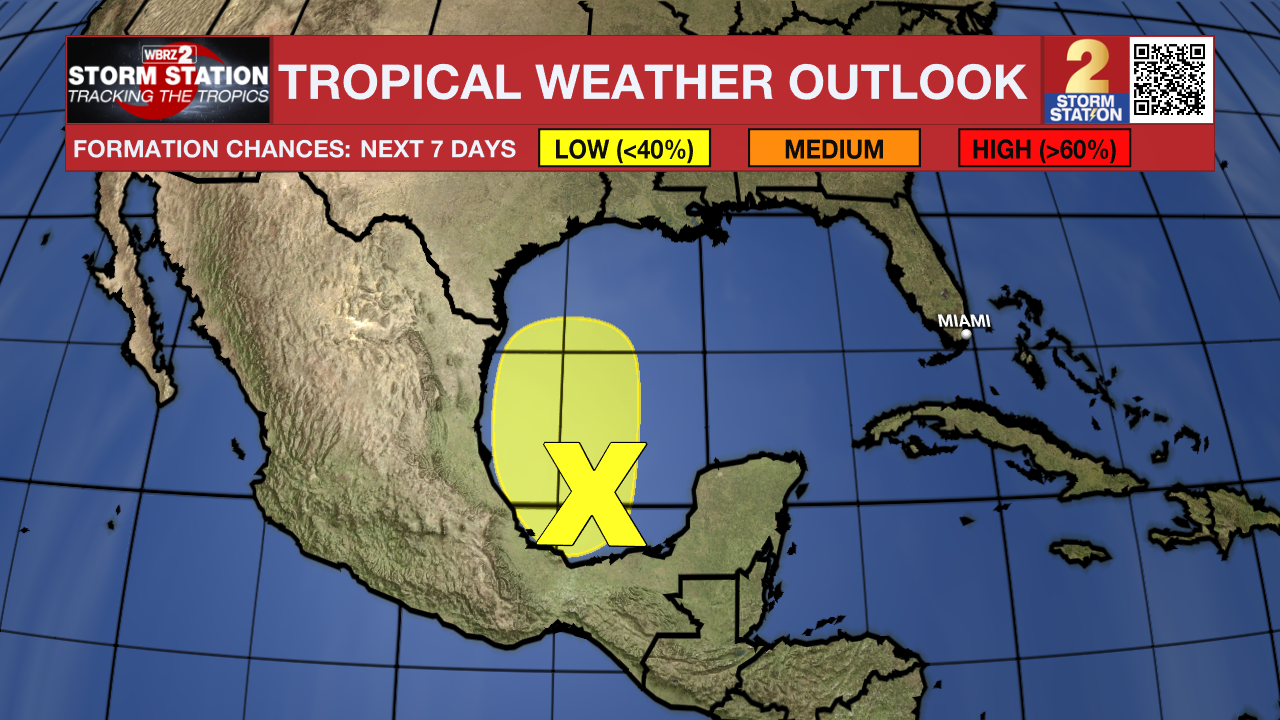
One of those areas is in the southwestern Gulf of Mexico. The National Hurricane Center only has a 20% chance of this storm developing into something tropical as it drifts north toward the U.S. Gulf Coast. This storm will eventually merge with the frontal system that affects our local weather by midweek. The associated area of low pressure will likely sit off the Louisiana coast on Wednesday. Even if it takes a name, our forecast will remain unchanged. We do not expect major impacts as of this time.
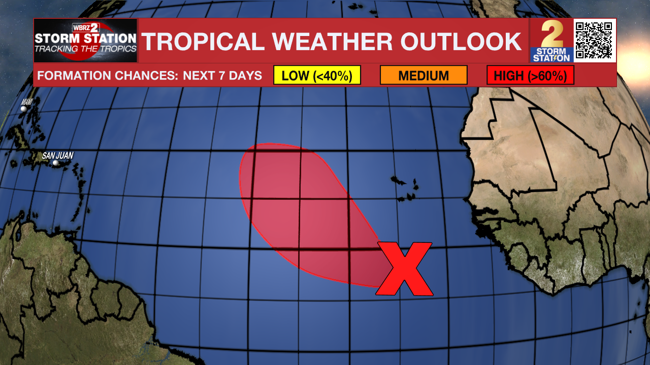
Meanwhile, another tropical wave is located several hundred miles south-southwest of the Cabo Verde Islands. The system is showing signs of organization and is operating in an environment conducive for additional development. A tropical depression is likely to form in the next couple of days in the eastern tropical Atlantic.
News
