

Latest Weather Blog
Monday evening video forecast
Related Story
The big headline this week will be arrival of the first significant fall cold front of the season. Until it arrives, expect highs in the 90s to continue.
Tonight & Tomorrow: Beneath clear skies, overnight low temperatures will slip into the mid to upper 60s. A northeast breeze of 5-10mph will mean that it should continue to feel more on the dry side rather than the muggy side. On Tuesday, mostly sunny skies will prevail, driving high temperatures into the low 90s for the record 136th time in 2023. Aside from a coastal shower, most of the area will continue those dry conditions.
Up Next: Wednesday and Thursday will continue the abnormally hot conditions for early October. With mainly clear skies, morning lows near 70s will become afternoon highs in the low 90s. However, by Thursday night, the first noteworthy cold front of the fall season will begin to press into the Gulf Coast region. This front will be running into drier air locally and so a line and showers and thunderstorms is expected to be weakening on approach with only isolated activity making it into the area after dusk. As a secondary front swings in from the north, moisture pooling along the original front may aid in the development of a few more showers and thunderstorms, especially early on Friday. After a muggy start to Friday, humidity will gradually drop through the end of the workweek with major changes felt by the weekend. Saturday will begin with lows in the mid 60s followed by highs in the mid 80s, despite sunshine. The coolest temperatures so far this season are anticipated on Sunday and Monday morning with lows in the low to mid 50s and highs barely returning to the low 80s.
Get the latest 7-day forecast and real time weather updates HERE.
Watch live news HERE.
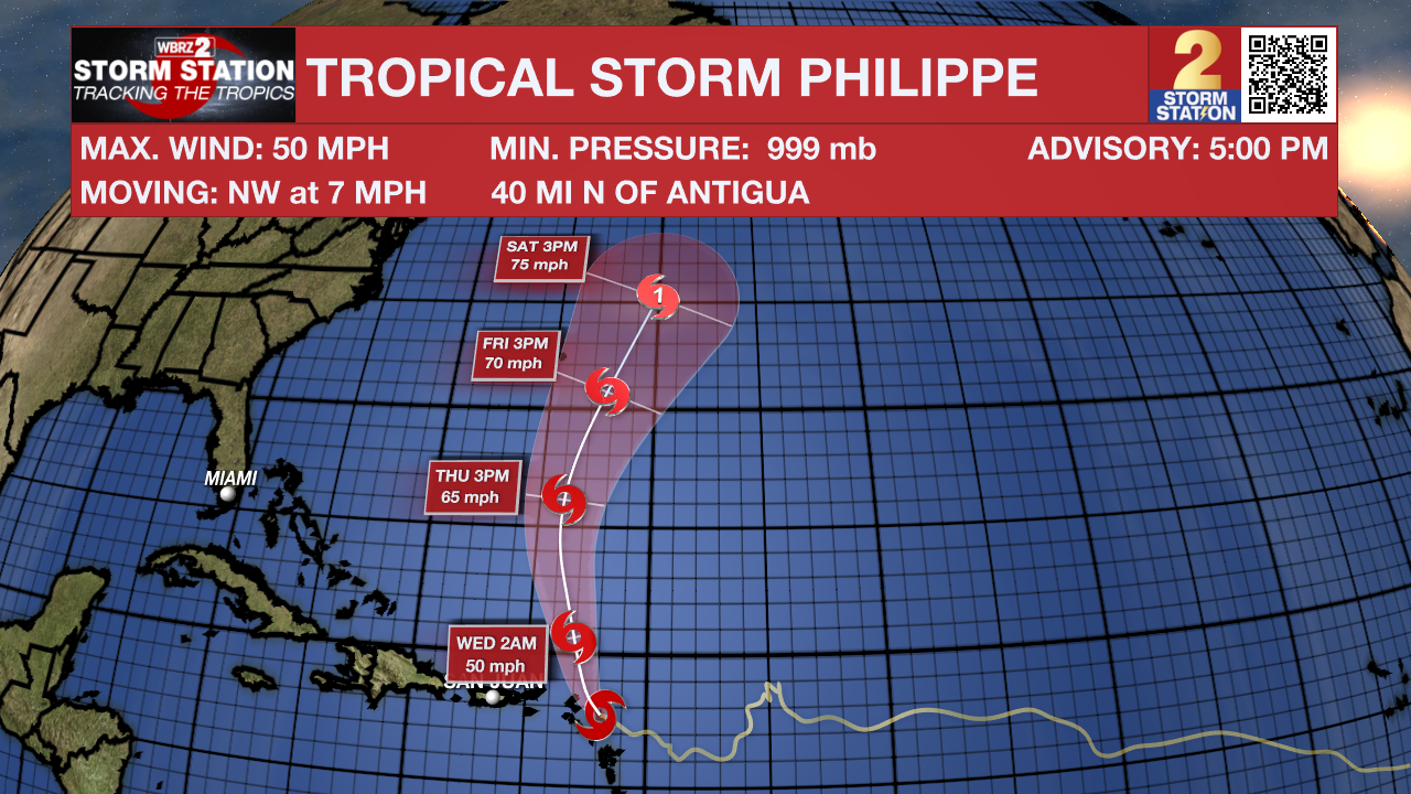
The Tropics: Tropical Storm Philippe will bring heavy rain and flooding potential to the Leeward Islands Monday into Tuesday. Maximum sustained winds of 50mph will hold steady for the next few days but Philippe may intensify as it starts to jog more northward and away from the islands during the middle of the week.
– Josh
The Storm Station is here for you, on every platform. Your weather updates can be found on News 2, wbrz.com, and the WBRZ WX App on your Apple or Android device. Follow WBRZ Weather on Facebook and Twitter for even more weather updates while you are on the go.
News
