

Latest Weather Blog
Monday 10pm Video Forecast
Related Story
11:00pm Update - As of 10:48pm, a line of storms was moving through Baton Rouge. These contained gusty winds, but were below severe limits. The severe threat is over for Baton Rouge, but areas east and southeast will still need to monitor these storms. They have thankfully exhibited a weakening trend, but parts of the line could get stronger. Brief tornadoes and severe wind gust will still be possible.
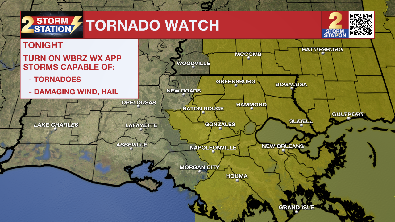
A TORNADO WATCH means conditions are favorable for tornadoes and/or damaging winds in and around the watch area. Be on the lookout for threatening weather conditions and listen for later statements and possible warnings. If a tornado warning is issued, seek shelter in a low-level, interior room of a sturdy building. Take pets (on a leash) with you, have on hard-soled shoes, monitor storm coverage on a wireless device and cover your head in the event of wind or tornado impact. For more on tornado safety, CLICK HERE.
The Storm Station is tracking a potential for high winds, heavy rain, and strong thunderstorms into the night. Make sure to grab your rain gear, keep your phone charged, and turn weather alerts ON! Here are a few things to keep in mind:
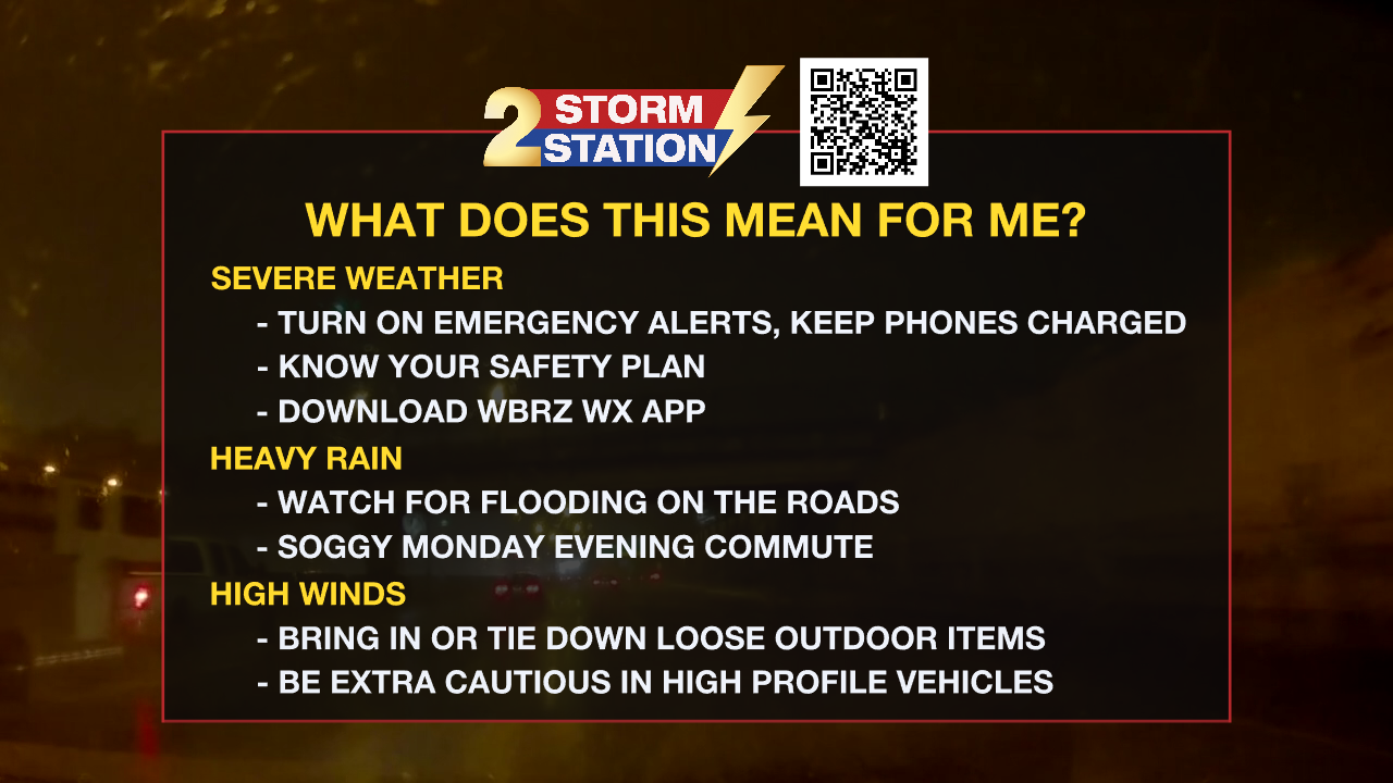
Heavy Rain - Rain and thunderstorms will continue into the overnight hours. Expect a line of thunderstorms to arrive as we approach midnight and the heaviest rainfall will occur in those thunderstorms. High rainfall rates could overwhelm drainage systems and cause flooding of roads and low lying areas. A few showers will linger overnight into early Tuesday morning.
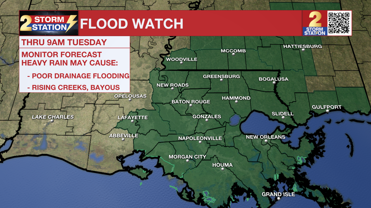
When all is said and done, several inches of rain are possible, with locally higher amounts. Flash flooding will be possible. A FLOOD WATCH is in effect until 9 a.m. Tuesday for the entire area. Don't try to drive through high water if you encounter flooded roads.
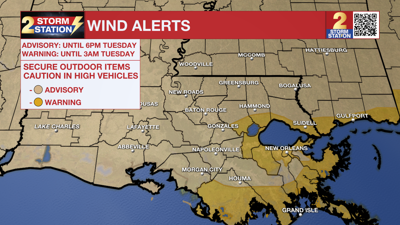
High Winds - Even outside of rain and storms, things will get pretty windy. Be sure to secure loose outdoor items and be extra cautious around high-profile vehicles on the roads. Sustained winds of 15-30 mph are possible, with gusts up to 45 mph in Baton Rouge. A WIND ADVISORY is in effect from until 9 a.m. Tuesday for the capital region. We expect even higher winds closer to the coast and near the tidal lakes. There, a HIGH WIND WARNING is in effect until 3 a.m. Tuesday where we could see gusts upwards of 50-60 mph.
Tonight & Tomorrow: Through early Tuesday, there is a severe weather potential. After 1 a.m., storms exit to the east and we contend with a few lingering showers through daybreak. Skies will clear out on Tuesday, and it will windy and cool with highs in the mid-50s.
Up Next: Rain chances stay limited the next few days with highs either near or below normal. Our next storm system arrives late in the week, and we have included a corresponding increase in storm chances by Friday. We'll have to watch that system closely also, as there are some signs a few of those storms could be strong.
Get the latest 7-day forecast and real time weather updates HERE.
Watch live news HERE.
The Storm Station is here for you, on every platform. Your weather updates can be found on News 2, wbrz.com, and the WBRZ WX App on your Apple or Android device. Follow WBRZ Weather on Facebook and Twitter for even more weather updates while you are on the go.
News
