

Latest Weather Blog
Friday Night Video Forecast
Related Story
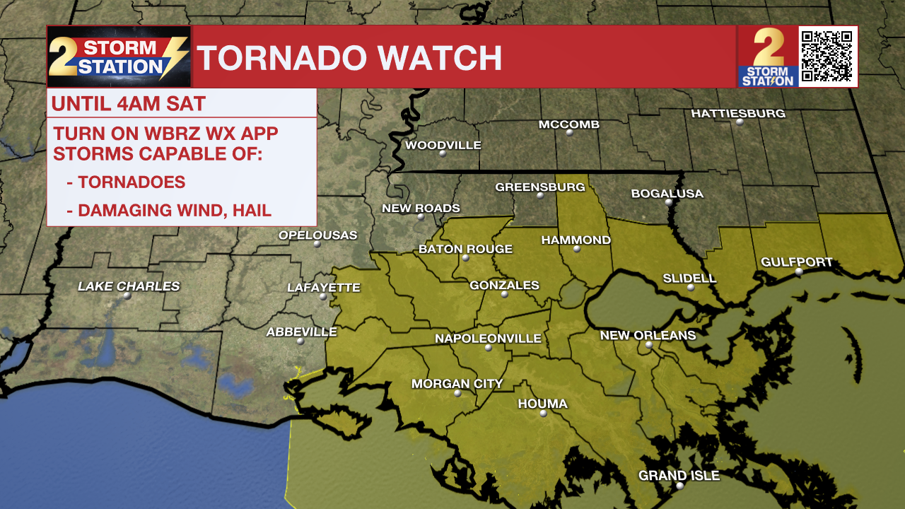
The National Weather Service has issued a TORNADO WATCH for East Baton Rouge, West Baton Rouge, Livingston, Ascension, Tangipahoa, Iberville, St. James, Assumption, and St. Mary parishes until 4 a.m. Saturday.
A TORNADO WATCH means conditions are favorable for tornadoes and/or damaging winds in and around the watch area. Be on the lookout for threatening weather conditions and listen for later statements and possible warnings. If a tornado warning is issued, seek shelter in a low-level, interior room of a sturdy building. Take pets (on a leash) with you, have on hard-soled shoes, monitor storm coverage on a wireless device and cover your head in the event of wind or tornado impact. For more on tornado safety, CLICK HERE.
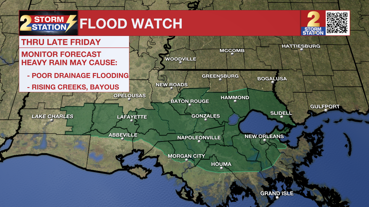
In addition, a FLOOD WATCH takes effect at 6pm Friday evening and lasts into early Saturday morning for East Baton Rouge, West Baton Rouge, Iberville, Ascension, Assumption, Livingston, St. James, St. Mary and Tangipahoa parishes.
Excessive runoff may result in flooding of rivers, creeks, streams, and other low-lying and flood-prone locations. CLICK HERE for flood safety information.
Urgent weather and storm information
Click HERE for the WBRZ weather page
Stream WBRZ newscasts and WBRZ Plus online here
Click HERE to watch the WBRZ 24-hour weather channel live online
Tonight & Tomorrow: Spotty showers on Friday afternoon will become more widespread as the night wears on. By 9-10 p.m., much of the area will be dealing with shower and thunderstorm activity. A ***FLOOD WATCH*** is in effect through late Friday night in areas that saw around 2-5" of rain on Thursday night. As a result, rain could runoff quickly leading to areas of flash flooding. In addition, rain intensity could lead to water piling up in the more urban areas leading to flash flooding in those areas. As a general baseline, we expect 1-2" of rain on Friday night. However, areas that end up under the heaviest rain may end up with 3"+.
A few storms on Friday may also be on the strong to severe side. While we do not expect widespread severe weather, be aware that a few storms may be capable of producing damaging winds and isolated tornadoes. A Tornado Watch is in effect along and south of the interstate until 4 a.m. Saturday. The best chance of that will in our southern parishes, closer to the coast. Be sure to have a way to receive weather alerts BEFORE you go to bed in case a Tornado Warning is issued in your location.
We'll see storms gradually becoming more scattered in the overnight hours, with scattered storms possible into Saturday morning. Cloud cover and rain will also keep temperatures on the mild side early Saturday, with lows in the mid to upper-60s. We'll see another lull in the rain late Saturday morning and into the early afternoon. That may be followed by another round of isolated or widely scattered storms by late afternoon and evening. It will get warm also, with highs in the mid-70s.
Up Next: The weather will turn much drier for the second half of the weekend. We'll keep mostly cloudy skies on Sunday, with high temperatures in the low-70s. Relatively quiet weather sticks around next week. We'll see a mixture of clouds and sun each day, and temperatures will get closer to "normal" values. By mid-week, we are looking at another potential cooldown with highs in the low to mid-60s. By Thursday morning, we might see lows dipping into the upper-30s.
-- Meteorologist Malcolm Byron
Remember that the WBRZ WX App. is *free* on Apple and Android devices and can be used for breaking weather alerts, live radar, as well as daily and hourly forecast details. If your power or broadcast signal is ever lost, you can watch live coverage on the WBRZ News App. For even more, plug in to the WBRZ Weather Team on Facebook and “X”.
News
