

Latest Weather Blog
Friday Morning Video Forecast
Related Story
*9:30am update* - All showers are now exiting the viewing area, and any severe threat is now over.
The rest of the day will be cool and very breezy. Temperatures remain chilly this weekend but it's advised to take necessary cold weather precautions this weekend before an extremely cold next week. Wrap up those pipes and dig the cold weather gear out of your closets!
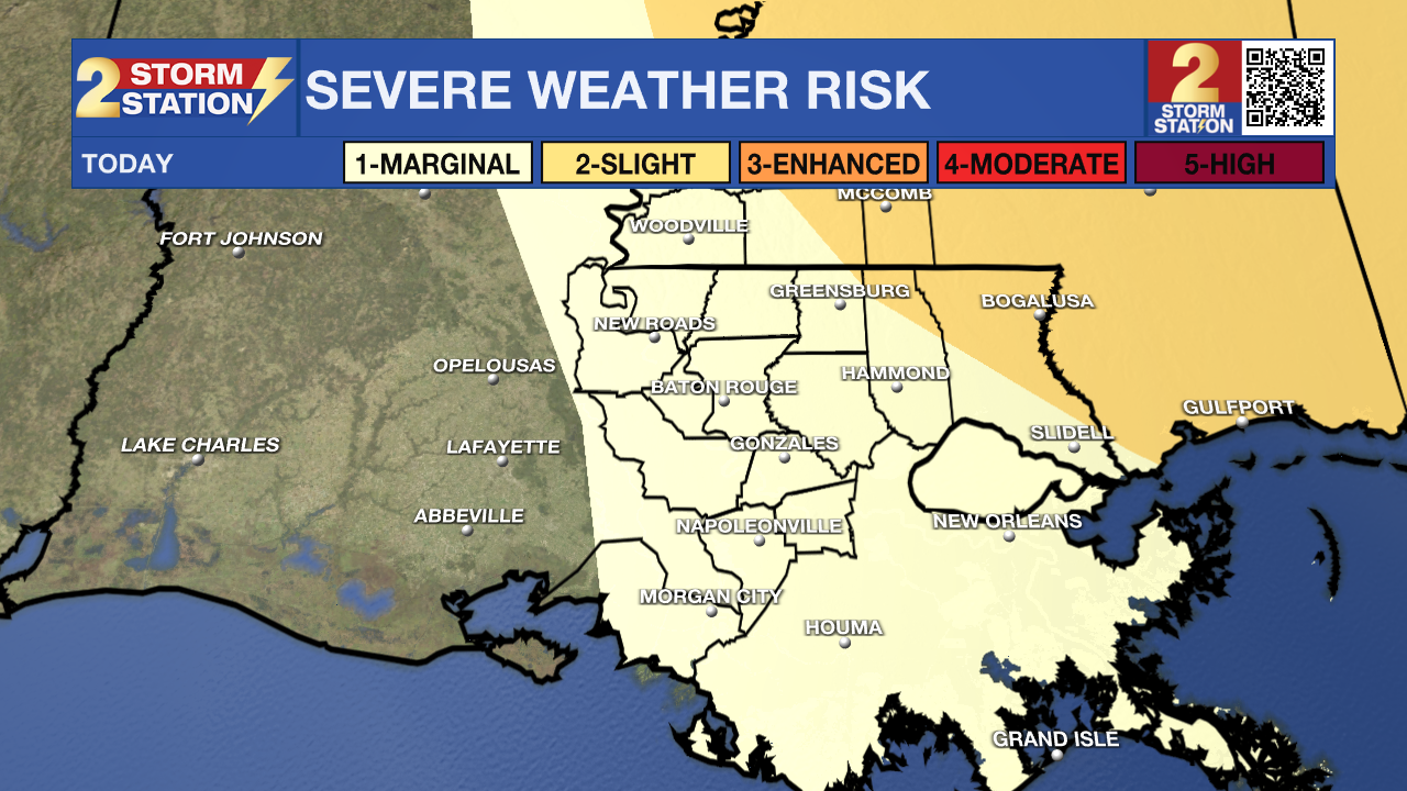
Today & Tonight: Overnight, isolated rain showers began to spring up around the state as a warm front passed through, keeping temperatures right around 70° this morning. Temperatures will quickly drop once a cold front brings a line of showers and storms across southern Louisiana between the hours of 5-10am. The Capital Area remains under a 1/5 "Marginal" Risk for severe weather associated to this line, and while this posses less of a threat than originally presumed, we still cannot rule out a stronger thunderstorm producing damaging straight line winds or a spin-up tornado. All of the state is included in a WIND ADVISORY during daytime hours as gusts could exceed 40 mph with sustained winds between 20-30 mph.
Post-frontal, winds remain elevated but cool and dry conditions quickly take over and eliminate most cloud cover for a nice, but chilly second half of the day! Overnight, the chill remains as mainly clear skies allow temperatures to dip right around the freezing mark or below for most.
Up Next: A quiet weekend forecast of mainly sunny skies, low temperatures near freezing and afternoons in the mid-50s to low 60's makes a great opportunity to prepare for what will be one of the coldest weeks of the season. Dig out extra cold weather gear; cloves, beanies, earmuffs, etc. and wrap up any pipes as wind chills next week become dangerously cold in the teens and a hard freeze is very likely.
An Arctic air mass continues to take over the majority of the United States this weekend, making it as far south as Louisiana during the day on Monday. Ahead of the cold, moisture from the gulf will allow showers during the day on Monday, and depending on timing of these two weather events, we could end up seeing light freezing rain or sleet towards the evening hours. We will have a better idea of the chance this weekend so make sure to check back in with the Storm Station.
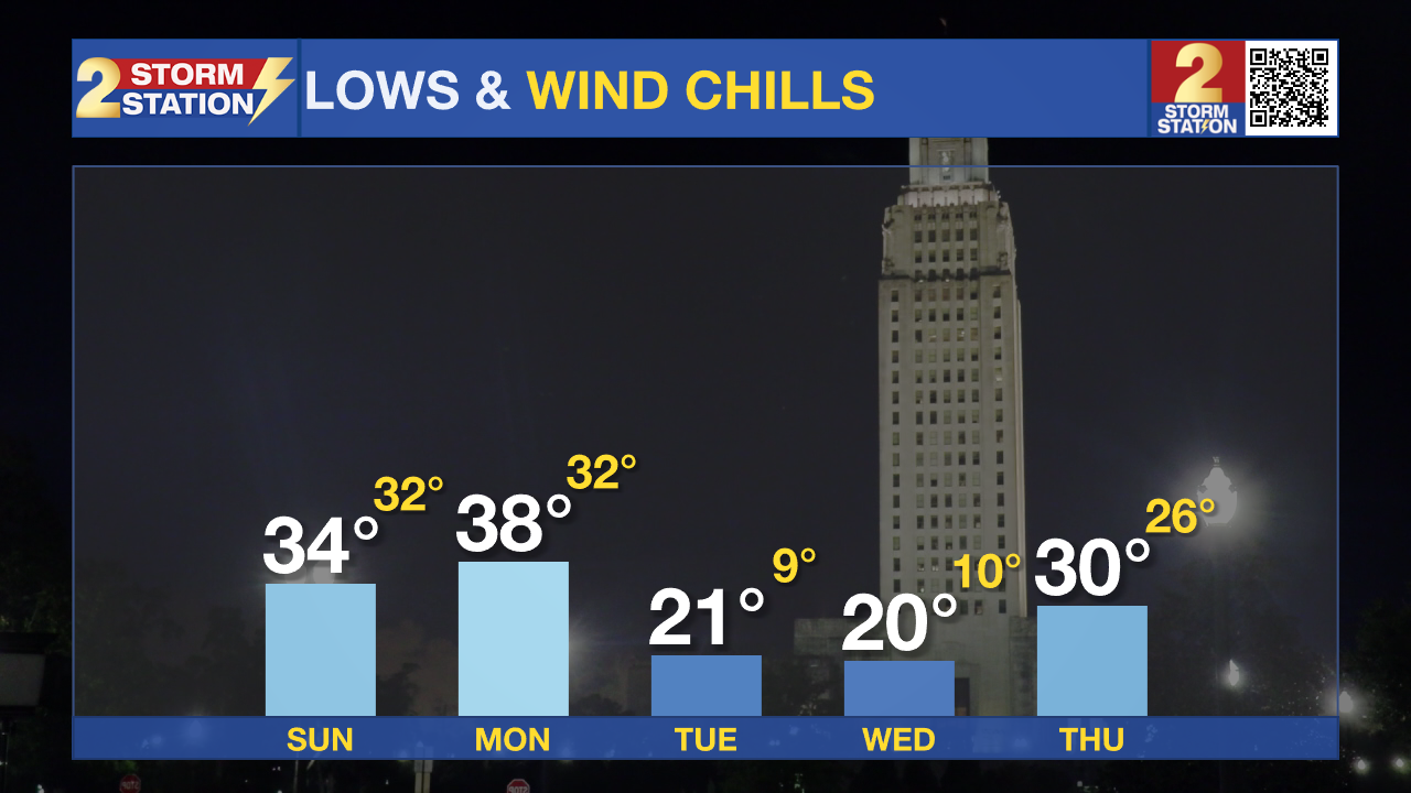
One thing is for certain though, next week will be extremely cold. Beginning Monday night we will have the first chance for a hard freeze in our area since 2022! Temperatures are forecasted near 21° in the Capital Area with parishes north and Mississippi counties easily recording temps in the teens that night. Add in the light winds, wind chills as low as 10° could be felt around the Storm Station area. Tuesday afternoon offers no relief with highs only in the 30s with a colder night expected going into Wednesday allowing another opportunity for a hard freeze.
The end of the workweek, while still cold, is trending a bit more towards average for January.
Get the latest 7-day forecast and real time weather updates HERE.
Watch live news HERE.
– Emma Kate Cowan
News
