

Latest Weather Blog
Friday Evening Video Forecast
Related Story
We’ve dealt with the all too familiar humidity for most of this week. However, another shot of dry air is soon to arrive. Low humidity moves in over the weekend, and that will reduce rain chances into next week.
Tonight & Tomorrow: Some clouds will linger on Friday night. We expect partly cloudy skies with a small chance to see a spotty storm during the evening hours. We’ll see an overnight low in the low-70s. Saturday is our transition day to a drier pattern. We’ll still have enough humidity where a spotty storm isn’t totally out of the question. That said, most of the rain will pop up closer to the coast. It’ll be warm on Saturday, with highs in the mid-90s.
Up Next: Dry air fully invades on Saturday night. While we expect highs in the middle-90s on Sunday, the low humidity will give the air a more comfortable feel. We expect more of the same next week. Lots of sunshine, low humidity, highs in the 90s, and a lack of rain chances. We’ll certainly have trouble eating away at the drought next week.
Get the latest 7-day forecast and real time weather updates HERE.
Watch live news HERE.
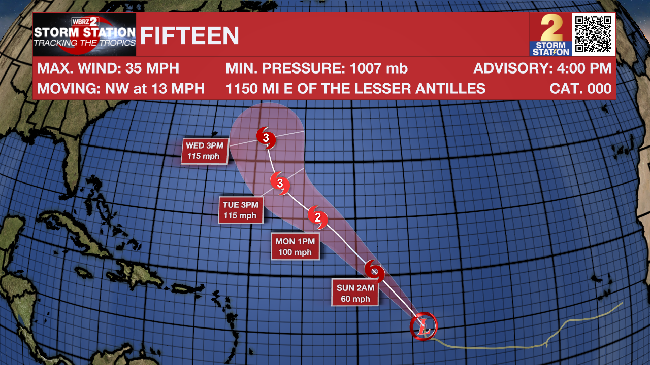
Tropics: Tropical Depression Fifteen has formed in the central Atlantic between the Cabo Verde islands and the Lesser Antilles. The storm is moving northwest at 13 mph and will gradually strengthen this weekend. Fifteen will likely become a tropical storm by Saturday, taking the name Nigel once that happens. We expect the storm to attain hurricane status next week.
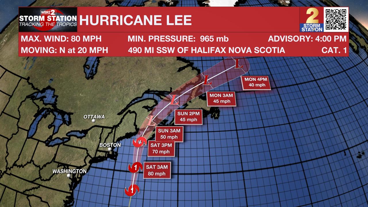
Hurricane Lee continues to race northward toward New England. The storm remains a Category 1 hurricane as of Friday afternoon but will weaken tropical storm status as it nears Nova Scotia on Saturday. Lee is a massive storm, with hurricane force winds extending 115 miles from the center and tropical storm force winds reaching 345 miles from the center. Although Lee will lose some tropical characteristics this weekend, Lee will remain very large and bring storm force winds, 1-3 feet of storm surge, and 1-6 inches of rain to the region.
Hurricane Margot became a tropical storm on Friday and continues to move very slowly. The storm will make a slow loop over the north-central Atlantic in the coming days. By the middle part of next week, we expect the storm to accelerate east toward the Azores.
-- Meteorologist Malcolm Byron
The Storm Station is here for you, on every platform. Your weather updates can be found on News 2, wbrz.com, and the WBRZ WX App on your Apple or Android device. Follow WBRZ Weather on Facebook and Twitter for even more weather updates while you are on the go.
News
