

Latest Weather Blog
Friday evening video forecast
Related Story
A cold front will bring the possibility of showers and thunderstorms for the second half of the weekend. Much colder temperatures will follow.
Tonight & Tomorrow: A cold front will continue to drift farther south into the Gulf of Mexico this evening. As this occurs, showers will end from north to south through dusk. Partial clearing is expected overnight with low temperatures retreating into the upper 50s and low 60s thanks to a wind shift to the north at 5-10mph. A light outer layer may be wanted if spending time outside. On Saturday, temperatures will quickly warm into the 80s with partly sunny skies during the afternoon. Remember to set the clocks ahead one hour before going to bed!
LSU Baseball: It is Military Appreciation Weekend for the weekend games against Samford. By 6:30pm Saturday, temperatures will be falling trough the 70s with partly cloudy skies. First pitch on Sunday goes out at 1pm. Preparing for that game could be a challenge. Temperatures will warm into the mid 80s on Sunday ahead of a cold front. That system is pegged to reach the area around midday with isolated showers and thunderstorms. Additionally, sharp temperature changes are expected on the other side of the front so it might be a good idea to take rain gear and warmer layers to add. Of course, check in with the Storm Station as we drill into the timing during our weathercasts. You can also get hour by hour weather on the WBRZ WX App.
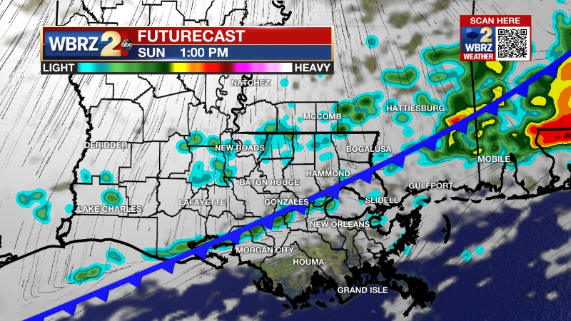
Up Next: Another cold front will move into the area on Sunday. Unseasonably warmth is expected ahead of it with lows in the upper 60s and highs in the mid 80s. The front will trigger scattered showers and thunderstorms from late morning to late afternoon. Sunday does not look like a washout, but with rain possible during the middle of the day, any outdoor activities may want to have a wet weather plan. Lingering showers and thunderstorms will be possible into the evening, but rain will wrap up with drier and much cooler conditions for the Monday morning drive. Especially Tuesday and Wednesday morning, a light jacket will come in handy as low temperatures dip into the low to mid 40s. Expect a couple of sunny afternoons with highs in the 60s. Next, we have eyes on a storm system that will bring a much better chance of organized rain, and possibly thunderstorms toward the end of next week. Timing is starting to trend toward Friday afternoon and evening which is good news for the Wearin’ of the Green parade.
Get the latest 7-day forecast and real time weather updates HERE.
Watch live news HERE.
--Josh
The Storm Station is here for you, on every platform. Your weather updates can be found on News 2, wbrz.com, and the WBRZ WX App on your Apple or Android device. Follow WBRZ Weather on Facebook and Twitter for even more weather updates while you are on the go.
News
