

Latest Weather Blog
Friday evening video forecast
Related Story
Near freezing temperatures are expected overnight into Saturday. After a chilly start to the weekend, a gradual and significant warming trend will get underway.
Tonight & Tomorrow: Winds will ease a bit into the evening hours, and with mainly clear skies, low temperatures will have no problems sinking into the low 30s. Areas north of I-12 could briefly touch freezing, while south of I-10, that is not a concern. Ample sunshine will welcome the first half of the weekend. Winds will transition from northeast to southeast and high temperatures will tick a little warmer than Friday, hitting the upper 50s.
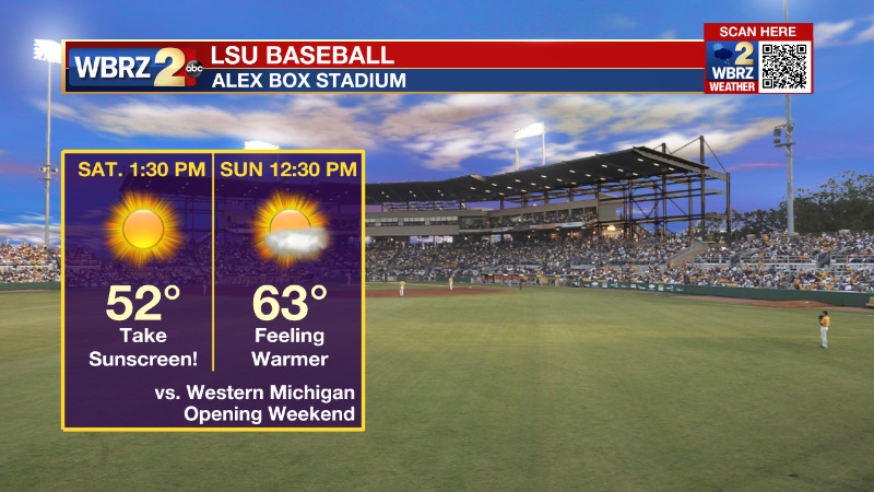
Parade Forecasts:
Krewe of Southdowns, Friday at 7pm -- Mostly clear and breezy with temperatures falling through the 40s.
Spanishtown, Saturday at 12pm -- Sunny with temperatures rising through the 50s.
Krewe of Good Friends of the Oaks, Sunday at 12pm -- Mostly sunny with temperatures rising through the 60s.
Krewe of Comogo, Sunday at 7pm -- Mostly clear with temperatures falling through the 50s.
Up Next: The second half of the Mardi Gras Weekend will feature moderating temperatures with lows in the upper 30s and highs in the upper 60s beneath mainly clear skies. Lundi Gras and Mardi Gras both look dry with high temperatures in the upper 70s to even low 80s! In fact, high temperatures in the 80s will be common from Tuesday through the end of next week and some records could fall on Thursday. The next chance for rain will be in the form of a stray shower on Wednesday. A weak cold front could enter the area next Friday.
Get the latest 7-day forecast and real time weather updates HERE.
Watch live news HERE.
Detailed Forecast: Light breezes will ease overnight as a surface high pressure system settles over the Mid South. With mainly clear skies and dew point temperatures in the low 30s, thermometers will be able to approach freezing. Along and north of I-12, 32 degrees is possible for a short time. As the surface high moves into the Southeast, surface winds will shift from northeast to southeast through the daytime hours. With sunny skies, high temperatures will warm a bit more than Friday. The real warming trend will commence on Sunday. An upper level ridge of high pressure will anchor over the Gulf of Mexico by next week leading to above average temperatures across the Southeast. Monday through Friday, high temperatures will be in the upper 70s to low 80s! Some low level moisture will result in mild nights in the mid 60s and some clouds from time to time. A weakening front off to our northwest could result in isolated showers by Wednesday or Thursday. The next system that will affect the area will approach on Wednesday. A surface low looks to rapidly eject northeast from north Texas toward the Great Lakes. The associated cold front will stall beneath upper level winds parallel to the boundary. An isolated shower or two will be possible, especially north and west of Baton Rouge, but overall rain prospects remain low through Thursday. Beyond that, another front could near the area by next Friday, but that is quite a way out to resolve particulars, especially with models in pretty poor agreement.
--Josh
The Storm Station is here for you, on every platform. Your weather updates can be found on News 2, wbrz.com, and the WBRZ WX App on your Apple or Android device. Follow WBRZ Weather on Facebook and Twitter for even more weather updates while you are on the go.
News
