

Latest Weather Blog
Wednesday PM Forecast: seemingly weekly threat for strong storms comes tomorrow
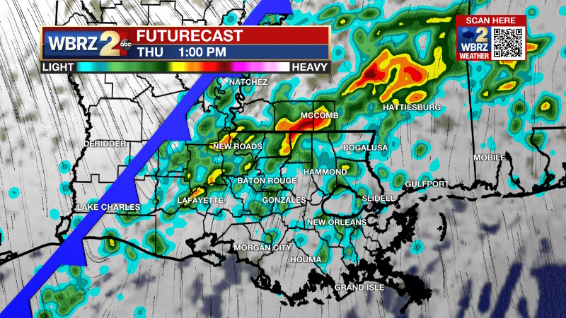
A cold front will bring a chance for strong to severe thunderstorms on Thursday. Much colder air will come behind with front to end the workweek.
Tonight & Tomorrow: Still, no major impact weather is anticipated overnight. The area will remain beneath cloudy skies with an isolated shower possible. The south winds of 10-15mph will keep low temperatures in the upper 60s. A cold front will enter the area on Thursday morning. Continuing south winds of 10-15mph will bump temperatures into the low 70s, but showers and thunderstorms are expected to break out by the mid-morning hours. There is a window of opportunity between 10am – 4pm where the atmosphere will support strong thunderstorms, so be alert to any potential watches and subsequent warnings. The cold front will push through later in the afternoon and winds will shift to the northwest, effectively ending the threat for severe weather. However, showers will linger into the evening and clouds may be slow to break overnight.
Up Next: A sharply colder air mass will be in place by Friday morning and temperatures will dive into the low 40s. Despite gradually returning sunshine, high temperatures will remain in the low 50s. The Mardi Gras Weekend will begin with near freezing temperatures on Saturday morning followed by a sunny afternoon with thermometers in the mid 50s. Sunday will feature moderating temperatures with lows in the upper 30s and highs in the upper 60s beneath mainly clear skies. Lundi Gras and Mardi Gras both look dry with high temperatures in the upper 70s to even low 80s!
Trending News
Get the latest 7-day forecast and real time weather updates HERE.
Watch live news HERE.
Detailed Forecast: Warm and moist air will continue to advance into the region overnight as an upper level trough of low pressure and associated surface low deepen over the Midwest. This air mass will prime the atmosphere in advance of a cold front associated with the previously mentioned system. With temperatures in the low 70s and dew points in the upper 60s, instability will be no problem across the forecast area. As a result, showers and thunderstorms will begin to fire early and ahead of the cold front on Thursday. The question will be wind shear. While it is expected to be borderline, recent trends have suggested slightly more becoming available during the middle of the day, making this period the prime window for thunderstorms to achieve severe limits. The greatest overlap of severe weather ingredients will be along and north of I-10/12, warranting the "slight risk" from the Storm Prediction Center. The cold front should exit the area early Friday morning, taking all of the showers east with it. Cold air will advance in behind the front. Friday will be sunny, brisk and cold with highs in the 50s. A surface high pressure system will park over the Mid-South on Friday night into Saturday leading to lighter winds and clear skies to maximize cooling in the region. It is possible a few spots north and east of Baton Rouge get close to freezing by Saturday morning. Temperatures will gradually warm through the rest of the weekend with cool mornings giving way to mild and dry afternoons. The next chance for rain will come during the middle part of next week, we will monitor closely to see if this plays a role in Mardi Gras forecast.
--Josh
The Storm Station is here for you, on every platform. Your weather updates can be found on News 2, wbrz.com, and the WBRZ WX App on your Apple or Android device. Follow WBRZ Weather on Facebook and Twitter for even more weather updates while you are on the go.
More News
