

Latest Weather Blog
Wednesday PM Forecast: one more night of fog, increasing potential for some rain
DENSE FOG ADVISORY: is in effect from 1 - 10am Thursday across southeast Louisiana and southwest Mississippi. Visibility could drop to one quarter of a mile or less causing hazardous driving. Slow down, use low beam headlights, and leave plenty of distance ahead of you. Especially near New Orleans, wildfire smoke mixing with fog can create extremely dangerous driving conditions. Plan extra time for your morning commute through this area and be prepared for sudden changes in both visibility and traffic conditions.
NEW: Rain chances are increasing as a cold front is expected to cross the area on Friday and stall in the region on Saturday. While any rain is helpful given the drought, dreary conditions could put a damper on some outdoor events.
Tonight & Tomorrow: Another night of partly cloudy skies and patchy fog is expected. The thickest fog is most likely after midnight until just after dawn, mainly for areas near the lakes and Metro New Orleans. Low temperatures will stop in the low 60s. Thursday will be warm with high temperatures returning to the mid 80s. Though a little morning sun will help to break up fog, it will give way to increasing clouds through the afternoon as a frontal system approaches the area.
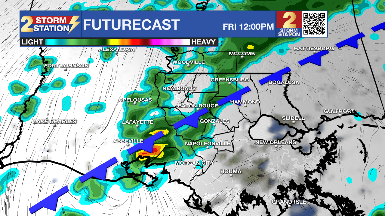
Up Next: On Friday, a weak cold front will crawl into the region from the northwest. The front will bring our best chance at rain in quite some time. With temperatures in the low 70s, the workweek will end with scattered showers.
Trending News
The front is likely to stall near the coast, leaving cloud cover and some rain around, for at least the first half of the weekend. Saturday will be overcast with occasional light rain and drizzle. Temperatures will remain in the 60s. Sunday will have lower rain coverage but a spotty shower remains possible.
Through the weekend, rainfall rates are expected to be on the lower end and thunderstorms are not expected. Most locations will receive between a half inch and an inch of rain over the three day stretch. None of the three days are expected to be washouts, but given the off and on potential of the showers, you should have an umbrella or poncho at the ready for any outdoor events.
Unsettled weather could continue after the weekend, but confidence is very low in that part of the forecast at this time. Stay in touch with the Storm Station as new information becomes available.
Get the latest 7-day forecast and real time weather updates HERE.
Watch live news HERE.
The Tropics: For the North Atlantic, Caribbean Sea and the Gulf of Mexico, the tropical are quiet. No development is expected during the next 7 days.
– Josh
The Storm Station is here for you, on every platform. Your weather updates can be found on News 2, wbrz.com, and the WBRZ WX App on your Apple or Android device. Follow WBRZ Weather on Facebook and Twitter for even more weather updates while you are on the go.
More News
