

Latest Weather Blog
Wednesday PM Forecast: heat and drier conditions continue
Searing heat will stay the story as the Capital Area goes into a heat advisory for the 9th straight day. The first sign of rain relief shows up by the weekend.
A *HEAT ADVISORY* will be in effect on Wednesday from 12pm - 7pm for all of southeast Louisiana and southwest Mississippi. Heat index values up to 112 may cause heat illnesses to occur.
Drink plenty of fluids, stay in an air-conditioned room, stay out of the sun, and check up on relatives and neighbors. Young children and pets should never be left unattended in vehicles under any circumstances. Take extra precautions if you work or spend time outside. When possible reschedule strenuous activities to early morning or evening. Know the signs and symptoms of heat exhaustion and heat stroke. Wear lightweight and loose fitting clothing when possible. To reduce risk during outdoor work, the Occupational Safety and Health Administration recommends scheduling frequent rest breaks in shaded or air conditioned environments. Anyone overcome by heat should be moved to a cool and shaded location. Heat stroke is an emergency!
Tonight & Tomorrow: Overnight will be clear and warm with low temperatures in the upper 70s. Thursday will bring a heat repeat with sunshine pushing high temperatures into the upper 90s. Humidity will cause feels-like temperatures between 107 – 112 degrees. We will be hard pressed to find any cooling showers.
Up Next: As the workweek ends, don’t look for much change. Dangerous heat indices and low rain chances will continue. On Saturday, the big dome of warm air will start to get squeezed west as a very weak front chugs southward toward I-20. While temperatures will shoot into the upper 90s ahead of it, some late day showers and thunderstorms could cool off a few spots. Then on Sunday, the front will begin to stall in the region and severe as a trigger for additional clouds, showers and thunderstorms. All of this will lead to highs and lows a bit closer to average in the low 90s and mid 70s respectively. If you have outdoor plans, pay attention to the radar and lightning tracker on the Storm Station App in case you need to move inside for a little while. Similar weather is expected for the beginning of next week.
Trending News
Get the latest 7-day forecast and real time weather updates HERE.
Watch live news HERE.
The Tropics: Tropical Storm Don is strengthening over the central Atlantic Ocean. Moving to the west at 8mph with maximum sustained winds of 45mph, Don will turn northwest by the weekend doing a little more strengthening along the way. By next week, the storm will weaken over the cooler waters.
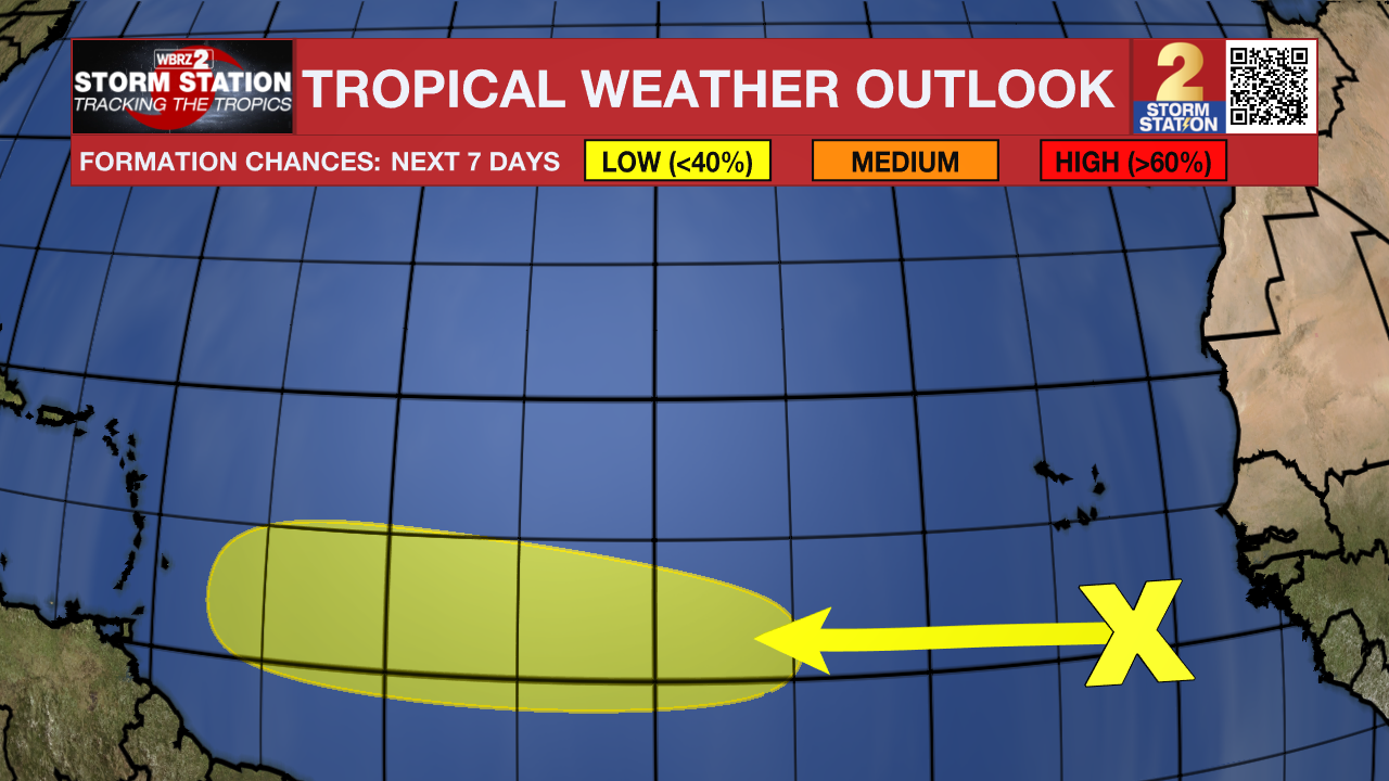
In the eastern Tropical Atlantic, cloudiness and showers continue a few hundred miles south of the Cabo Verde Islands in association with a tropical wave. While dry air should prevent significant organization during the next few days, environmental conditions could become more conducive for some development by the weekend while the wave moves westward at about 20 mph.
--Josh
The Storm Station is here for you, on every platform. Your weather updates can be found on News 2, wbrz.com, and the WBRZ WX App on your Apple or Android device. Follow WBRZ Weather on Facebook and Twitter for even more weather updates while you are on the go.
More News
