

Latest Weather Blog
Wednesday AM Forecast: Still Hot - Much Less Humidity
The string of heat alerts is over. Though still hot, most will be able to sense lower humidity.
Today & Tonight: On Wednesday, sunshine will still push temperatures above average into the upper 90s, but due to lower humidity, feels-like temperatures will not be much higher. Given the recent stretch of dangerous heat, you should be able to feel a difference outside. Overnight will be clear and quiet with potential for the lowest temperature in several weeks as thermometers slip into the low 70s.
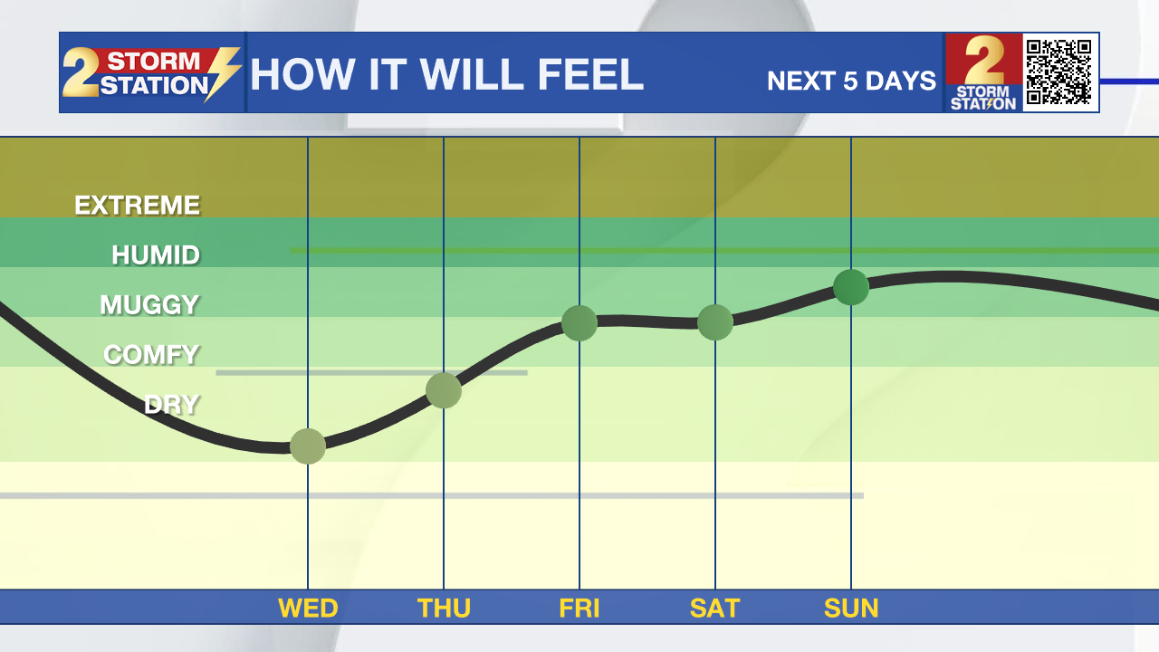
Up Next: Thursday will remain sunny and hot, but dry. By Friday afternoon, some moisture will start to creep into the atmosphere again. Over the weekend, lows will return to the upper 70s and low 80s and highs will be pushing on the century mark. This will necessitate the need for heat alerts once again. Sunday and into next week, a fast moving plume of moisture crossing the Gulf of Mexico will provide an opportunity for some showers, especially near the coast. Time will tell how far inland moisture will make it for rain chances in the Metro Area. Coincidentally, that same area is marked by the National Hurricane Center as one to watch for development (more below).
Get the latest 7-day forecast and real time weather updates HERE.
Trending News
Watch live news HERE.
The Tropics: A broad area of low pressure could form in the central or western Gulf of Mexico by the beginning of next week. Some slow development of this system is possible thereafter as it moves generally westward, potentially nearing the western Gulf of Mexico coastline in about a week.
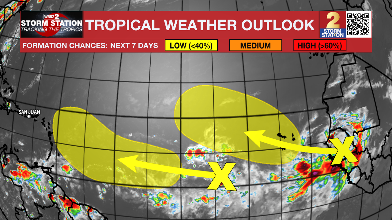
A tropical wave is producing disorganized showers and thunderstorms a few hundred miles west-southwest of the Cabo Verde Islands. Development, if any, of this system should be slow to occur while it moves generally west-northwestward at about 15 mph across the tropical Atlantic through the end of the week.
Another tropical wave is forecast to move off the west coast of Africa tonight or early Wednesday. Some slow development of this system is possible later this week or over the weekend while it moves generally west-northwestward or northwestward across the eastern Atlantic. Environmental conditions are expected to become unfavorable for development by early next week.
--Keller
The Storm Station is here for you, on every platform. Your weather updates can be found on News 2, wbrz.com, and the WBRZ WX App on your Apple or Android device. Follow WBRZ Weather on Facebook and Twitter for even more weather updates while you are on the go.
More News
