

Latest Weather Blog
Tuesday PM Forecast: Rain tapers off for the rest of the week
After several days of dreary weather, we’re finally getting toward the back half of the gloominess. Though we might see some lingering showers into Wednesday, we’ll be able to stow away the rain gear soon thereafter. By the weekend, we might even see the sun poke out.
Tonight & Tomorrow: After a relatively dry Tuesday morning, rain showers were able to build back into the capital area for the afternoon. Isolated to widely scattered showers remain possible into Tuesday evening. By midnight, we’ll be left with a few hit-or-miss showers. While we can’t rule out a few of them into Wednesday morning, we are looking at mostly dry conditions overall with a low temperature in the mid-50s.
We’ll keep mainly cloudy skies on Wednesday. Again, we can’t totally rule out a spotty shower. However, the overall odds of getting wet are slim. It’ll be another cool day with highs in the low to mid-60s.
Up Next: Cloud cover may be a bit stubborn as we close out the workweek. Eventually, we’ll see the sun poke out. By this weekend, we’ll likely be dealing with a mixture of clouds and sun. It does appear dry starting Thursday and heading through the weekend – and that is despite a cold front passage on Saturday. Our next rainmaker likely won’t arrive until early next week. It’s still too far out to pinpoint exact details, but the Storm Station will be figuring those out in the coming days.
Get the latest 7-day forecast and real time weather updates HERE.
Trending News
Watch live news HERE.
The Tropics: We are watching a disorganized, but large area of storms over the southwest Caribbean Sea. The environment seems conducive for development of the system in the coming days, and a tropical depression is likely to form during the latter part of the week. Residents of Jamaica, Cuba, Haiti, the Dominican Republic, the southeastern Bahamas, and the Turks and Caicos Islands should monitor the progress of this system.
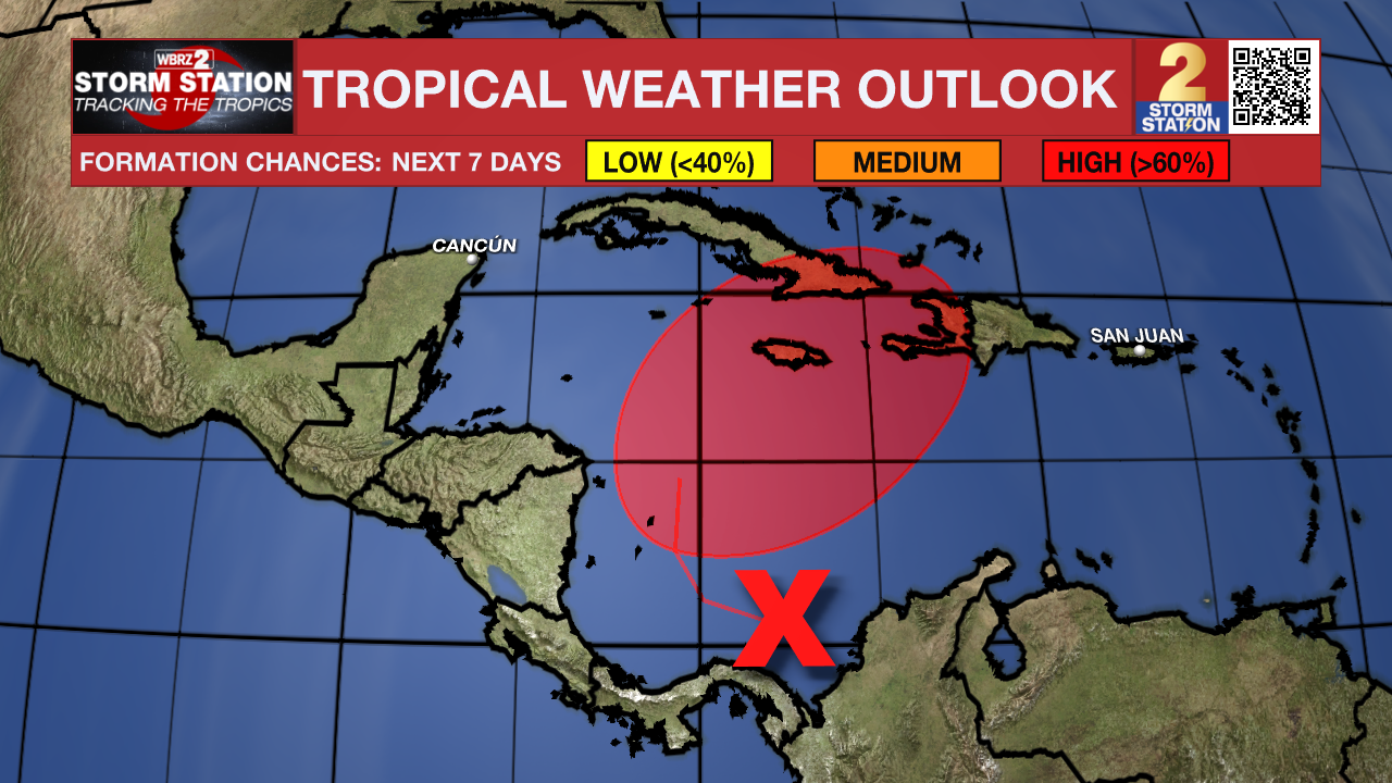
Regardless of development, the system has the potential to produce heavy rain over portions of the Caribbean coast of Central American and Greater Antilles through the end of this week.
-- Meteorologist Malcolm Byron
The Storm Station is here for you, on every platform. Your weather updates can be found on News 2, wbrz.com, and the WBRZ WX App on your Apple or Android device. Follow WBRZ Weather on Facebook and Twitter for even more weather updates while you are on the go.
More News
