

Latest Weather Blog
Tuesday PM Forecast: lull ahead of next storm threat, major cold blast lurks
While the storm system that produced a tornado in Assumption Parish is behind us, the weather pattern is far from quiet. Another severe weather threat and the coldest air so far this season lurk in the Storm Station 7-Day Forecast.
Tonight & Tomorrow: A cold night is ahead. As winds lighten, clear skies will help temperatures drop into the low 30s. While 33 degrees is expected in Baton Rouge, the forecast is close enough to freezing that precautions for plants and pets should be taken. Patchy frost will be possible essentially anywhere north of I-10. Plenty of sunshine will carry into Wednesday which will warm temperatures into the upper 50s. One or two spots could hit 60 degrees.
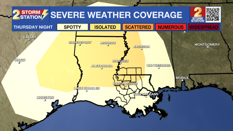
Up Next: Expect a rebound high temperature in the 70s on Thursday. Clouds will thicken in advance if a strong front which will push in from the west overnight. The chance for showers and thunderstorms will increase, especially after midnight, with rain a possibility through around midday Friday. The forecast window for wet weather will most likely tighten as we get closer. In addition, the Capital Area will also face another threat for severe weather. The Storm Prediction Center carries a 2/5 “Slight Risk” for severe weather mainly along and north of I-12. This means that within the risk area, isolated severe weather events are expected. It is too early to nail down specifics on threats and timing.
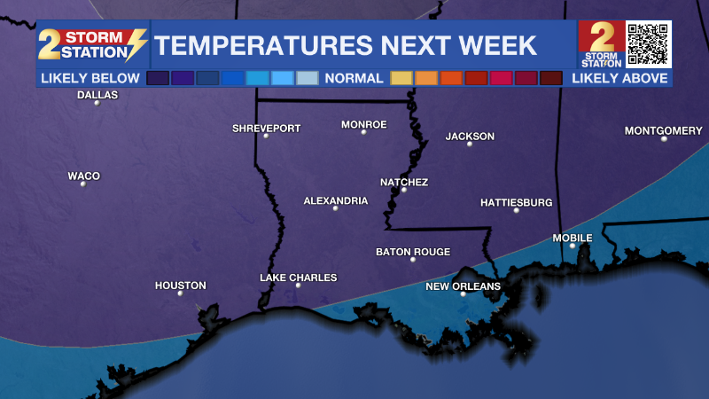
After this front passes, a cold and quiet weekend is ahead. With mainly clear skies, Saturday and Sunday will both feature morning lows near or below freezing and afternoon highs in the upper 50s. The next weather impact will take shape next week. The coldest air of the season will invade from the north through Monday and into Tuesday. At the same time, a batch of rain is expected to move across the central Gulf Coast. There is a possibility that some frozen precipitation mixes in toward the end of the event if enough moisture coincides with the tumbling temperatures. While it is much too early to speculate on frozen precipitation or ice potential after the rain, there is high confidence that the coldest air of the season will take over the region. A couple of nights next week will spend several hours in the mid to upper 20s so plan for hard freezes, taking the necessary precautions on pipes and other home infrastructure this weekend.
Trending News
Get the latest 7-day forecast and real time weather updates HERE.
Watch live news HERE.
– Josh
The Storm Station is here for you, on every platform. Your weather updates can be found on News 2, wbrz.com, and the WBRZ WX App on your Apple or Android device. Follow WBRZ Weather on Facebook and Twitter for even more weather updates while you are on the go.
More News
