

Latest Weather Blog
Tuesday AM Forecast: Spookishly chilly Halloween forecast
Grab a jacket to go with those Halloween costumes today, temperatures are quite chilly behind the cold front that passed through yesterday. Winds are also elevated which could pose an issue; we’re looking at fire weather concerns through midweek. Beyond Halloween, overnight lows venture into the 30s for a couple of mornings – very close to frost/freeze territory.
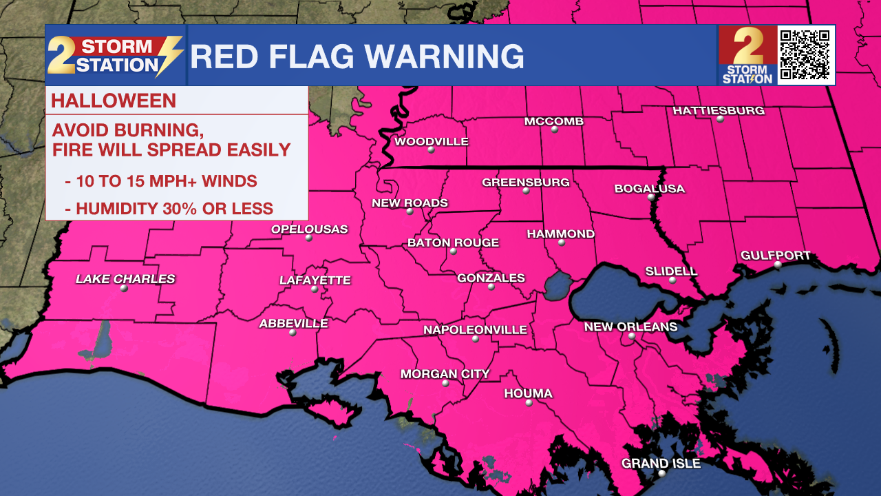
Today & Tonight: The skies are playing along with the theme of Halloween this morning by starting off mainly overcast. We also cannot rule out a spotty shower early today, although it will most likely be very light and chances dwindle throughout the day. Temperatures remain very cool for your Halloween with temperatures only reaching around 60° this afternoon. By trick-or-treating time, skies turn mostly clear as temperatures fall into the lower-50s. The clearing skies are a sign of drier air moving into the region. With northerly winds gusting up to 25 mph, dangerous fire conditions are a concern. A Red Flag Warning is in place across the area for Halloween.
Overnight, we will greet November with a not-so-warm welcome with temperatures dropping into the 30s and the possibility for wind chills to feel even colder.
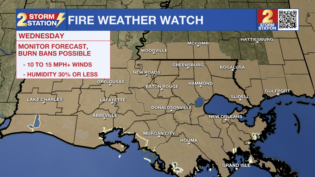
Up Next: We cannot rule out a few areas of patchy frost on Wednesday morning, but the wind should alleviate those concerns to some extent. We’ll be sunny and windy on Wednesday afternoon with highs in the low-60s. Fire weather will be a concern once again. For that reason, a Fire Weather Watch is in effect across the capital area on Wednesday. This may need to be upgraded to a Red Flag Warning at some point.
Wind speeds relax overnight and into Thursday morning, and that will help temperatures dip into the low to mid-30s. Areas of frost cannot be ruled out, so you’ll want to consider bringing animals inside along with plants. Especially in some of our northern parishes and counties in MS, temperatures may be very close to freezing. Afterward, temperatures begin to steadily climb. By the weekend, we’ll see highs back near 80° with lows in the 40s and 50s.
Trending News
Get the latest 7-day forecast and real time weather updates HERE.
Watch live news HERE.
The Tropics: We are watching a tropical wave located over the eastern Caribbean that now has a high chance of acquiring tropical characteristics in the next 7 days. The system may gradually develop in the next week, perhaps becoming a tropical depression late this week as it reaches the central and southwestern Caribbean. As of now, the system is generally moving west toward central America.
-- Emma Kate Cowan
The Storm Station is here for you, on every platform. Your weather updates can be found on News 2, wbrz.com, and the WBRZ WX App on your Apple or Android device. Follow WBRZ Weather on Facebook and Twitter for even more weather updates while you are on the go.
More News
