

Latest Weather Blog
Tuesday AM Forecast: Frost likely tomorrow, More storms possible by end of week
After a stormy Monday, much cooler and drier air begins to move into southern Louisiana. Frost will be likely early Wednesday morning and by the end of the week we could see more storms around the Capital Area.
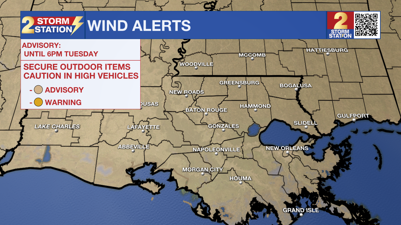
Today & Tonight: High temperatures today likely occurred right around midnight as storms traveled through the state. By daybreak we will be mainly dry and temperatures will be in the 40s. While clouds will clear throughout the day, Tuesday will be chilly. We remain under a WIND ADVISORY until 6pm this evening, as breezy conditions continue and gusts are likely to exceed 30mph. Overnight, with mainly clear skies and much calmer winds, many in southern Louisiana will near the freezing mark and frost is likely early Wednesday morning.
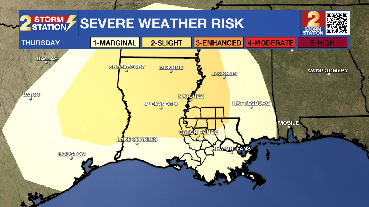
Up Next: Wednesday will be mainly sunny with afternoon temperatures near 60° and by Thursday temperatures will rise above average into the lower 70s. Rain coverage this week stays limited until Thursday afternoon when another storm system could track across Louisiana. This system brings another chance for strong storms to the capital region. Check in with the Storm Station daily as we will have to watch that system closely and have more details as we near the end of the week.
Trending News
- Emma Kate Cowan
Get the latest 7-day forecast and real time weather updates HERE.
Watch live news HERE.
The Storm Station is here for you, on every platform. Your weather updates can be found on News 2, wbrz.com, and the WBRZ WX App on your Apple or Android device. Follow WBRZ Weather on Facebook and Twitter for even more weather updates while you are on the go.
More News
