

Latest Weather Blog
Tuesday AM Forecast: Flood Watch issued for Capital Area ahead of heavy rain tomorrow
Spotty showers are possible Tuesday but numerous storms will arrive early Wednesday and could result in messy commute conditions. Flood Watches have been issued ahead of the heaviest showers and storms of the week. Make sure to have the Storm Station app downloaded to be notified when heavy rain is near your location and remember to turn around if you encounter flooded roadways.
Today & Tonight: Light showers overnight left slick roads for the Tuesday morning's commute. Most of the rain however has exited southern Louisiana and rain chances will be spotty throughout the day today. Temperatures remain very mild, morning lows for everyone near 60° with afternoon highs about 10° warmer, in the lower 70s. Overcast skies continue to dominate resulting in another gloomy and sticky day with humidity levels on the rise as well.
Tuesday night into early Wednesday we expect rain coverage to ramp up. While temperatures will only drop into the low to mid-60s again, rain coverage increases after midnight tonight. Widespread showers and storms that are expected to enter the Capital Area right around daybreak could create issues on roadways for your morning commute. Heavy rainfall is definitely a possibility and a flood watch will go into effect for much of Louisiana at 6am on Wednesday.
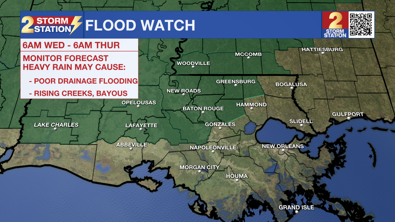
Up Next: Both Wednesday and Thursday will be warm and muggy – a combination which could support thunderstorms. A strong storm or two isn’t out of the question, but the bigger concern will be heavy rain. Flood Watches have been issued in anticipated of the heaviest showers and storms of the week beginning early Wednesday morning Should several inches of rain fall in a short period of time, we could see some standing water issues. We will be monitoring this threat closely in the Storm Station.
Trending News
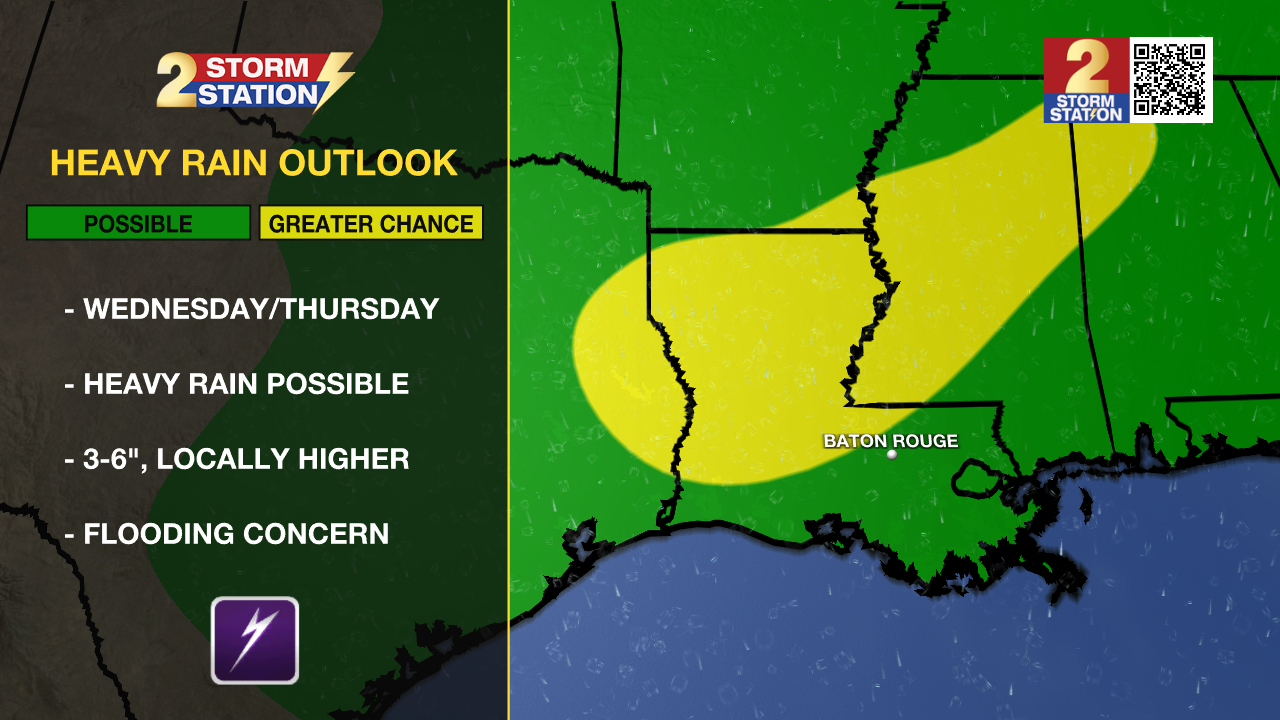
By Thursday afternoon, we should see a break in rainfall coverage with another round of showers and storms possible Friday evening into Saturday morning. By the end of the week, 3-6” of rain is possible across southern Louisiana in the next week, with locally higher amounts in select areas. Saturday does not seem to be a complete washout and by the time Sunday rolls around, much drier conditions will begin to dominate the state.
-- Emma Kate Cowan
Get the latest 7-day forecast and real time weather updates HERE.
Watch live news HERE.
The Storm Station is here for you, on every platform. Your weather updates can be found on News 2, wbrz.com, and the WBRZ WX App on your Apple or Android device. Follow WBRZ Weather on Facebook and Twitter for even more weather updates while you are on the go.
More News
