

Latest Weather Blog
Thursday PM Forecast: warm finish to workweek before next cold front
The workweek will finish with above average temperatures. However, the next cold front is not far away and then below average temperatures will prevail for the better part of next week.
Tonight & Tomorrow: Skies will be partly cloudy overnight and low temperatures will slip into the low 60s with light southeast winds. As this happens, some patchy fog will form and it could be especially dense along and west of the Mississippi River. Once that fog gives way around mid-morning Friday, mostly sunny skies will lift high temperatures into the upper 80s. A cold front will approach during the evening and overnight hours. A stripe of clouds, and perhaps a spotty shower, will precede the front. However, not serious impacts or inconveniences are expected.
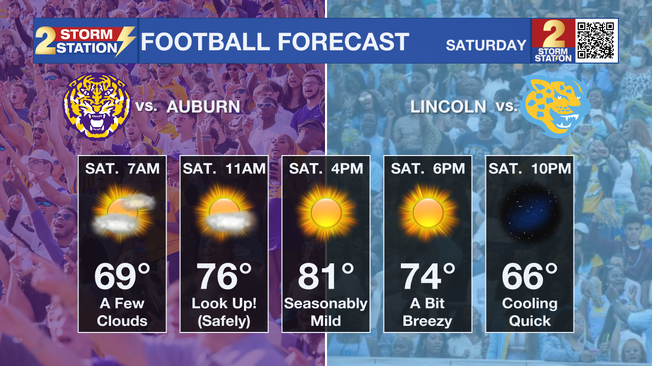
Up Next: By Saturday morning, the front will be moving east of the region and skies will start to clear out. The weather left behind will be very cooperative with all the outdoor events. Viewing should be great for the partial eclipse late Saturday morning into the afternoon. Be sure to gaze safely. For the college football games this weekend, an outer layer may be wanted for morning tailgating or in the stadiums during the evening hours. That won’t be necessary during the middle of the day though as temperatures will work into the low 80s. Sunday will be a little cooler with more distance behind the front and lows will be in the low 50s followed by highs in the mid 70s. A reinforcing shot of cool air could send temperatures a few degrees cooler early next week as skies stay clear.
Trending News
Get the latest 7-day forecast and real time weather updates HERE.
Watch live news HERE.
The Tropics: Tropical Storm Sean continues to struggle but has once again moved beyond depression status. With 40mph maximum sustained winds, it is chugging along to the northwest at 10mph. Little change in strength, direction or speed is expected as Sean stays in the open, eastern Atlantic Ocean over the next several days.
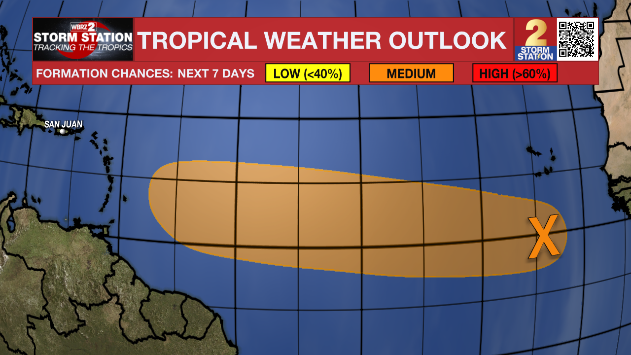
Shower and thunderstorm activity is limited and disorganized this afternoon in association with a broad area of low pressure located several hundred miles to the south of the Cabo Verde Islands. While environmental conditions are currently only marginally favorable for slow development over the next couple of days, they are forecast to become more favorable and a tropical depression could form by the middle of next week as this system moves generally westward across the eastern and central tropical Atlantic.
– Josh
The Storm Station is here for you, on every platform. Your weather updates can be found on News 2, wbrz.com, and the WBRZ WX App on your Apple or Android device. Follow WBRZ Weather on Facebook and Twitter for even more weather updates while you are on the go.
More News
