

Latest Weather Blog
Thursday PM Forecast: crank the heat up even more into the weekend
An *EXCESSIVE HEAT WATCH* has been issued all of southeast Louisiana on Friday. This means the heat could be even more extreme than what has been felt over the last few days. Heat index values over 113 degrees are possible. Hot temperatures and high humidity combined may cause heat illnesses to occur.
Drink plenty of fluids, stay in an air-conditioned room, stay out of the sun, and check up on relatives and neighbors. Young children and pets should never be left unattended in vehicles under any circumstances. Take extra precautions if you work or spend time outside. When possible reschedule strenuous activities to early morning or evening. Know the signs and symptoms of heat exhaustion and heat stroke. Wear lightweight and loose fitting clothing when possible. To reduce risk during outdoor work, the Occupational Safety and Health Administration recommends scheduling frequent rest breaks in shaded or air conditioned environments. Anyone overcome by heat should be moved to a cool and shaded location. Heat stroke is an emergency!
Tonight & Tomorrow: While a rogue shower or thunderstorm remains possible given the ample humidity, most of the night will be quiet with just a few clouds. Low temperatures will remain very uncomfortable in the upper 70s and low 80s. The heat will ramp up even further on Friday. High temperatures will charge into the upper 90s and with dew point temperatures in the upper 70s and relative humidity over 50%, it may feel-like greater than 113 degrees at times during the afternoon. Similar to Thursday, isolated showers and thunderstorms will be possible, especially north and east of Baton Rouge. While not necessarily widespread, any storm that develop could quickly turn strong with gusty wind and hail.
Up Next: The weekend will feature high temperatures in the upper 90s, between 97 – 99 degrees, and low temperatures in the upper 70s, between 77 – 79 degrees. High dew point temperatures and ample humidity will cause afternoon feels-like temperatures to maximize between at least 105 – 110 degrees. This type of prolonged heat, with little relief overnight, can lead to heat illness. Be sure to remain hydrated and do not overexert outdoors during the middle of the day. As far as showers and thunderstorms go, coverage will remain lower, in the 10 – 30 percent range. As always, remember to move indoors if you can hear thunder. Any storms that do form will have plenty of moisture and heat energy to quickly strengthen.
Get the latest 7-day forecast and real time weather updates HERE.
Trending News
Watch live news HERE.
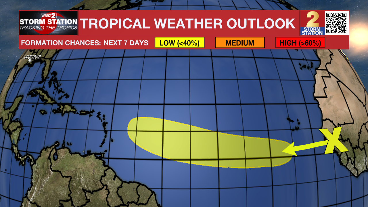
The Tropics: In the Eastern Tropical Atlantic, a tropical wave is forecast to move off the west coast of Africa tonight and early Friday. Environmental conditions are expected to be conducive for a low, twenty percent chance of development of this system while it moves generally westward to west-northwestward at 15 to 20 mph across the eastern and central tropical Atlantic during the early to middle part of next week.
--Josh
The Storm Station is here for you, on every platform. Your weather updates can be found on News 2, wbrz.com, and the WBRZ WX App on your Apple or Android device. Follow WBRZ Weather on Facebook and Twitter for even more weather updates while you are on the go.
More News
