

Latest Weather Blog
Saturday AM Forecast: Rain chances on the rise the next several days
Rain chances will start to slowly go up starting today. They will max out on Monday before going back down by the middle of the week.
Today & Tonight: Your college football Saturday will be unseasonably warm and humid with high temperatures chugging into the mid 90s. Humidity will cause feels-like temperatures near 100 degrees. Spotty showers and thunderstorms will be possible but these should be clearing out by kickoff time. Tonight, we will get into the lower 70's under partly cloudy skies.
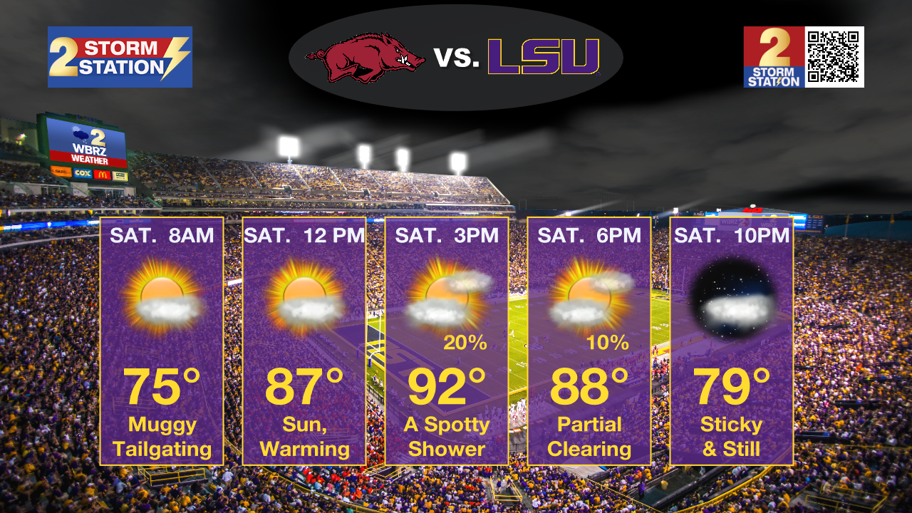
Up Next: Sunday will also warm into the mid 90s with partly sunny skies and a chance for a stray shower. The weekend will not be a washout by any means. Rain chances continue to trend up into early next week with the arrival of a cold front. With ongoing exceptional drought, the hope is that we can get some meaningful rain out of it. At this time, about forty percent of the area is expected to receive rainfall and some spots could collect a half inch or so. The front will linger in the area on Tuesday, allowing some spotty showers to stick around. By the middle of next week, rain chances should start to go down. There is some disagreement in models about how much we dry out by the end of next week, but confidence in that will start to go up over the next couple of days.
Trending News
Get the latest 7-day forecast and real time weather updates HERE.
Watch live news HERE.
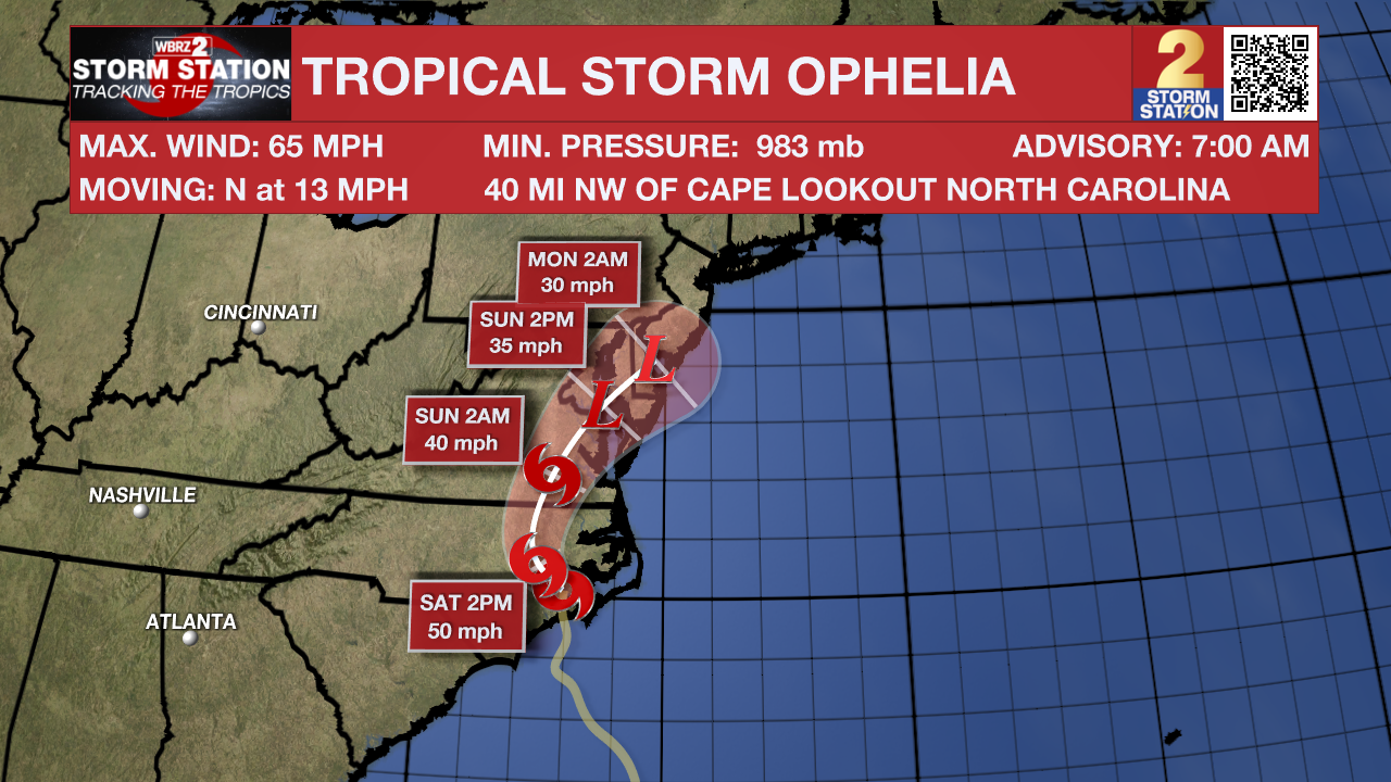
Tropics: Tropical Storm Ophelia has just made landfall in North Carolina with max sustained winds of 70 mph. It is expected to slowly weaken and dissipate by tomorrow.
Shower and thunderstorm activity associated with an area of low pressure located several hundred miles west of the Cabo Verde Islands has decreased slightly over the last few hours, however, further development is still expected. A tropical depression is likely to form during the next couple of days while the system moves generally westward at 10 to 15 mph. The system is then expected to turn west-northwestward early next week as it moves over the central tropical Atlantic.
-Balin
The Storm Station is here for you, on every platform. Your weather updates can be found on News 2, wbrz.com, and the WBRZ WX App on your Apple or Android device. Follow WBRZ Weather on Facebook and Twitter for even more weather updates while you are on the go.
More News
