

Latest Weather Blog
Friday PM Forecast: warm and humid weekend, rain chances bump up next week
Warm and humid conditions will continue into the weekend. While a spotty shower is not out of the question, better rain chances will arrive early next week.
Tonight and Tomorrow: Any leftover showers will slowly fizzle past sunset. By midnight, clouds will begin to break as well. It will stay muggy with low temperatures remaining in the low 70s. Your college football Saturday will be unseasonably warm and humid with high temperatures chugging into the mid 90s. Humidity will cause feels-like temperatures near 100 degrees. Partly sunny skies may give way to a rogue shower, but any rain would be short-lived. Those out on campus tailgating shouldn't worry about anything more than that; and then of course, we know what happens once things move inside Death Valley.
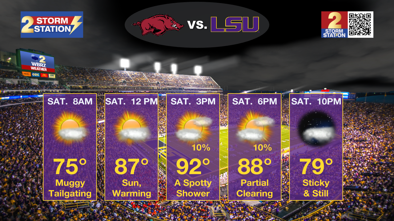
Up Next: Sunday will also warm into the mid 90s with partly sunny skies and a chance for a stray shower. The weekend will not be a washout by any means. Rain chances continue to trend up into early next week with the arrival of a cold front. With ongoing exceptional drought, the hope is that we can get some meaningful rain out of it. At this time, about forty percent of the area is expected to receive rainfall and some spots could collect a half inch or so. The front will linger in the area on Tuesday, allowing some spotty showers to stick around. By the middle of next week, dry air will filter out some of that humidity allowing lows to return to the upper 60s, but high temperatures will remain above average in the low 90s.
Trending News
Get the latest 7-day forecast and real time weather updates HERE.
Watch live news HERE.
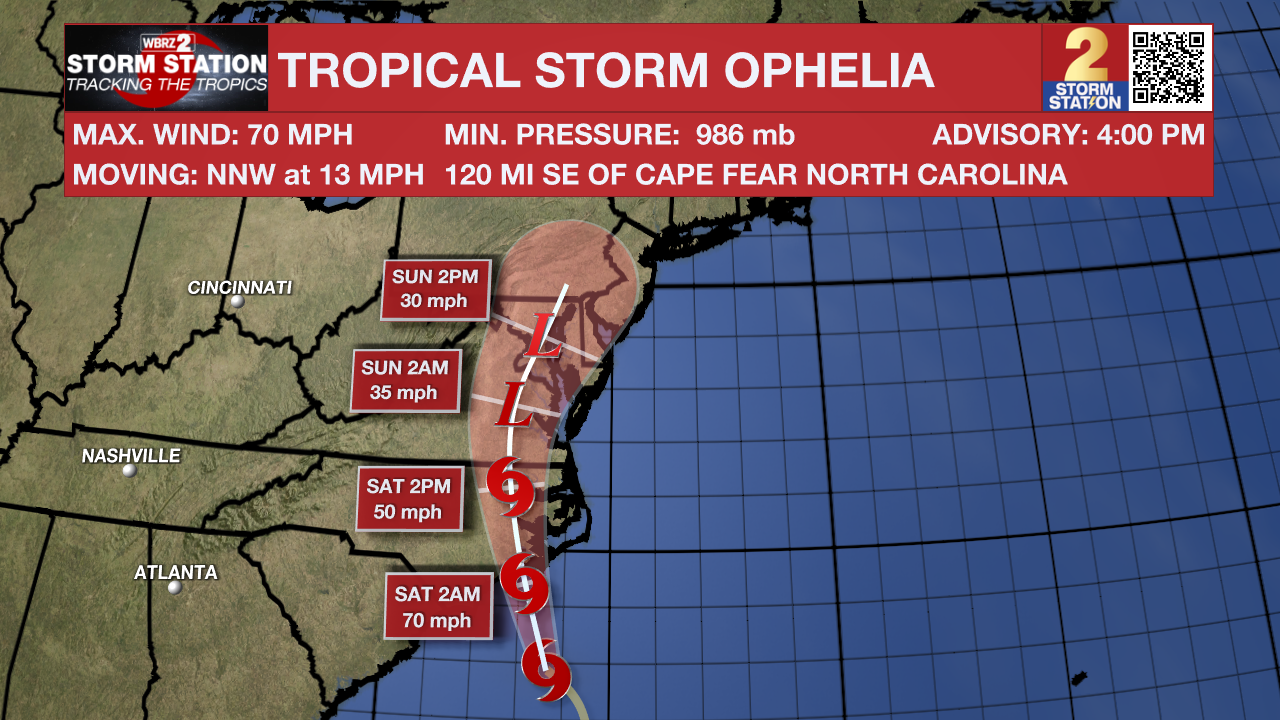
Tropics: Tropical Storm Ophelia is churning southeast of North Carolina with maximum sustained winds of 70mph and a northwest movement at 13mph. This general motion is expected to continue during the next day or so, followed by a slight turn toward the north and north-northeast. Only minor fluctuations in strength are expected before landfall early this weekend. Ophelia will produce storm surge from South Carolina to Delaware with the highest levels of four feet near the Albermarle Sound. Additionally, tropical storm conditions are expected across the Carolinas and Virginia with isolated rainfall totals as high as five to seven inches through Sunday morning.
Shower and thunderstorm activity associated with an area of low pressure located several hundred miles west of the Cabo Verde Islands has decreased slightly over the last few hours, however, further development is still expected. A tropical depression is likely to form during the next couple of days while the system moves generally westward at 10 to 15 mph. The system is then expected to turn west-northwestward early next week as it moves over the central tropical Atlantic.
-Josh
The Storm Station is here for you, on every platform. Your weather updates can be found on News 2, wbrz.com, and the WBRZ WX App on your Apple or Android device. Follow WBRZ Weather on Facebook and Twitter for even more weather updates while you are on the go.
More News
