

Latest Weather Blog
Friday PM Forecast: unrelenting excessive heat
An *EXCESSIVE HEAT WARNING* will remain in effect across southeast Louisiana on Saturday. This means heat index values could go over 113 degrees. Hot temperatures and high humidity combined may cause heat illnesses to occur.
Drink plenty of fluids, stay in an air-conditioned room, stay out of the sun, and check up on relatives and neighbors. Young children and pets should never be left unattended in vehicles under any circumstances. Take extra precautions if you work or spend time outside. When possible reschedule strenuous activities to early morning or evening. Know the signs and symptoms of heat exhaustion and heat stroke. Wear lightweight and loose fitting clothing when possible. To reduce risk during outdoor work, the Occupational Safety and Health Administration recommends scheduling frequent rest breaks in shaded or air conditioned environments. Anyone overcome by heat should be moved to a cool and shaded location. Heat stroke is an emergency!
Tonight & Tomorrow: Overnight will be quite muggy and uncomfortable. Low temperatures will likely stop in the low 80s beneath mostly clear skies. The weekend will begin with more steam. High temperatures will run into the upper 90s and the humidity will cause feels-like temperatures to reach above 107 degrees, perhaps as warm as 115 degrees in spots. Even though most will stay dry, a rogue shower or thunderstorm is possible, especially north and east of Baton Rouge.
Up Next: The weekend will end with more unpleasant heat. After lows in the 80s, highs will return to the 90s. Partly sunny skies could give way to an isolated shower or thunderstorm. Continued high dew point temperatures and ample humidity will cause afternoon feels-like temperatures to maximize between at least 105 – 110 degrees. Into next week, temperatures will remain above average with plenty of humidity. Afternoons may start to offer a slightly better chance at some cooling showers and thunderstorms, but likely not enough for all to avoid that afternoon heat index in the triple digits.
Get the latest 7-day forecast and real time weather updates HERE.
Trending News
Watch live news HERE.
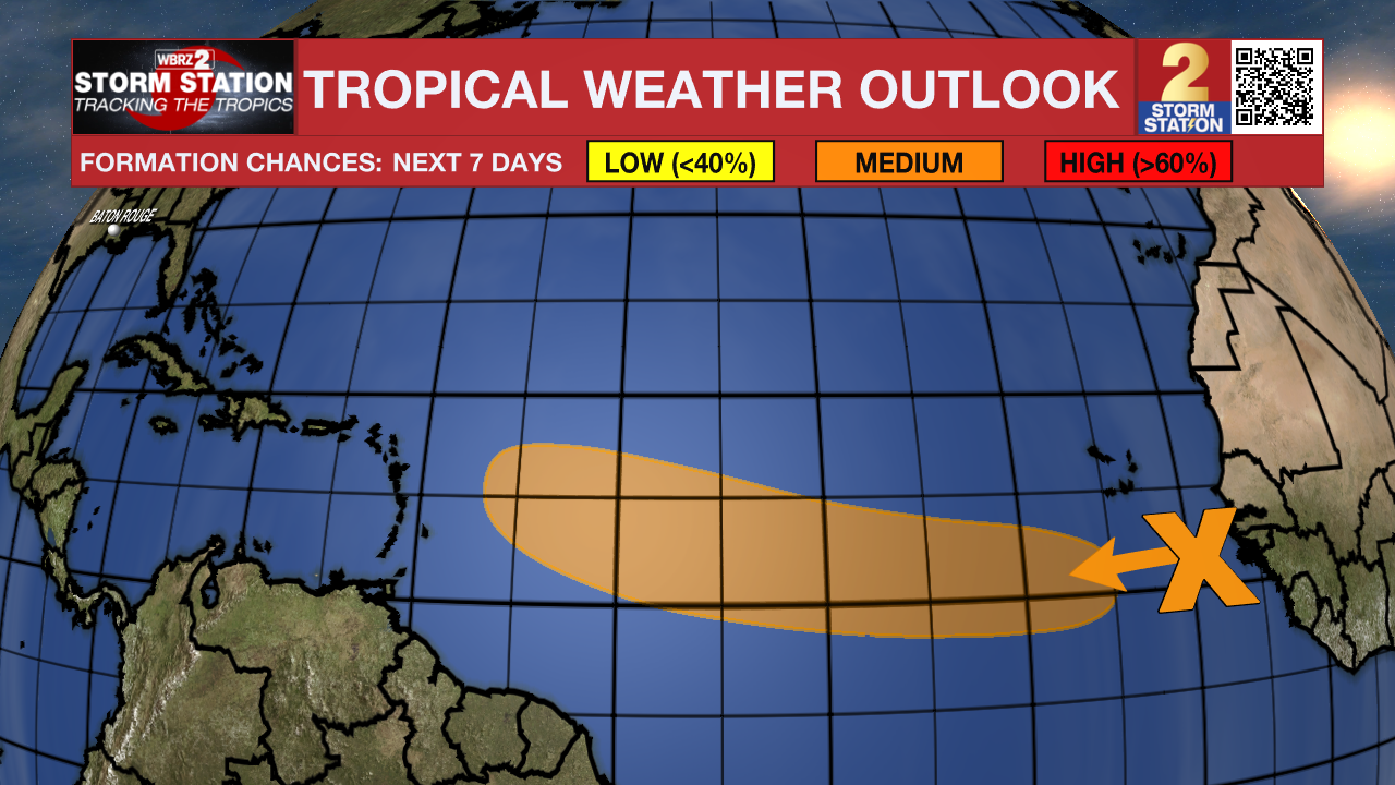
The Tropics: In the Eastern Tropical Atlantic, a tropical wave located between the west coast of Africa and the Cabo Verde Islands is producing disorganized showers and thunderstorms. Environmental conditions appear to be conducive for gradual development, and there is a sixty percent chance that a tropical depression could form during the early to middle portions of next week while the system moves westward at 15 to 20 mph across the eastern and central tropical Atlantic.
--Josh
The Storm Station is here for you, on every platform. Your weather updates can be found on News 2, wbrz.com, and the WBRZ WX App on your Apple or Android device. Follow WBRZ Weather on Facebook and Twitter for even more weather updates while you are on the go.
More News
