

Latest Weather Blog
Friday PM Forecast: tracking showers and thunderstorms for the weekend
Warm temperatures will continue into Mardi Gras weekend. While wet weather will still be a consideration Saturday and Sunday, there have been some significant adjustments to the forecast.
Tonight & Tomorrow: The overnight hours will remain cloudy and mild, almost muggy, as low temperatures stay in the low 60s. A slow-moving cold front will drape across north Louisiana and Mississippi on Saturday. Steady rain and thunderstorms will concentrate closer to the front, well north and west of the Baton Rouge area. A lot of cloud cover will stick around, although a few breaks of sunshine may be found and this could help push high temperatures into the low 80s again. While any rain will not be widespread or long lasting, certainly do not be surprised by isolated showers. It's not a bad idea to take an umbrella to the parades.
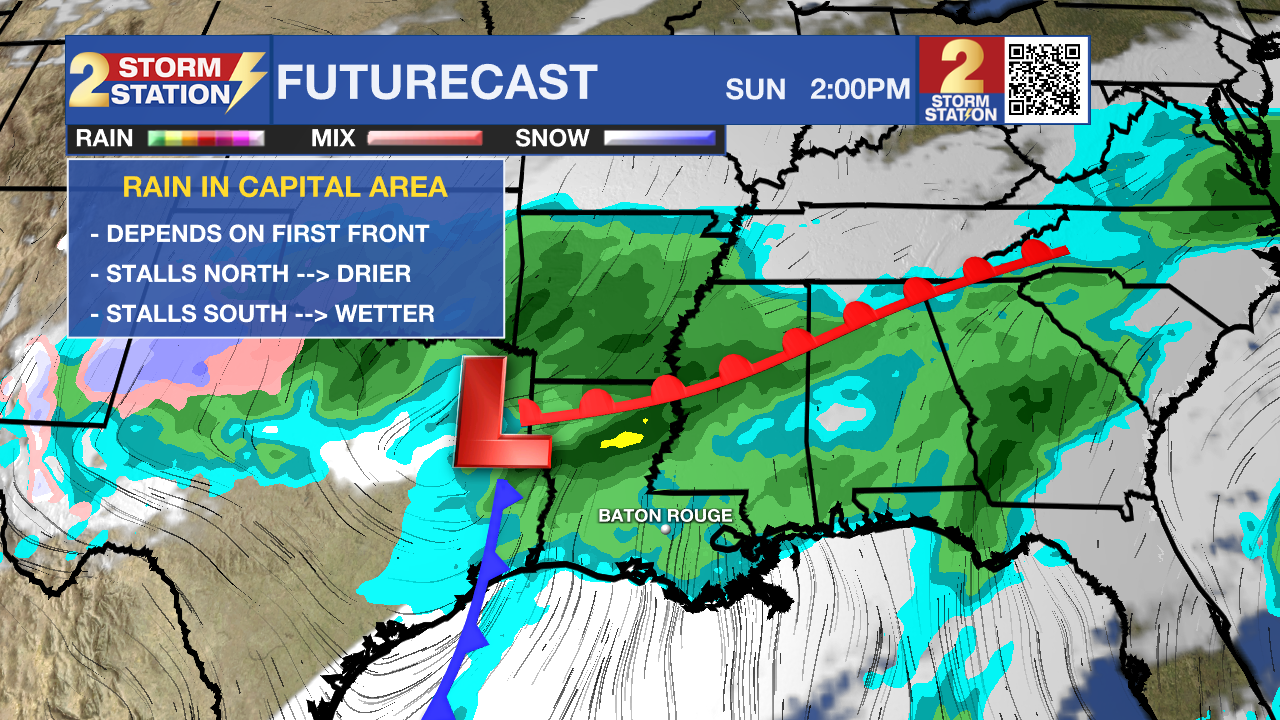
Up Next: The weak cold front will move closer overnight into Sunday. Where this boundary slows down, or even stalls, is a critical aspect to the forecast. Most of the precipitation will hug that boundary and so just a few miles could be the difference between a near washout and mainly dry. The latest information suggests the stall may occur north of the I-10/12 corridor allowing for a lot of dry time in the Capital Area on Sunday. With some added dry time, high temperatures will hit the upper 70s. The approaching front will be close enough that outdoor events will need to pay careful attention to the forecast which still calls for scattered showers and thunderstorms, but the total coverage and duration of rain has been trimmed back considerably. Even if the day catches a lot of dry time, any lightning at all poses a danger to those outside.
Trending News
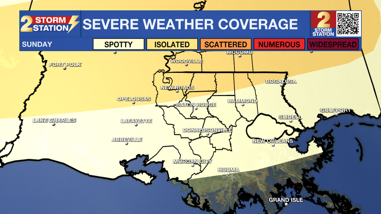
During the afternoon and evening, there could be a spotty severe thunderstorm, especially north and west of Baton Rouge. Ingredients point toward storms capable of gusty wind, hail and a brief tornado cannot ruled out as a possibility. By the time rain wraps up on Monday morning, about an inch or two of rain will have fallen.
Into the new week, skies will start to clear out with sun even possible by the end of Lundi Gras. Mardi Gras will be mostly clear and cool with lows in the low 40s and highs in the low 60s. Generally, below average temperatures are anticipated for most of next week. Clouds will start to thicken again by Thursday but the next rain chance will hold off until at least Friday.
Get the latest 7-day forecast and real time weather updates HERE.
Watch live news HERE.
– Josh
The Storm Station is here for you, on every platform. Your weather updates can be found on News 2, wbrz.com, and the WBRZ WX App on your Apple or Android device. Follow WBRZ Weather on Facebook and Twitter for even more weather updates while you are on the go.
More News
