

Latest Weather Blog
Friday PM Forecast: stay hydrated during another weekend of excessive heat
It was another record warm morning at 83 degrees, this time just for the date and not all-time. Dangerous heat will continue this weekend.
An EXCESSIVE HEAT WARNING will be in effect Saturday from 11am to 7pm for the entire Storm Station Forecast Area. Dangerously hot conditions with heat index values possibly exceeding 115 degrees are expected. Extreme heat and humidity will significantly increase the potential for heat related illnesses, particularly for those working or participating in outdoor activities.
Drink plenty of fluids, stay in an air-conditioned room, stay out of the sun, and check up on relatives and neighbors. Young children and pets should never be left unattended in vehicles under any circumstances. Take extra precautions if you work or spend time outside. When possible reschedule strenuous activities to early morning or evening. Know the signs and symptoms of heat exhaustion and heat stroke. Wear lightweight and loose fitting clothing when possible. To reduce risk during outdoor work, the Occupational Safety and Health Administration recommends scheduling frequent rest breaks in shaded or air conditioned environments. Anyone overcome by heat should be moved to a cool and shaded location.
Tonight & Tomorrow: Beneath mostly clear skies, low temperatures will keep to the low 80s for the 21st time this year. There will be a southwest wind of 5-10mph. Plenty of early sunshine will drive temperatures into the upper 90s by lunchtime on Saturday with most maximizing around 100 degrees during the afternoon. Adding in seasonably high humidity will result in feels-like temperatures over 113 degrees at times between late morning and late afternoon. Most locations will stay dry.
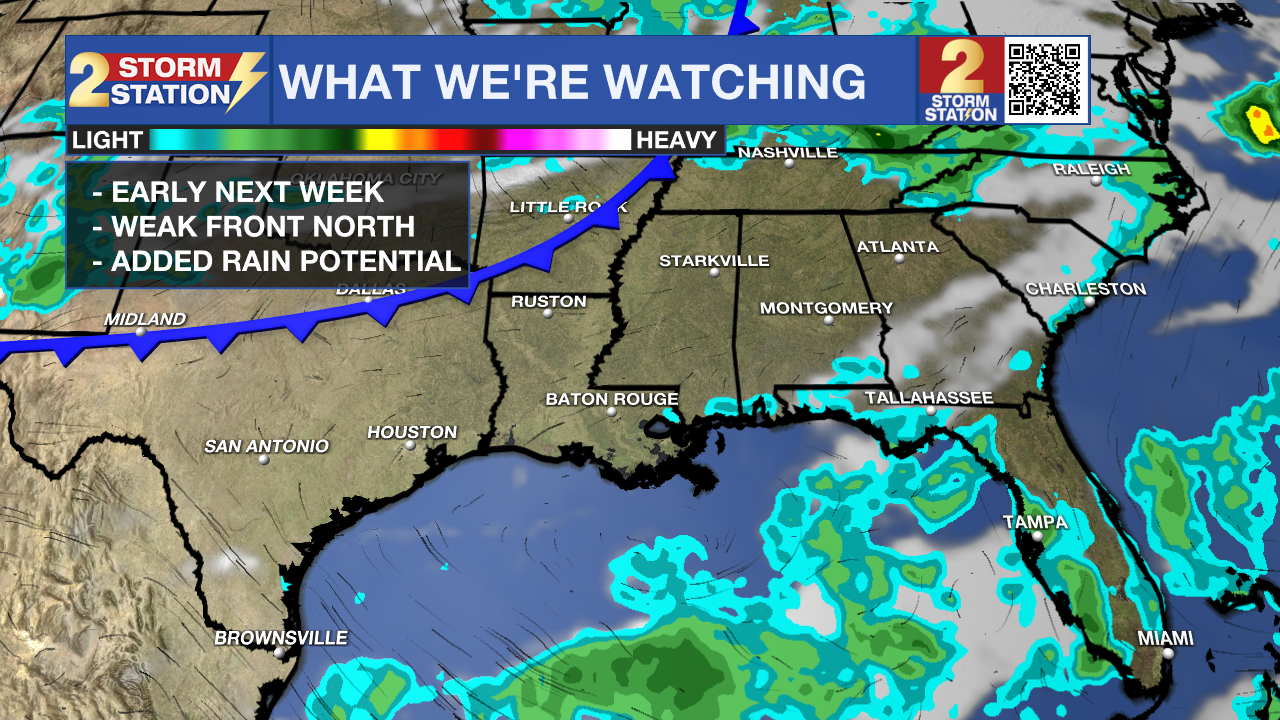
Up Next: Sunday will be very similar to the first half of the weekend with sunshine driving high temperatures into the low 100s. The afternoon may offer a spotty shower or thunderstorm with the best chances south and east of Baton Rouge. By next week, the stubborn heat dome may show just enough weakness to allow a weak front to settle north of the area, near I-20. While temperatures will stay very hot, some pop-up afternoon showers and thunderstorms and associated clouds may limit the duration of the heat during the afternoon hours. If the front makes it far enough south, there could even be a drop in humidity later in the week.
Trending News
Get the latest 7-day forecast and real time weather updates HERE.
Watch live news HERE.
The Tropics: For the Gulf of Mexico, Caribbean Sea and Atlantic Ocean, there are no active storms. Tropical development is not expected over the next seven days. On Thursday, the National Oceanic and Atmospheric Administration (NOAA) updated their seasonal hurricane forecast. Remember, the outlook is a prediction on total activity, not where storms will form or strike. Remain prepared as usual.
--Josh
The Storm Station is here for you, on every platform. Your weather updates can be found on News 2, wbrz.com, and the WBRZ WX App on your Apple or Android device. Follow WBRZ Weather on Facebook and Twitter for even more weather updates while you are on the go.
More News
