

Latest Weather Blog
Friday PM Forecast: Heat and fire danger continues, big pattern change on the way
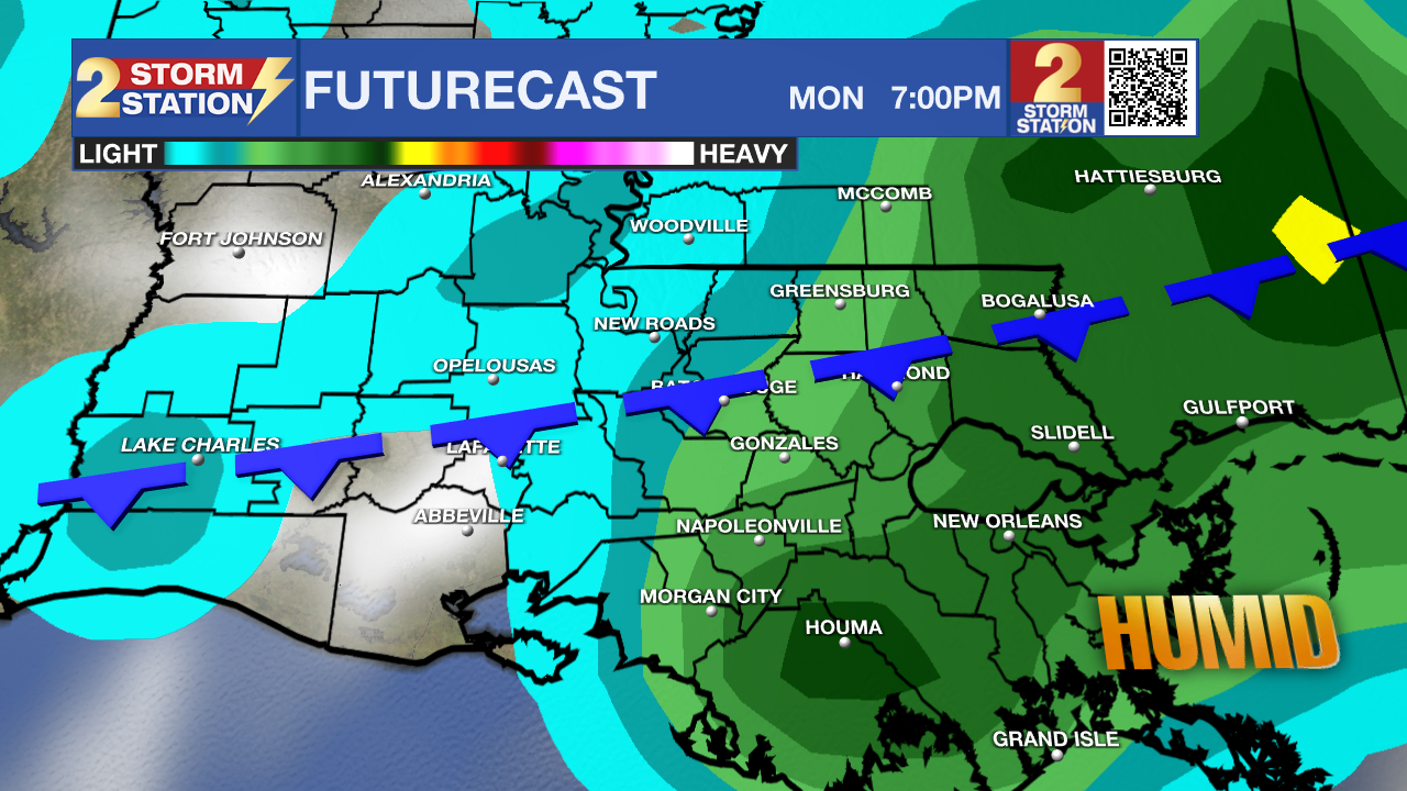
Heat and fire danger will continue to be the story through the weekend. A weak front will move through the area Monday and Tuesday. This will bring in some much needed rain to help with the drought conditions.
A ***EXCESSIVE HEAT WARNING*** is in effect until 8pm tomorrow for the entire WBRZ Viewing Area. Dangerously hot conditions with heat index values up to 115 expected. Extreme heat and humidity will significantly increase the potential for heat related illnesses, particularly for those working or participating in outdoor activities. Drink plenty of fluids, stay in an air-conditioned room, stay out of the sun, and check up on relatives and neighbors.
A ***RED FLAG WARNING*** is in effect until 8pm tomorrow. Any fires that develop will likely spread rapidly. A Burn Ban is already in place for all areas.
Tonight and Tomorrow: Skies will clear out nicely tonight and we will bottom out with a low around 79 degrees. Tomorrow, heat will continue to be the story and we could top out around 103 degrees under partly sunny skies. Humidity will be high once again, which will make feels like temperatures climb to around 115 degrees. There looks to be a decent shot at some rain in the afternoon as 20-30% of the viewing area might see some cool down showers.
Up Next: Sunday looks to be a tad drier than Saturday, but a stray shower can not be ruled out. The main rain will arrive Monday afternoon as a weak cold front makes its way into the area. This could last into Tuesday and some areas could pick up some decent rainfall totals. By the middle of next week, we will dry out once again, but humidity and temperatures will take a noticeable drop.
Trending News
Get the latest 7-day forecast and real time weather updates HERE.
Watch live news HERE.
The Tropics:
1. Northwestern Caribbean Sea and eastern Gulf of Mexico (AL93): Satellite images indicate that the area of low pressure over the northwestern Caribbean Sea is gradually becoming better organized, with increasing thunderstorm activity and a better-defined low-level circulation. Environmental conditions appear conducive for further development during the next several days, and a tropical depression is likely to form late this weekend or early next week while it moves generally northward over the eastern Gulf of Mexico. Interests in the Yucatan Peninsula of Mexico, western Cuba, and Florida should monitor the progress of this system.
2. Tropical Storm Franklin: Franklin just passed over the Dominican Republic, and is forecast to strengthen into the season's second hurricane. It is no threat to the Gulf of Mexico.
3. Other Tropical Waves: Two tropical waves are currently located in the central Atlantic, and one is about to come off the coast of Africa. These are currently no threat to the United States.
--Balin
The Storm Station is here for you, on every platform. Your weather updates can be found on News 2, wbrz.com, and the WBRZ WX App on your Apple or Android device. Follow WBRZ Weather on Facebook and Twitter for even more weather updates while you are on the go.
More News
