

Latest Weather Blog
Friday PM Forecast: cold front clears area before busy weekend of events
A cold front will push through the area as the weekend begins to spread cooler and drier air across the Capital Area. A reinforcing shot of cool air will send temperatures about 10 degrees below average early next week.
Tonight & Tomorrow: As a front rolls through the area overnight, a stripe of clouds may pass with it. It is unlikely that this front will be able to stir up any showers. As winds remain southerly ahead of the boundary, temperatures will remain in the low to mid 60s. By Saturday morning, the front will be moving east of the region and skies will quickly clear from west to east. The weather left behind will be very cooperative with all the outdoor events. Viewing should be great for the partial eclipse late Saturday morning into the afternoon. Be sure to gaze safely. For the college football games this weekend, an outer layer may be wanted for morning tailgating or in the stadiums during the evening hours. That won’t be necessary during the middle of the day though as temperatures will work into the low 80s.
Up Next: Sunday will be a little cooler with more distance behind the front and lows will be in the low 50s followed by highs in the mid 70s. A reinforcing shot of cool air could send temperatures a few degrees cooler early next week. Monday and Tuesday will have highs in the low 70s followed by lows in the mid 40s. Thermometers will work gradually warmer toward the end of next week in advance of another frontal system—the next earliest chance for any rain.
Get the latest 7-day forecast and real time weather updates HERE.
Watch live news HERE.
Trending News
The Tropics: Sean is struggling to hold on to tropical storm status producing maximum sustained winds of 40mph while moving west-northwest across the east, central Atlantic Ocean. The storm will start to slow down and turn northwest, gradually weakening into a remnant low over the weekend.
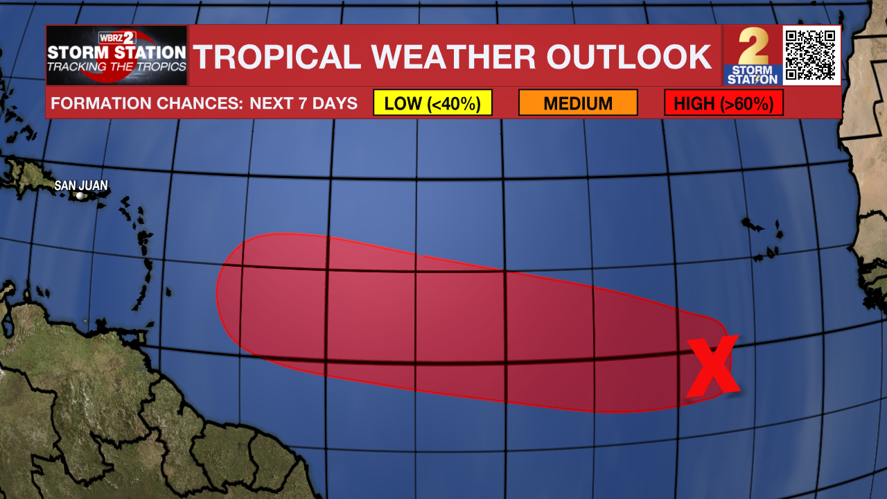
A broad area of low pressure located several hundred miles south-southwest of the Cabo Verde Islands continues to produce disorganized showers and thunderstorms. Environmental conditions are expected to become more conducive for development by the end of the weekend while the disturbance begins to move westward across the central tropical Atlantic. Additional development is expected after that, and a tropical depression is likely to form during the early to middle portion of next week as the system moves steadily westward across the central and western tropical Atlantic.
– Josh
The Storm Station is here for you, on every platform. Your weather updates can be found on News 2, wbrz.com, and the WBRZ WX App on your Apple or Android device. Follow WBRZ Weather on Facebook and Twitter for even more weather updates while you are on the go.
More News
