

Latest Weather Blog
Friday PM Forecast: cold and blustery weekend, followed by a rainy workweek
A very cold weekend is ahead. However, winter clothes will get traded in for rain gear next week as a very wet pattern unfolds.
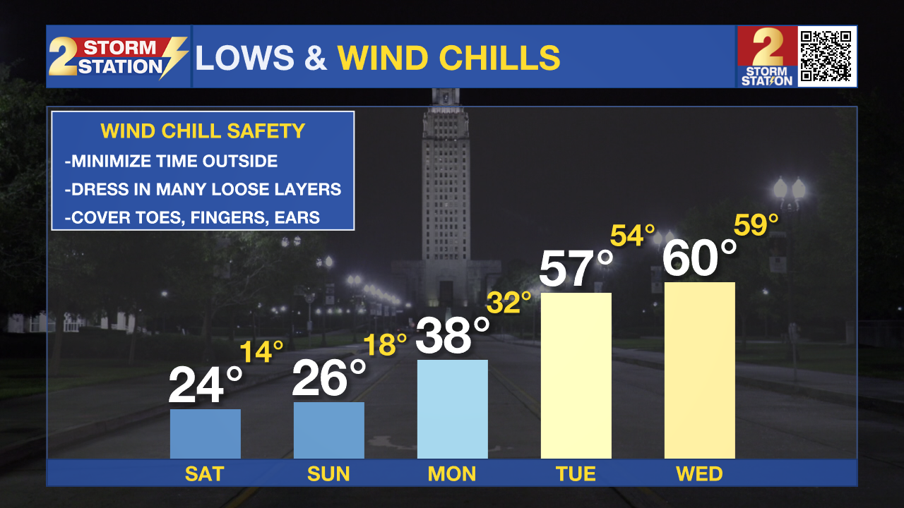
A ***HARD FREEZE WARNING*** is in effect Friday night into Saturday morning for parishes and counties north of Interstates 10/12. This includes all viewing area parishes and counties except Assumption and St. Mary. Below freezing temperatures in the upper teens and lower 20s will cause conditions that could kill crops, other sensitive vegetation and possibly damage unprotected outdoor plumbing.
Take steps by Friday night to protect tender plants from the cold. If you haven't already this week, outdoor water pipes should be wrapped, drained, or allowed to drip slowly. Those that have in-ground sprinkler systems should drain them and cover above-ground pipes to protect them from freezing.
A ***WIND CHILL ADVISORY*** is in effect from midnight until 9am Saturday. Wind chills could be as low as 7 to 10 degrees across portions of southeast Louisiana and southern Mississippi that are generally along and north of the Interstate 10/12 corridor. Very cold temperatures and wind chills can lead to hypothermia if proper clothing is not worn. Use caution while traveling outside. Wear appropriate clothing, a hat, and gloves.
Trending News
Tonight & Tomorrow: Temperatures will tumble overnight with the Metro Area reaching freezing by midnight. While skies will be clear—ideal for cooling—elevated winds out of the north at 10-15mph may prevent readings from going as low as earlier this week. Most locations north of I-10/12 will get into hard freeze territory below 25 degrees. Wind chills will be in the teens and 20s. Saturday will be a breezy and chilly afternoon in the 40s despite full sun.
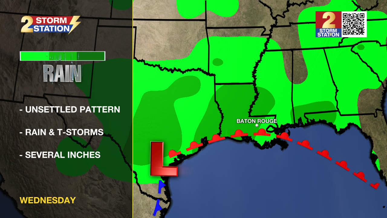
Up Next: Clear skies into Sunday morning will promote another hard freeze in the mid 20s and then slightly warmer highs in the low 50s. Clouds will build in as the weekend concludes signaling the start of a substantial pattern change. Next week, expect warmer temperatures rain, and possibly thunderstorms. A few steadier waves of rain are anticipated. While exact timing is difficult this far in advance, Tuesday morning and Thursday look particularly unsettled. Scattered activity will remain possible otherwise. Through the end of the week, 5-7 inches of rain may fall with isolated higher totals. Such amounts could cause some flooding issues, so stay in touch with the forecast.
Get the latest 7-day forecast and real time weather updates HERE.
Watch live news HERE.
– Josh
The Storm Station is here for you, on every platform. Your weather updates can be found on News 2, wbrz.com, and the WBRZ WX App on your Apple or Android device. Follow WBRZ Weather on Facebook and Twitter for even more weather updates while you are on the go.
More News
