

Latest Weather Blog
Friday PM Forecast: a shot at showers over the weekend
The weekend should start with our final day in a long stretch of dangerous heat. The temperatures will be tamped down by some showers and thunderstorms, worth paying attention to if you have outdoor plans.
A *HEAT ADVISORY* will be in effect on Saturday from 12pm - 7pm for all of southeast Louisiana and southwest Mississippi. Heat index values up to 112 may cause heat illnesses to occur.
Drink plenty of fluids, stay in an air-conditioned room, stay out of the sun, and check up on relatives and neighbors. Young children and pets should never be left unattended in vehicles under any circumstances. Take extra precautions if you work or spend time outside. When possible, reschedule strenuous activities to early morning or evening. Know the signs and symptoms of heat exhaustion and heat stroke. Wear lightweight and loose fitting clothing when possible. To reduce risk during outdoor work, the Occupational Safety and Health Administration recommends scheduling frequent rest breaks in shaded or air conditioned environments. Anyone overcome by heat should be moved to a cool and shaded location. Heat stroke is an emergency!
Tonight & Tomorrow: Tonight will remain mostly clear and quiet with low temperatures around 80. On Saturday, the big dome of warm air will start to get squeezed west. Temperatures will still shoot into the upper 90s with feels like temperatures near 110. A very weak front will chug into the area late, triggering scattered showers and thunderstorms. A few of these storms could cause gusty wind, frequent lightning and downpours.
Up Next: Some rain and thunder may continue overnight Saturday, even heavy at times. On Sunday, a stalled, weak front will cause additional clouds, showers and thunderstorms. All of this will lead to highs and lows a bit closer to average in the low 90s and mid 70s respectively. If you have outdoor plans, pay attention to the radar and lightning tracker on the Storm Station App in case you need to move inside for a little while. Similar weather is expected for the beginning of next week. Since it is summer, a few rounds of heavy rain could result in isolated pockets of 3 to 6 inches of rain and some poor drainage flooding. Most locations will receive just about 1 to 3 inches though.
Trending News
Get the latest 7-day forecast and real time weather updates HERE.
Watch live news HERE.
The Tropics: Tropical Storm Don continues to move west-northwest at 10mph with maximum sustained winds of 50mph. The storm will eventually turn due north over the weekend followed by weakening over the cooler, north Atlantic Ocean waters.
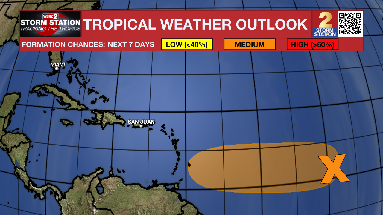
A tropical wave located a few hundred miles southwest of the Cabo Verde Islands is currently interacting with the Intertropical Convergence Zone. The combination of these features is producing an elongated area of showers and thunderstorms over the eastern and central tropical Atlantic. While dry air to the north may prevent significant organization during the day or two, environmental conditions could become more conducive for some development later this weekend as the system moves westward across the central tropical Atlantic.
--Josh
The Storm Station is here for you, on every platform. Your weather updates can be found on News 2, wbrz.com, and the WBRZ WX App on your Apple or Android device. Follow WBRZ Weather on Facebook and Twitter for even more weather updates while you are on the go.
More News
