

Latest Weather Blog
UPDATE: Severe weather threat winding down
7:00 PM Update - Spotty to isolated thundershowers will be possible through the rest evening, but the coverage and intensity should be much less. Radar does not look very impressive at this hour.
The severe weather threat has just about wrapped up at this point. For the Baton Rouge metro area, the severe weather threat is over. A Tornado Watch remains in effect for the Northshore until 9pm Friday. Even there, the severe threat is quickly diminishing.
7pm Friday - Radar returns look very innocent across the region. Aside from a stray shower, we trending in a drier direction this evening. The severe threat just about over in the WBRZ coverage area at this point... pic.twitter.com/2kiRbSEdx5
— Malcolm Byron (@mbyronwx) March 9, 2024
A ***TORNADO WATCH*** remains in effect for Tangipahoa Parish until 9pm Friday.
Trending News
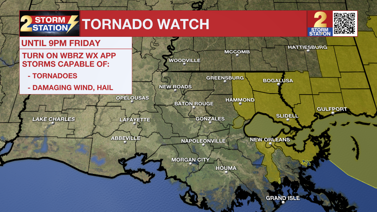
A Tornado Watch means conditions are favorable for tornadoes and/or damaging winds in and around the watch area. Be on the lookout for threatening weather conditions and listen for later statements and possible warnings. If a tornado warning is issued, seek shelter in a low-level, interior room of a sturdy building. Take pets (on a leash) with you, have on hard-soled shoes, monitor storm coverage on a wireless device and cover your head in the event of wind or tornado impact. For more on tornado safety, CLICK HERE.
Tonight & Tomorrow: Lingering showers and storms will be possible into Friday evening. These storms appear to be a touch weaker than their afternoon counterparts. That said, we won’t rule out some rogue cells intensifying into something stronger, but the overall threat will be lower. Overnight, rain coverage drops off almost entirely. We’re mostly dry by daybreak on Saturday with overcast skies. Expect an overnight low in the mid-60s.
Aside from an outside shot at a stray sprinkle, Saturday looks dry. We’ll keep mostly cloudy skies. It’ll be a touch cooler with highs perhaps rebounding into the low-70s. This is actually close to normal for this time of year. If your plans take you to Alex Box Stadium, the weather will cooperate on Saturday.
Up Next: We keep some high clouds around on Sunday. It remains cool, with highs in the low-60s. We start off next week on a dry note with temperatures gradually warming with each day. Highs return to the 80s by mid to late week. Rain chances begin to come back around that time also.
Remember that the WBRZ WX App. is *free* on Apple and Android devices and can be used for breaking weather information, live radar, and forecast details. You can also use it to watch live coverage if power or broadcast signal is ever lost. For even more, connect with the Storm Station on Twitter and Facebook. Stream WBRZ+ for continuous information as it becomes available.
Click HERE to watch WBRZ streaming live online
Click HERE for the WBRZ weather page.
Click HERE to see how to download the WBRZ weather app.
More News
