

Latest Weather Blog
Despite well-defined circulation on satellite, there is no tropical threat
The Storm Station has received a few questions regarding a well-defined circulation on satellite imagery located southeast of the Mouth of the Mississippi River. Although it may have a concerning appearance, this circulation is not and will not become a tropical cyclone. Rather, it is a low-pressure system known as an extratropical cyclone. These are very common.
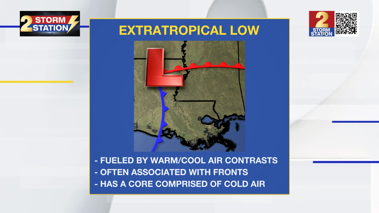
If you hear the Storm Station referencing an area of low pressure, chances are we’re referring to an extratropical low. Extratropical lows are fueled by contrasts of warm and cool air. For that reason, we often see fronts attached to them. An extratropical low also has a core comprised of cold air.
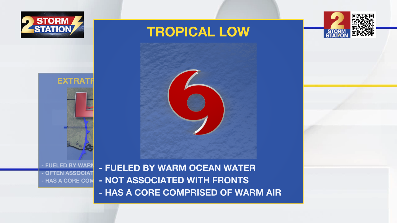
For an area of low pressure to be tropical, a few things must be true. First, the system must obtain its energy from warm ocean waters. Second, the low-pressure center cannot be associated with any fronts. Finally, tropical systems have warm cores. The air generally gets warmer as you near the very center of a tropical cyclone.
Even though this system is non-tropical, it has still produced gale force winds over open water. The highest offshore wind report we’ve seen thus far was 58 mph at Mississippi Canyon. In the next few days, we’ll see the low-pressure system offshore gradually pull away from the region.
Trending News
The Storm Station is here for you, on every platform. Your weather updates can be found on News 2, wbrz.com, and the WBRZ WX App on your Apple or Android device. Follow WBRZ Weather on Facebook and Twitter for even more weather updates while you are on the go.
More News
