

Latest Weather Blog
Strong Storms and Flooding Possible Today
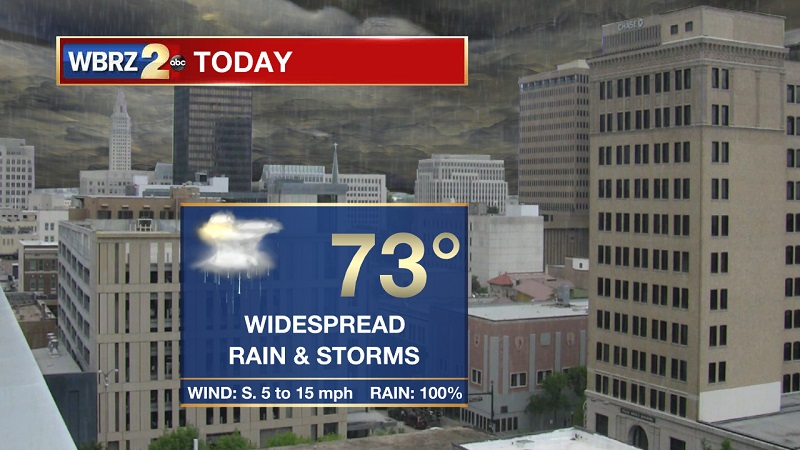
THE FORECAST:
Today and Tonight: Windy conditions through much of the day as a strong line of storms moves through during the hours afternoon. Rain will begin between 9 AM and 10 AM, with pockets of heavy rain through the early afternoon. Storms begin to push in around 2 PM, and will stall through the remainder of the day. This raises the concern for flooding issues, as a FLASH FLOOD WATCH has been issued for the region until 6 AM Friday. Expected rainfall amounts are between 3-5 inches, with some isolated areas potentially picking up 6+ inches. Showers and storms poised to linger into the evening, but the line should push east around midnight. Clouds will break quickly overnight, plunging temperatures into the upper 50s into Friday morning.

Up Next: A brief dry period Friday, but showers return Saturday and Sunday. Another system will bring rain and storms on Monday, before conditions begin to improve into the start of the new year.

Trending News
THE EXPLANATION:
A strong weather system is moving through the Great Plains. This system has an associated cold front that is efficient at picking up significant Gulf moisture. Rainfall could top out at between 3 to 5 inches, with some areas potentially picking up 6 or 7 inches. This is highly dependent on how long and where this cold front begins to stall as it passes through southeastern Louisiana. Models are suggesting that it will start to slow through Amite County, East Baton Rouge and St. Mary Parishes shortly after noon. The line should continue to linger through much of the day, acting as a conveyor belt pulling moisture from the Gulf and northeast along the frontal boundary through Central Mississippi. The cold front finally breaks east into Mississippi and Alabama just before midnight. This front will continue to flatten and proceed into the Gulf, but will get picked up as a warm front from a developing low pressure off the coast of Texas. The warm front will move onshore Saturday, to bring a return to showers and isolated storms to the region through much of the weekend. Another relatively strong system will break through on Monday from the west, but is oriented more north-to-south in order to pull in a high pressure across the Gulf States, and begin to dry us out to start 2019.
--Meteorologist Matt Callihan
The WBRZ Weather Team is here for you, on every platform. Your weather updates can be found on News 2, and the WBRZ WX App. on Apple and Android devices. Follow WBRZ Weather on Facebook and Twitter for even more weather updates while you are on the go.
More News
