

Latest Weather Blog
Significant flooding threat in Southeast Louisiana, Southern Mississippi
FLASH FLOOD WARNINGS will continue across the area today. Avoid areas of rising water and locations that typically have problems with poor drainage and runoff.
Today and Tonight: Another very active day of weather is ahead. Widespread showers and thunderstorms will bring heavy rain at times with several more inches possible. Action will come in waves and while there may be some breaks, the fully saturated ground won’t be able to handle additional downpours and runoff issues can be expected in many locations. Temperatures won’t make it beyond the low 80s. Unfortunately, the overnight period looks active as well. Showers and storms, some heavy, will continue into Saturday Morning with lows in the middle 70s.
Up Next: On Saturday, scattered showers and thunderstorms will persist yet again. Though the most widespread action should be about wrapped up, any additional rain will aggravate already saturated areas. Highs will make it into the upper 80s with perhaps some late day breaks of sunshine. On Sunday, the area will transition into a more typical summer weather pattern with partly sunny skies and highs in the low 90s before scattered showers and storms flare up in the afternoon. Similar weather is expected into the middle of next week.

Threats: Much of the area will receive another 5-8” of rain with locally higher amounts as thunderstorm downpours create runoff issues. For this reason, a FLASH FLOOD WATCH continues into Saturday for the entire forecast area. Due to high rainfall amounts and associated drainage, a river FLOOD WARNING has been issued for the following locations: Amite River at Denham Springs and Bayou Manchac, Comite River at Joor Road and Tangipahoa River at Robert. More river flood warnings are anticipated as well.
Trending News
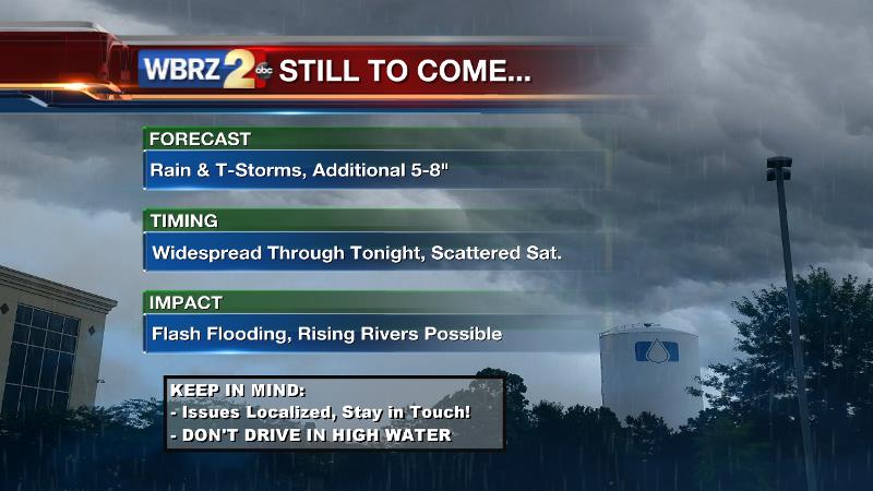
Timing: Rounds of showers and thunderstorms are expected not just during the day but at night as well. Any storms now through Friday Night bring the most widespread flooding threat. However, scattered showers and thunderstorms over the weekend will contribute to the forecast rain totals as well.
What should I do? Continue to stay in touch with the WBRZ Weather Team for updates and alerts. If you live in a flood prone area, be prepared. If you come across rushing water on roadways, turn around don’t drown! Several inches of moving water can float a car. If you come across a flooded street, hit the brakes y’all, don’t stall! Even if it is a familiar street that you travel every day, do not attempt to drive across it. Once the water reaches car doors or engines, damages run into the thousands of dollars.
THE SCIENCE:
Forecast Discussion: An upper level low and associated surface trough continue to meander northwestward through Southeast Louisiana. Waves of upper level energy will coincide with the surface trough to kick out rounds of showers and thunderstorms. The atmosphere remains completely juiced with moisture as observed and forecast precipitable water values are off the charts. The record moisture content is much higher than has even been observed with past tropical storms that have moved through the area. With such deep tropical moisture in place, any storms of moderate intensity will be very efficient rain producers and could result in localized flooding. 2-3"/hour rainfall rates are certainly possible. A FLASH FLOOD WATCH remains in effect for the entire forecast area, for this reason. Plus, with heavy rain already down across much of the area, it will not require much to aggravate saturated grounds. Runoff will be a significant issue, meaning that standing water will be widespread and drainage into rivers will be high. Typically troubled areas along the Amite, Comite, Tickfaw and Tangipahoa River should take precautions now for rising water. Another upper trough moving east across the United States will begin to absorb the local upper energy by late weekend. Meanwhile Bermuda ridge will move back westward causing the highly active pattern to cease. Still, with the ridge not directly overhead, a more active that usual summer pop-up storm pattern will persist into the middle of next week. Models show upper level ridges remaining in place east and west of the region. As long as the area stays between those two features, higher than usual rain chances will persist.
--Josh
For updates, stay connected with Meteorologist Josh Eachus:
More News
