The National Weather Service has issued a FLOOD WATCH for East Baton Rouge, West Baton Rouge, Iberville, East Feliciana, Livingston, Pointe Coupee, St. Helena, Tangipahoa and West Feliciana Parishes as well as, Amite and Wilkinson Counties from 7 p.m. Thursday until 7 a.m. Saturday.
A FLOOD WATCH means conditions may develop that lead to flash flooding. Flash flooding is a very dangerous situation. Be on the lookout for threatening weather conditions and listen for later statements and possible warnings. For more on flooding safety, CLICK HERE.
Multiple rounds of storms will be moving through the area beginning Thursday night and continuing into Saturday morning. 1 to 4 inches of rainfall with locally higher amounts in excess of 6 inches will be possible, enhancing the flash flooding threat.
Tonight & Tomorrow: Look for a few clouds to mix into skies overnight with a slightly milder low temperatures in the upper 60s. Thursday will have enough sunshine to push high temperatures into the upper 80s. Clouds will thicken through the daytime hours, likely stopping most locations from reaching the 90s. As a warm front lifts inland across Louisiana, an upper level disturbance will move from west to east across the region, likely sending a line of rain and thunderstorms through the Metro Area as well. Early timing suggests action is possible between 6pm – 1am.
Up Next: The forecast for Friday is nothing, if not difficult. Any showers and thunderstorms will be highly dependent on three things:
-How much energy is left in, or returns to the atmosphere after Thursday’s round
-The position of a stalling front
-The position and strength of upper level disturbances riding over the front
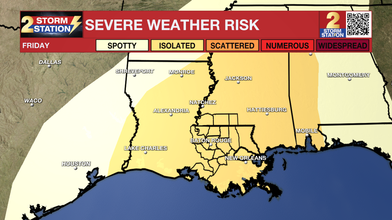
At a maximum, two to three rounds of showers and thunderstorms will be possible throughout Friday, each having the potential for heavy rain and severe weather. At a minimum, weaker and more scattered variety showers and thunderstorms will need to be dodged with a lot of dry time in between. The Storm Prediction Center has issued a Level 2/5 “Slight Risk” for severe thunderstorms but given the uncertainties with the forecast, it is too early for specific threats or most likely times.
A weak cold front will push through the area Friday night into Saturday morning with a final pop of showers and thunderstorms. Again, the extent will be determined by how much energy is leftover from previous activity. By afternoon, much more sunshine will be available though, and high temperatures will be pumped into the upper 80s. Sunday through Tuesday will be warm and muggy with highs near 90 and lows near 70s. Rain chances tuck back to about nil over the three day stretch.
Get the latest 7-day forecast and real time weather updates HERE.
Watch live news HERE.
Remember that the WBRZ WX App. is *free* on Apple and Android devices and can be used for breaking weather information, live radar, and forecast details. You can also use it to watch live coverage if power or broadcast signal is ever lost. For even more, connect with the Storm Station on Twitter and Facebook. Stream WBRZ+ for continuous information as it becomes available.
Click HERE to watch WBRZ streaming live online
Click HERE for the WBRZ weather page.
Click HERE to see how to download the WBRZ weather app.
Posts below are from the WBRZ Weather X account. Monitor for weather warnings below.


