

Latest Weather Blog
Tuesday morning video forecast
Related Story
There will be plenty of dry time in the morning hours today before storms spark up in the afternoon.
THE FORECAST
Today & Tonight: Today will be a near perfect repeat of yesterday. Temperatures will climb into the low 90s before showers and storms develop in the afternoon. That means there will be dry skies this morning for first day of school photos. There will be on and off showers and storms during school dismissal and evening commute times. Temperatures overnight will be in the mid-70s.
Up Next: The rainy afternoons are not going anywhere. The majority of the WBRZ viewing area is expected to get measurable rainfall each afternoon this week. The threat for flooding will increase on Wednesday with showers and storms becoming more numerous. There will be higher amounts of available moisture which will lead to very efficient rain makers. Storms will be able to produce rain faster than the drains can handle. If you are driving while it is actively raining, avoid the typical problem spots and any areas under an active Flash Flood Warning. The afternoon shower trend continues into the weekend, but we are not tracking any weekend washouts. Click here to see the 7-day forecast.
Reminder: With the threat for impactful weather— street and poor drainage flood —please have access to alerts through this week. You can download or activate the WBRZ WX App on your Apple or Android device or turn on a NOAA Weather Radio for bulletins such as watches and urgent warnings. Of course, WBRZ, WBRZ+ and the Cable Weather Channel will have updates as active weather dictates.
In the Tropics:
There is a new area to watch off the coast of Africa. It is not a major concern for the local area at this time, but we will continue to monitor for updates.
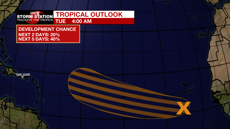
Eastern Tropical Atlantic: A tropical wave continues to produce a large area of disorganized cloudiness and thunderstorms over the eastern tropical Atlantic a few hundred miles south-southwest of the Cabo Verde Islands. Gradual development of this system is possible and a tropical depression could form around the middle to latter portion of the week before environmental conditions become less favorable by this weekend. This system is expected to move westward to west-northwestward at 15 to 20 mph across the tropical Atlantic during the next several days.
* Formation chance through 48 hours...low...20 percent.
* Formation chance through 5 days...medium...40 percent.
News
