

Latest Weather Blog
Monday morning video forecast
Related Story
The excessive heat is out, and the rain is in.
THE FORECAST
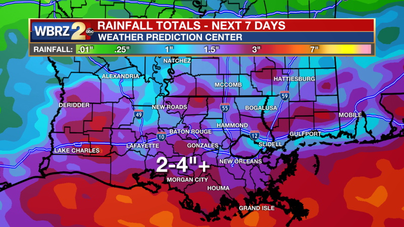
Today & Tonight: For the first time in 10 days, South Louisiana is not under any type of heat warning for advisory. Instead today, we will be dealing with rain. A weak cold front is positioned in northern Louisiana and eventually it will push toward our area bringing widespread rain. The bulk of the shower activity will come in the afternoon and evening. Brief heavy downpours will be possible along with localized street and poor drainage flooding. Between the showers, temperatures will be in the mid to upper 80s. Overnight conditions will be muggy in the mid-70s.
Up Next: The same rainmaker from Monday will linger in the area on Tuesday and continue to promote widespread showers and storms. Again, the most active time for storms will be in the afternoon and evening. In the sunny spots temperatures will get into the upper 80s otherwise it will be a bit cooler. On Wednesday a few more showers will be left over, but it will be mostly dry. Temperatures will trend in the low 90s for the rest of the week with shower activity very low. Click here to see the 7-day forecast.
In the Tropics:
No development expected for the next five days. Click here to visit the WBRZ Hurricane Center.
Need weather conditions HOUR BY HOUR? Get hour by hour weather and right now weather conditions for your location on the WBRZ WX App on your Apple or Android device. Follow WBRZ Weather on Facebook and Twitter for even more weather updates and unique weather insight from the whole team!
News
