

Latest Weather Blog
Thursday PM Forecast: closing in on much cooler temperatures
We will have just one more uncomfortable, unseasonable day to close out the week. Your “friendly, neighborhood” front will move through on Friday night to bring big changes.
Next 24 Hours: With some clouds up top, another muggy night is expected as temperatures do not leave the 70s. Friday will continue the pattern of the week and that is partly sunny, warm and humid with highs in the upper 80s. An isolated shower or two could develop during the afternoon, but most will stay dry until a cold front arrives after dusk. That front will be accompanied by a thin line of showers and thunderstorms, likely between 10pm and 2am.
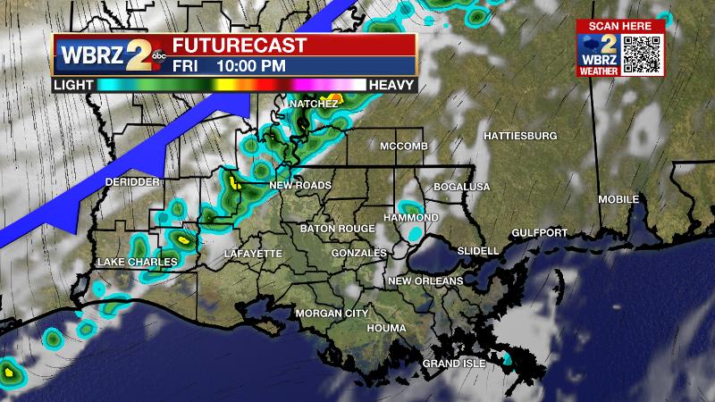
At this time, it is expected that most high school football games will be able to finish before rain arrives. Heavy rain and severe weather are not expected from the front, though a few higher wind gusts are possible.
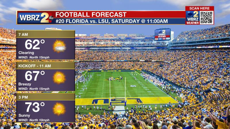
Up Next: The cold front will kick out humidity and any rain will be over by Saturday morning. Temperatures will bottom out around 60 degrees. Despite clearing skies, brisk northerly winds of 10-15mph will make it difficult for highs to warm past the mid 70s on Saturday afternoon. LSU fans heading to campus may want to take an extra layer for the cool morning that can be removed under the afternoon sun.
Trending News
As the autumn air mass continues to press in, lows will then be in the low 50s into Sunday. Quiet and cool conditions will prevail through Tuesday with highs in the 70s and lows in the 50s. One item worth noting, fog could be an issue for commuters on Monday, Tuesday and Wednesday mornings. CLICK HERE for your full 7-Day Forecast.
The Tropics: A broad low pressure system northeast of Puerto Rico has just a 10 percent chance of development before it will interacts with a frontal system on Friday. For the latest tropical forecasts, advisories and information, visit the WBRZ Hurricane Center as we navigate all 183 Days of Hurricane Season.
The Explanation: An upper level trough will move east across the Midwest and into the Great Lakes region Friday into Saturday. An associated cold front will sweep across the country with a passage expected in the Baton Rouge area on Friday night. Lift in the region will be weak with the exception of areas immediately ahead of the front and therefore a narrow band of showers and perhaps an embedded thunderstorm is all that is anticipated. Some of the showers could produce gusty wind. A sharp change in direction will come behind the showers with northwesterly winds of 10-15mph. This will push much cooler, drier air into the region and locations north of the interstates will be near 60 degrees by sunrise Saturday. Winds will remain elevated into the afternoon as the cooler air mass continues to take hold of the region and so despite sunshine, temperatures will struggle to reach the mid 70s. As winds subside on Saturday night, the coolest low temperatures of the forecast period will occur with many spots reaching the low 50s, with a few pockets in the upper 40s by Sunday morning. An area of high pressure will build into the region on Sunday resulting in lighter winds, but continued clear and cool conditions. The high pressure system will nudge east on Monday leading to east and even southeast winds. In the upper levels, a fast moving upper level disturbance will slide over the area but likely be too moisture starved to create anything other than some clouds. The subtle wind shift will be enough to moderate temperatures with readings nearing average, in the upper 50s, by Tuesday morning and the upper 70s in the afternoon. Moisture advancing inland on the southeasterly winds could lead to some foggy mornings Tuesday through the middle of next week. By Wednesday, enough moisture may also be available for some isolated, light showers in the afternoon hours. Another front is then expected to approach the area near the end of next week.
--Josh
The WBRZ Weather Team is here for you, on every platform. Your weather updates can be found on News 2, wbrz.com, and the WBRZ WX App on your Apple or Android device. Follow WBRZ Weather on Facebook and Twitter for even more weather updates while you are on the go.
More News
