Saturday PM Forecast: Showers held off for most of the day, a shower is still possible in the late afternoon hours
Full moon tonight and some changes in the forecast
Keep your eyes on the skies tonight! If you get a good shot of the full Harvest moon be sure you email it in to us at weather@wbrz.com.
THE FORECAST
Tonight & Tomorrow: Mostly dry day for the Capital Area and we are expecting more of the same for the rest of your weekend. Overnight some clouds will linger in the forecast and temperatures will fall into the low-70s. Plenty of sunshine expected for your Sunday. Waking up to mostly sunny skies, feeling comfortable with lower temperatures. Daytime highs will peak near 90 degrees. Throughout the day humidity will stay on the lower side allowing for a more pleasant feeling day. Some sneaky showers will begin bubbling up around the area during the afternoon hours, but we are not forecasting a total washout. In the overnight hours temperatures will cool into the low-70s.
Up Next: Some much needed changes coming into the forecast for the start of the workweek. We will begin to transition out of the rainy pattern due to a weak cold front passage on Monday. Monday morning will start off humid with temperatures in the low-70s and mostly sunny skies. Winds will shift to out of the northwest as the front begins to make its way through the Capital Area during the day. Not expecting much rain with this system but some showers are possible along the leading edge of the front. Regardless we are expecting partly sunny skies for most of the day. Northerly breeze will bring drier air into the area and this will set up a new drier pattern for the rest of your work week. Waking up temperatures will be in the mid-60s. Comfortable start to the day, then temperatures will warm into the high-80s low-90s. Rain will not be a problem for the area this workweek. Click here to see the 7-day forecast.
Hour-by-hour weather tracking is available for your location on the WBRZ WX App on your Apple or Android device. Follow WBRZ Weather on Facebook and Twitter for even more weather updates and unique weather insight from the whole team!
Trending News
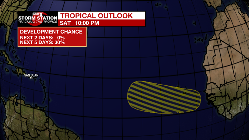
In the Tropics:
Post-tropical cycle Earl will continue to weaken into the overnight hours, not expected to impact any areas of land. The Storm Station is monitoring an area of low chance of development. As of now no threats to the local viewing area.


