

Latest Weather Blog
Drier Conditions on Sunday
THE FORECAST:
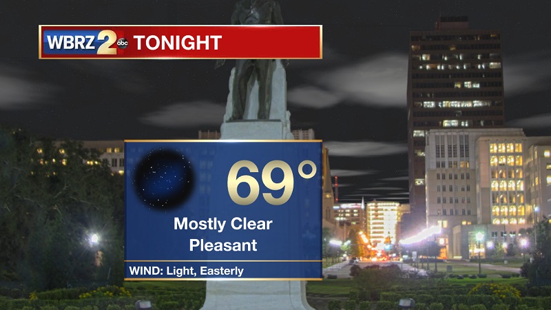
Tonight and Tomorrow: Mostly clear skies tonight, as showers taper off by 7 PM. Winds will stay calm through the night, as temperatures drop into the 70s around 11PM before reaching an overnight low of 69°. Sunny and warm conditions Sunday, with highs peaking near 90° with heat index values around 97°. Winds will stay light and out of the southeast.
Up Next: Dry and sunny conditions persist through the week, as above average high temperatures stay the course.
Trending News
The Tropics:
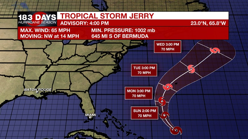
Tropical Storm Jerry is currently located about 645 miles south of Bermuda and about 320 miles north of San Juan Puerto Rico with 65 mph sustained winds and moving northwest at 14 mph. This general motion is expected to continue tonight. Jerry is forecast to turn northward on Sunday and then gradually accelerate northeastward early next week. Little overall change in strength is forecast for the next several days, but short-term fluctuations in intensity are possible.
We are also tracking two tropical waves.
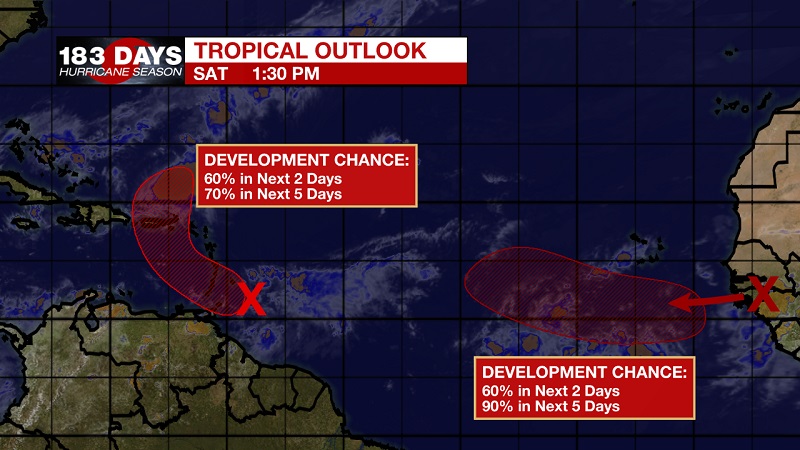
Showers and thunderstorms associated with a strong tropical wave located less than 100 miles east of Barbados have not become any better organized during the day, and the system does not have a well-defined circulation. However, a NOAA Hurricane Hunter mission earlier this afternoon indicated that the wave is producing winds to 35 mph. At least gradual development of this system is expected, and a tropical depression or tropical storm could form during the next couple of days while it moves westward and then northwestward at about 15 mph across the Windward Islands and over the eastern Caribbean Sea. This system is then expected to turn northward, moving near Puerto Rico and the Virgin Islands on Tuesday. The National Hurricane center is forecasting a 60% chance of tropical development within the next 2 days, which increases to a 70% chance within the next 5 days.
The second wave is expected to move off the west coast of Africa by Sunday. Environmental conditions are expected to be conducive for development, and a tropical depression or tropical storm is likely to form early next week while the wave moves westward across the eastern tropical Atlantic. The National Hurricane center is forecasting a 60% chance of tropical development within the next 2 days, which increases to a 90% chance within the next 5 days.
THE EXPLANATION:
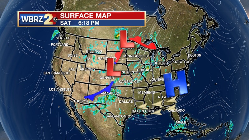
Mid-to-upper level ridging dominates the entire southeast and Gulf Coast, keeping conditions dry and temperatures above normal through much of the week. The ridge does get suppressed to the south late in the week, bringing a return to isolated showers and storms Thursday and Friday. Even with the afternoon showers, high temperatures will still warm back into the low 90s. Cloud cover will also be sporadic, but mostly sunny skies should stay through the remainder of the workweek. The ridge should build back just in time for the weekend, returning drier air back into the region. Sunny skies on Saturday to complete the last weekend of September.
--Meteorologist Matt Callihan
The WBRZ Weather Team is here for you, on every platform. Your weather updates can be found on News 2, and the WBRZ WX App. on Apple and Android devices. Follow WBRZ Weather on Facebook and Twitter for even more weather updates while you are on the go.
More News
