

Latest Weather Blog
The second severe weather season awakens
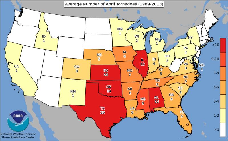
The spring surge of tropical moisture clashing with winter leftovers in the Midwest and Gulf South, makes March to May prime tornado season.
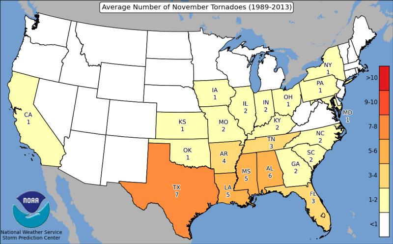
Not to be underestimated though, is the arrival of cold air displacing lingering summer humidity southward. Indeed, October – December offers a fair smattering of spin ups as well.
In fact, for Louisiana and Mississippi, only April averages more tornadoes than November since the mid 80s.
Trending News
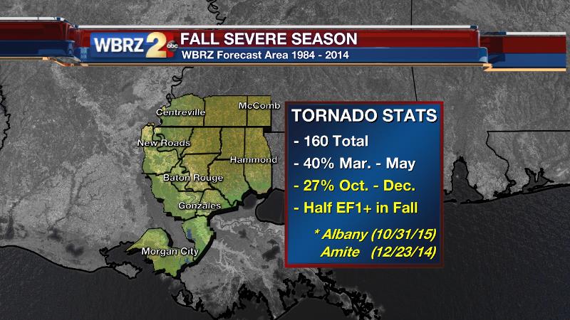
A deeper look at tornado statistics for the WBRZ forecast area confirms that severe weather in the fall season is more common than you might realize.
Over the last 20 years, there have been 160 confirmed tornadoes in the WBRZ forecast area resulting in 5 deaths, 149 injuries and $32.5 million in damage.
40% of those tornadoes unsurprisingly occurred during the “textbook” severe weather season of March – May. However, 27% of the twisters in that 20-year period have happened in the months of October, November and December. That makes up for 96 of the 160 events. The remaining 33% happened in no discernable cluster over the other 6 months of the year.
Perhaps the most telling stat comes from a closer look at tornado strength in those 20 years. The fall season produced barely fewer (35) EF1 or stronger tornadoes than the spring season (40). No tornado at any time of year should be taken lightly and the numbers prove that destructive twisters aren’t just reserved for spring.
Actually, the strongest tornado of the last 5 years to occur in the WBRZ forecast area was an EF2 that significantly damaged parts of Amite, Tangiphaoa Parish on December 23, 2014.
As Andrea Thompson points out, it is the shifting jet stream that helps to spark off severe thunderstorms during the transitional season. Cooler air resides north of the jet stream, with warm humid air to the south. Waves that disturb a stable west to east wind flow across the United States generate storm systems and fronts which lead to chaotic weather.
Such an upper wave will slice through the Midwest on Wednesday, sparking off a round of severe weather.
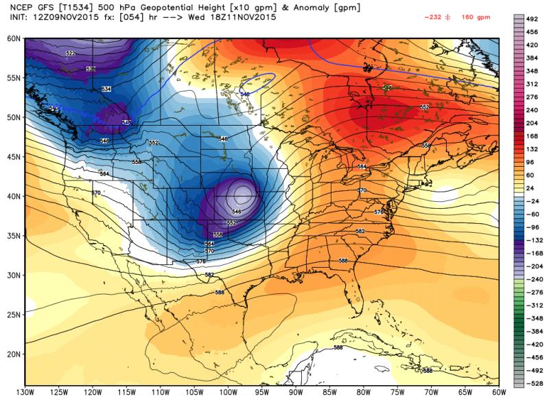
Blues represent cooler air with the oranges marking warmer air. It is on the leading eastern edge of that wave in the jet stream, where cool meets warm, that forecasters look to as the focal point for severe weather. Arkansas, Illinois and Missouri will be on alert for damaging wind and isolated tornadoes.
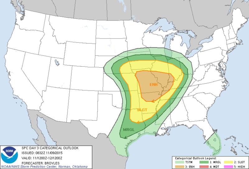
Fairly uncommon three days in advance, an “enhanced risk” for severe weather has already been issued by the National Weather Service Storm Prediction Center. Numerous severe storms with a few tornadoes are expected for areas from Little Rock to St. Louis to Des Moines.
In South Louisiana and Southern Mississippi, many of the ingredients aren’t there. A slower jet stream and lesser clash of air masses will limit storm strength. A line of showers and thunderstorms is expected to cross the area overnight Wednesday—still bringing the potential for some gusty wind. Overall though, this will not be a high impact episode for the WBRZ forecast area.
That is this time though. History shows, there will be plenty more opportunity for nasty storms between now and the new year.
Stay connected with the WBRZ Weather Team through severe weather --> TWITTER | FACEBOOK
More News
